Logatec - Sekirica (via football field)
Starting point: Logatec (495 m)
| Latitude/Longitude: | 45,91100°N 14,21870°E |
| |
Route name: via football field
Walking time: 10 min
Difficulty: easy unmarked way
Elevation gain: 50 m
Elevation difference along the route: 50 m
Map:
Recommended equipment (summer):
Recommended equipment (winter):
Views: 1.575
 | 1 person like this post |
Access to starting point:
A) From the highway Ljubljana - Koper we go to the Logatec exit, in the next few crossroads and roundabouts we continue straight ahead, that is, on the main road. After the Hofer store we turn left onto the first road, where we already notice signs that we have approximately 350 meters to the parking lot. We park on a larger macadam parking lot below the football field.
B) From the old road Logatec - Kalce we drive to the roundabout at the MOL gas station, and from there we continue driving in the direction of the highway. After approximately 300 meters from the roundabout we turn right onto a macadam road, which then past a larger chapel brings us to a larger macadam parking lot below the football field.
Route description:
From the parking lot, we ascend along the road which runs on the right side of the nearby football field. When we reach the football field the road flattens and leads us past the hut of the Logatec football school. When on the other side of the football field from the road a well-beaten footpath branches off to the right, we head onto it, and then we quickly reach the ridge of Sekirica and a wide cart track, which we follow to the right. A little further, the path ascends through a lane of bushes, and then with occasional views on Logatec and surrounding hills, in a few minutes brings us to the top of Sekirica.
Description and pictures refer to the condition in the year 2015 (July).
Photos:
 1
1 2
2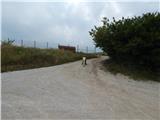 3
3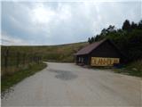 4
4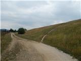 5
5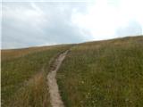 6
6 7
7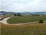 8
8 9
9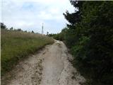 10
10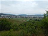 11
11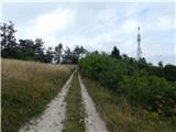 12
12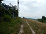 13
13 14
14 15
15
Discussion about the trip Logatec - Sekirica (via football field)
|
| Acibujl30. 12. 2025 15:59:58 |
And at the top of Skirca, as we locals call the hill, the largest Slovenian flag is waving! There's also a nice circular path around, you can't get lost here, this Logatec hillock is quite visited...
|
|
|
To post a comment you must log in:
If you do not yet have a username, you must first
register.