Ljubelj - Vrh Ljubeljščice (Triangel)
Starting point: Ljubelj (1058 m)
| Latitude/Longitude: | 46,4324°N 14,2602°E |
| |
Walking time: 1 h 50 min
Difficulty: easy unmarked way
Elevation gain: 646 m
Elevation difference along the route: 646 m
Map: Karavanke - osrednji del 1:50.000
Recommended equipment (summer):
Recommended equipment (winter): ice axe, crampons
Views: 36.996
 | 3 people like this post |
Access to starting point:
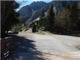
From the highway Ljubljana - Jesenice we go to the exit Ljubelj and follow the road ahead to the border crossing. Only a few meters before the border crossing signs for Zelenica point us to the left and after some 10 meters of additional driving the road brings us to a parking lot below the ski center Zelenica.
Route description:
At the beginning of the parking lot signs for Stol, Vrtača and Dom na Zelenici point us to a wide cart track which starts ascending by the torrent. When a little higher the cart track turns left, we continue straight on the mountain path which continues through the forest and soon returns to the cart track. The cart track a little higher turns right and brings us out of the forest on a ski track of the former ski area Zelenica. Next follows a short steeper ascent on the ski slope, and then the path flattens and leads us by the foot of the scree below Begunjščica.
From the marked path soon a path which runs on a service road branches off to the right, and we continue on the "road" to the nearby Koča Vrtača.
At the hut the road turns right, and we continue straight in the direction of the mountain path to Zelenica. For a short time we continue below the former one-seater lift Zelenica II, and then the path starts to ascend more steeply on a slope which is partly overgrown by dwarf pines. After a few hairpin turns we return to the service road, on which we continue with a view of the Šentanski plaz.
The path ahead leads us along the slopes of Spodnji Plot (peak on which a sport climbing route was equipped some years ago), then from the road we turn right onto a footpath which cuts a longer bend. When we return to the road we are already at the upper station of the former one-seater lift Zelenica II, and only a few steps of descent separate us from the Dom na Zelenici.
Before the mountain hut a marked path to Begunjščica branches off to the left, and behind the hut also to the left a path to Stol, Vrtača and Završnica, but behind the hut we continue straight on a poorly visible unmarked path which ascends through an indistinct valley. A little higher we continue right (straight to the saddle Čez Pod and the top of the former draglift Triangel), we cross a small stream and start to ascend steeply on the grassy slope. Higher we reach the ridge which connects Vrh Ljubeljščice and Spodnji Plot, and we continue left towards Vrh Ljubeljščice (right Spodnji Plot), a summit which is also known as Triangel.
The path ahead moves a little left from the ridge, and then with fine views reaching beyond Stol all the way to Triglav we reach the panoramic summit.
Ljubelj - Koča Vrtača 0:40, Koča Vrtača - Dom na Zelenici 0:40, Dom na Zelenici - Vrh Ljubeljščice 0:30.

Photos:
 1
1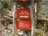 2
2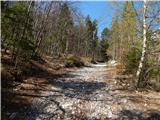 3
3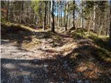 4
4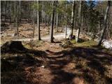 5
5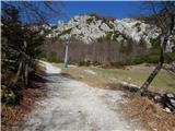 6
6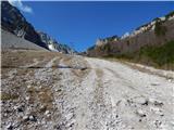 7
7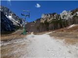 8
8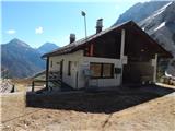 9
9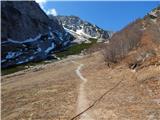 10
10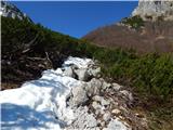 11
11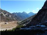 12
12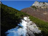 13
13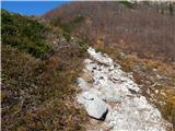 14
14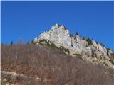 15
15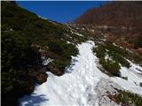 16
16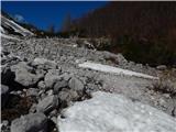 17
17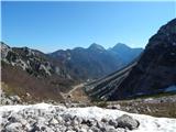 18
18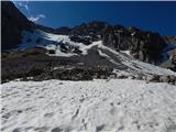 19
19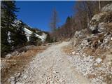 20
20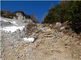 21
21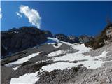 22
22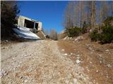 23
23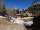 24
24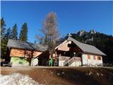 25
25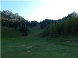 26
26 27
27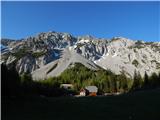 28
28 29
29 30
30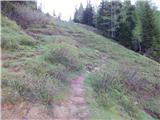 31
31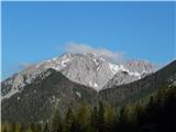 32
32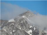 33
33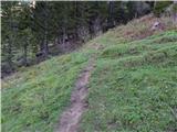 34
34 35
35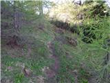 36
36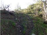 37
37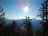 38
38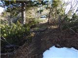 39
39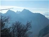 40
40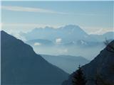 41
41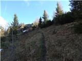 42
42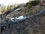 43
43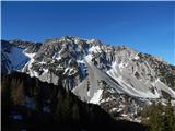 44
44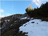 45
45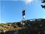 46
46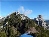 47
47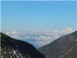 48
48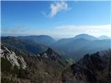 49
49
Discussion about the trip Ljubelj - Vrh Ljubeljščice (Triangel)
|
| robter7. 02. 2011 |
Today I was at this peak above Zelenica. At home I checked Geopedia.si, where this peak is named Čez pod (1704 m). Can someone tell me what's with this Čez pod or Zgornji plot?
Well, when we say Triangel, it's clear to everyone anyway.
Otherwise nice spring-like weather.
|
|
|
|
| robter7. 02. 2011 |
I got information that all three names are correct.
|
|
|
|
| neyo31. 07. 2014 |
On Saturday 19.7. my wife and I went along the ridge of Ljubeljščica to Zelenica. From there to Vrtača. The ridge path is extremely scenic and beautiful. I don't know how to rate it. It's neither difficult nor easy. Physically not demanding, but requires a great deal of caution. Especially because there are no very large drops anywhere, so one quickly relaxes and is no longer attentive. The path is slippery in several places. It can end badly quickly. Perhaps due to the deceptive sections I should rate it as difficult, or maybe even very difficult. But it's a wonderful and solitary world. We didn't meet anyone. Actually, I shouldn't be promoting this path, because it's good that there are paths where crowds don't go. Where you're alone, or meet only those who love peace and quiet in the mountains. For those who want that, this path is really the right choice and I highly recommend it.
|
|
|
|
| neyo31. 07. 2014 |
A few more pictures that might tempt someone to this path.
|
|
|
|
| neyo31. 07. 2014 |
Sorry, but I can't find the button where I could add pictures.
|
|
|
|
| mukica31. 07. 2014 |
You can't upload pictures here... only for current conditions
|
|
|
|
| neyo31. 07. 2014 |
Thanks mukica. I'll try there. LP
|
|
|
|
| Jst_Me18. 08. 2014 |
Can anyone describe the path to Triangel more precisely? From the koča at Zelenica onwards. Do you continue on that little path to the right that leads to Vrtača?
|
|
|
|
| sla18. 08. 2014 |
The Triangel draglift is clearly visible on photo no. 9.
No peak with that name exists.
|
|
|
|
| robter18. 08. 2014 |
Jst Me: Straight up from the hut. Can't miss it, as the peak we call Triangel too is visible all the way. There's a path across the meadow. Or go another 10 min towards Vrtača and then on the next meadow take the poorer track right upwards, you'll arrive too. Better for descent.
|
|
|
|
| Jst_Me19. 08. 2014 |
Thanks to both for the excellent description  . .
|
|
|
|
| tinky20. 08. 2014 |
Ask in Milan hut and he'll show you the path from the terrace.
|
|
|
|
| lolipop9. 07. 2018 |
I agree with Neyo's description from 19.7.2014. This description of "easy" unmarked path is not quite appropriate - that it's unmarked holds or sometimes the signpost already leads, but in certain sections there is danger of slipping and deep, so you couldn't even say goodbye.
|
|
|
|
| lukae27. 06. 2021 19:20:18 |
|
|
|
|
| Barbara 7527. 12. 2023 12:15:00 |
Hi, has anyone been to Ljubeljščica during this holiday season? I'm wondering if there's a lot of snow, I'm from MB, there's none here🙂
|
|
|
|
| bongo27. 12. 2023 14:04:20 |
|
|
|
|
| BorStenar5. 12. 2024 19:44:40 |
Hi, on the last day of November I went on this path to sp. Plot and Triangel. There is some snow, but not too much. A good descent leads over the saddle Čez Pod. But I noticed that from the saddle Čez Pod the path continues, going over a small peak before the towers Na Možeh. Does anyone know something about it
The peak is not on the map, but there is a drawn path that descends into Austria after the peak, which doesn't explain much. What is the difficulty or condition of this path, so I know before I just go somewhere.
|
|
|
To post a comment you must log in:
If you do not yet have a username, you must first
register.