Litija - Janče (via Širmanski hrib)
Starting point: Litija (238 m)
| Latitude/Longitude: | 46,0575°N 14,8242°E |
| |
Route name: via Širmanski hrib
Walking time: 3 h 30 min
Difficulty: easy marked way
Elevation gain: 554 m
Elevation difference along the route: 554 m
Map: Posavsko hribovje zahodni del 1:50.000
Recommended equipment (summer):
Recommended equipment (winter):
Views: 9.433
 | 3 people like this post |
Access to starting point:
Railway station Litija - you can get to Litija by train in the direction Zidani most – Ljubljana or Ljubljana – Zidani most, or by road in the direction Ljubljana – Litija.
Route description:
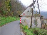
From the railway station Litija we go over the bridge to the right bank of the Sava, where we immediately turn right, first past the pharmacy, then again right along the Sava past Plečnik's monument to the fallen fighters and other NOB victims or on the local road towards Kresnice. Past the building of AMD Litija on our right we arrive after a few minutes at the oldest house in Litija (decaying), on which there is an information board for the mountain path to Janče and TV transmitter/Sitarjevec (Rudnik). Just behind the house we step left into the forest (to here from the railway station 10 minutes). We follow the blazes on the forest path and after approx. 15 minutes we come to the junction for Rudnik, we continue straight. Out of the forest we come to a macadam road and after 100 m to a crossroads (406 m), where the signs direct us straight. After a few minutes we come to a wooden cross by the hayrack, in front of us is the Arhova domačija homestead with farm buildings. We are on the eastern part of Širmanski hrib. To here from Litija a good hour.
We continue on the road past the homestead and by the meadow again step into the forest (at the fork we keep to the right). After approx. 15 minutes we are at the next homestead, just behind it there is a junction to the left towards Velika Štanga, we go straight on the middle path (here our path joins the beekeeping-forest educational trail) and after a few minutes we arrive at the next house. We follow the macadam road past the cross and in a few minutes we are at the next farm. From here we slightly descend on the road to another farm and from there into the forest. Soon we come to a fork: to the left is the educational trail, we take the right one, for Janče. The forest path slightly ascends to some houses. After a while the path widens again and we come to a fork, where our path goes left and slightly downhill. To Janče we have another 1 h 30 min.
We descend to Mala Štanga (550–640 m) and follow the asphalt road, which at the junction for Velika Štanga turns into well-compacted macadam. Here we go straight and follow the road about 2 km all the way to the village Tuji Grm (710 m). At the junction we turn right uphill, at the top of the slope left. We continue on the road through Tuji Grm, at the chapel we turn right from the road onto the meadow past the hayrack (if we miss the junction, it will be nothing serious, we will rejoin the path after a few 100 m). When we come through the spruce avenue back to the road, we cross it and immediately on the other side look for the continuation of the path (behind the ramp, where there is a sign for the end of the settlement). A short steep path through the forest brings us to a meadow, which we cross on the right and we are already at Janče. In front of us we can already see the church belfry and when we cross the main road, we head straight to the mountain hut on Janče (794 m). To here from Litija approx. 3 h 30 min.
We can return by the same path, or choose the mountain path to Jevnica (1 h 30 min), where we can board the train again.

Photos:
 1
1 2
2 3
3 4
4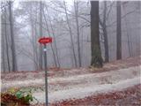 5
5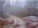 6
6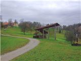 7
7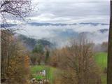 8
8 9
9 10
10 11
11 12
12 13
13 14
14 15
15 16
16 17
17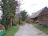 18
18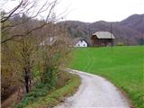 19
19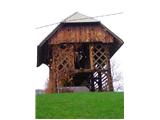 20
20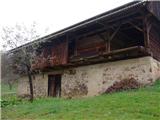 21
21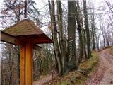 22
22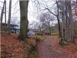 23
23 24
24 25
25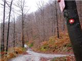 26
26 27
27 28
28 29
29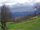 30
30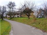 31
31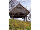 32
32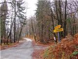 33
33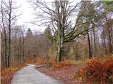 34
34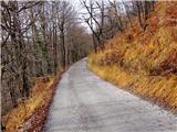 35
35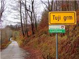 36
36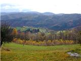 37
37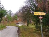 38
38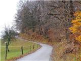 39
39 40
40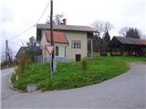 41
41 42
42 43
43 44
44 45
45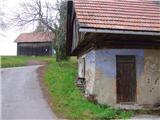 46
46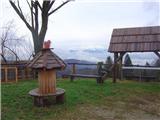 47
47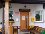 48
48
Discussion about the trip Litija - Janče (via Širmanski hrib)
|
| zdomec26. 11. 2013 |
This trail is very varied and shady in summer,
This trail can only be used by those who know it 100%.
Markings are rare, junctions are not equipped with direction signs, at least not all crossroads, so those going on the trail for the first time may have great difficulties.
PD Litija, it would be very commendable to equip the trail with direction signs.
|
|
|
|
| bruny26. 11. 2013 |
"This trail can only be used by those who know it 100%." Very interesting  . According to what's written, anyone who doesn't know this trail 100% shouldn't use it and should stay home, for example, lying in bed as someone already wrote... where a picture might fall on his head. I assume that every average reader of these pages has some orienteering skills, scouting, "trail following"..., so they should be able to hike the trail from Litija to Janče more or less correctly, even with the help of Žuže's excellent description, and arrive at Janče full of satisfaction in nature. Regards . According to what's written, anyone who doesn't know this trail 100% shouldn't use it and should stay home, for example, lying in bed as someone already wrote... where a picture might fall on his head. I assume that every average reader of these pages has some orienteering skills, scouting, "trail following"..., so they should be able to hike the trail from Litija to Janče more or less correctly, even with the help of Žuže's excellent description, and arrive at Janče full of satisfaction in nature. Regards
|
|
|
|
| zdomec27. 11. 2013 |
Bruny, I apologize, I really messed it up a bit and wrote it somewhat awkwardly. Why am I responding? In mid-October we were picking chestnuts on Širmanski hrib and met an older couple from Hrasnik who were heading back to Litija. They told us that at the junction they didn't know which way to turn and there was no one nearby to ask. That's just for clarification. Of course, everyone can use this trail, as it is really beautiful and scenic.
Regards.
|
|
|
|
| bruny27. 11. 2013 |
Yes, no problem, it will really be necessary to go to this part of Slovenia once, to check as some say... Janče "little gem" between Ljubljana and Litija. Regards
|
|
|
|
| Žuža29. 11. 2013 |
Janče is really a little gem. The trail is scenic and offers plenty of pleasures in all seasons: those to consume (forest strawberries, blueberries ...) and those to look at (beautiful views, interesting farm architecture ..). I usually prefer the ascent from Litija and descent to Jevnica. It is true that the trail in the opposite direction, i.e. Janče-Litija, is slightly harder to follow, at some junctions it would be good to add markings or direction signs. Otherwise, last year the markers of PD Litija were renewing the trail, but I think not completely, only the initial part from Litija up to about halfway (someone can correct me if they know different information). Enjoy the trail. Regards
|
|
|
|
| bruny30. 11. 2013 |
For paths from larger settlements, there is no particular panic regarding marking... the frequency of walkers, runners, cyclists... enthusiasts is high enough that the path is somehow maintained. Even from smaller settlements it's no problem, as some local trail marker ensures proper marking. The problem is the connecting links between individual hills, where you encounter ,,wonders,, and they are poorly visited, especially in border areas between individual societies or hills. But that motivates you even more to find at least mostly optimal and precise path somewhere. I notice there are even too many directional signs, which are a higher cost, but lack of markers, which are negligible cost. Well, regarding this path, I think there shouldn't be major problems from the viewpoint that it officially has no hiking trail junctions and just some marker at junctions simplifies the situation without unnecessary searches or returns. Regards
|
|
|
To post a comment you must log in:
If you do not yet have a username, you must first
register.