Lipa - Dom na Menini planini
Starting point: Lipa (721 m)
| Latitude/Longitude: | 46,2614°N 14,8937°E |
| |
Walking time: 3 h 15 min
Difficulty: easy marked way
Elevation gain: 732 m
Elevation difference along the route: 850 m
Map: Zgornja Savinjska dolina 1:50.000
Recommended equipment (summer):
Recommended equipment (winter): ice axe, crampons
Views: 25.415
 | 1 person like this post |
Access to starting point:
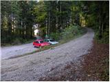
From the highway Ljubljana - Celje we go to the exit Vransko. We continue driving on the old road in the direction of Ljubljana, but only to a spot where the road towards Vransko branches off to the right. On the west side of Vransko we will notice a road which goes towards the village Prapreče and Vologa. The road that starts ascending steeper we follow through the village Vologa to a saddle Lipa, where we park on one of the parking lots.
Access from Zadrečka Valley is also possible.
Route description:
From the parking lot, we go on a macadam road in the direction of Smolnik and Menina planina. Moderately steep road which all the time runs through the forest, after good 10 minutes of walking, it brings us to a marked crossroad, where we continue left. The road ahead slightly flattens, and then it continues by crossing the slopes of Smolnik. After a time we will by the road notice signs for Smolnik (sharply right), and we continue on a macadam road which gradually starts gently descending. A little further, the marked path cuts a longer turn, and then it returns on the road, where starts descending steeper. Next follows smaller ascent, and then the road descends to a lonely farm Jeseničnik, where from the left joins the path from the village Vologa.
We continue through the yard, after that at farm outbuilding we continue right on a cart track. Cart track then ascends diagonally towards the left, and in doing so it crosses panoramic grassy meadow, from which a nice view opens up on Posavsko hribovje. When the path passes into the forest, turns sharply to the right, and is then a little steeper ascending until we get on a bad forest road. A little further from the mentioned road, wide cart track branches off slightly to the left, and after few minutes of additional walking brings us on extensive grassy slopes named Slopi.
Here on the right side we notice a lonely house, and we continue in the same direction and over poorly visible cart track we walk to the middle of a grassy slope. Here we run into a little wider cart track which we follow to the right and in a gentle descent, we descend there to a smaller hamlet. Here we stride across the grazing fence and we step on the road which we follow towards the west. The road then on the right side bypasses hamlet and after few steps of additional walking brings us to a crossroad by which stands a smaller cross. At the cross we continue straight (direction Biba), but on the left road, and it slowly starts ascending. After a short gentle ascent road brings us into the forest, and blazes here point us to the right on a steep footpath. The mentioned footpath soon crosses a wide cart track, and then continues on quite overgrown and already abandoned cart track. Higher, we join a wider cart track which we then follow all the way until we get out of the forest (because cart track has some crossings we carefully follow the blazes). When we step out of the forest, the path turns to the right and after few minutes of additional walking brings us on a macadam road which leads on Menina planina. We continue the ascent on the mentioned road, and at first, it offers nice views on surrounding hills. Relatively gentle road then leads us past the mountain pasture Limovska planina, and we follow it to the spot, where blazes point us to the right, over a grazing fence on a footpath. The footpath immediately turns to the left and by the edge of the forest quickly brings us to the cottage on the mountain pasture Biba planina.
From Biba planina we continue on a marked path, which immediately behind the chapel turns a little towards the left and is then moderately ascending over pleasant slopes. Higher, the path flattens, crosses stone fence and then continues on a pleasant grassy terrain. After few minutes of additional walking, the path slightly descends, after that at smaller watering place crosses wooden grazing fence. The path ahead crosses a short lane of a forest and then joins the macadam road. We continue the ascent on the mentioned gentle road, and then blazes point us slightly to the left, on a footpath which ascends diagonally above the lake Biba. On the other side of the lake path ascends a little steeper, and then again crosses the road. We continue ascent on a marked footpath which to the mountain hut Dom na Menini planini few more times crosses a road or there also continues.
In fog the orientation is relatively difficult.

Photos:
 1
1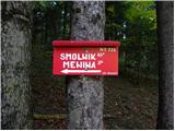 2
2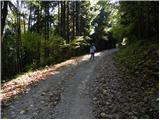 3
3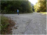 4
4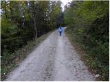 5
5 6
6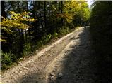 7
7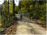 8
8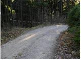 9
9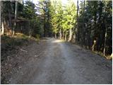 10
10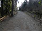 11
11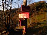 12
12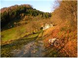 13
13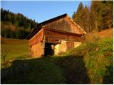 14
14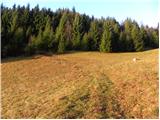 15
15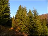 16
16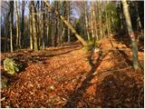 17
17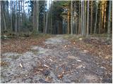 18
18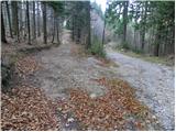 19
19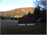 20
20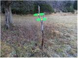 21
21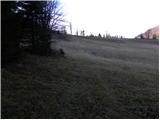 22
22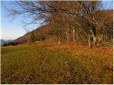 23
23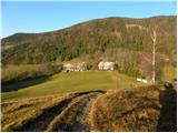 24
24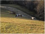 25
25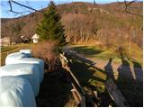 26
26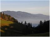 27
27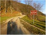 28
28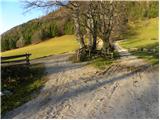 29
29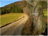 30
30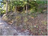 31
31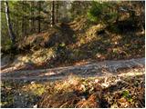 32
32 33
33 34
34 35
35 36
36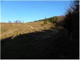 37
37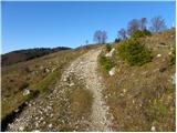 38
38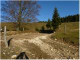 39
39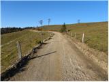 40
40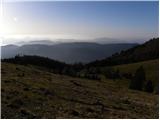 41
41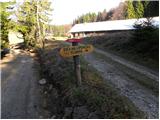 42
42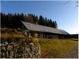 43
43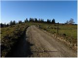 44
44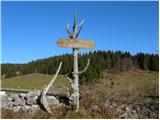 45
45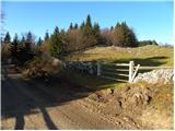 46
46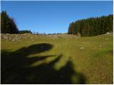 47
47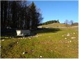 48
48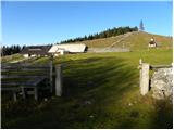 49
49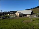 50
50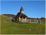 51
51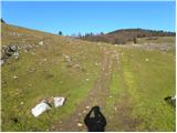 52
52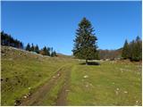 53
53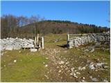 54
54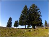 55
55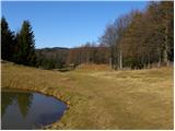 56
56 57
57 58
58 59
59 60
60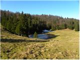 61
61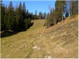 62
62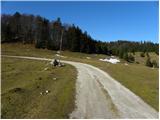 63
63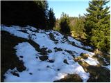 64
64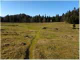 65
65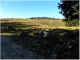 66
66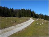 67
67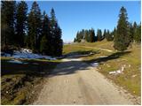 68
68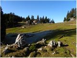 69
69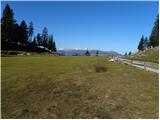 70
70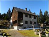 71
71
Discussion about the trip Lipa - Dom na Menini planini
|
| Vanjap10. 01. 2012 |
Visit Menina planina also in winter. They have duty shifts on weekends. Food excellent, tea gratis!
|
|
|
|
| Lj29. 01. 2012 |
We visited yesterday and everything holds as Vanjap wrote. At the junction in the 4th photo we went straight, the directions merge at Slopah. Nice hiking, extended variant of access to Menina planina. Currently little snow, so no gaiters needed. But I'm wondering, does anyone know which path is marked with yellow signs with a black snail drawn on them?
|
|
|
|
| potepinka30. 01. 2012 |
I forgot to mention that on the link you look under the tab "kam in kako", there is the path to Goli vrh on Menini planini.
Hope it's helpful and have a nice day!
|
|
|
|
| Vanjap30. 01. 2012 |
Yes, that's the snail. Now I know what it means.
|
|
|
|
| Lj30. 01. 2012 |
Thanks wanderer and have a nice day too!
Best, Ljubica
|
|
|
|
| pohodnica531. 02. 2012 |
I would like to shorten this trail from Lipa to the hut a bit in this winter time (to 2 hours of walking), so I'm wondering if it's possible to park somewhere in between;
thanks and best regards
|
|
|
|
| BRAZONIK1. 02. 2012 |
Oh yes, drive to Usranga klanca, that's past SEmprimožnika above G.grad, another 2km., park there, and off you go. Walking time under 2 hours. There are already duty staff up there, you can get tea or something else.
|
|
|
|
| pohodnica531. 02. 2012 |
BRAZONIK, thanks for the info, G.grad is even closer for me to access; great; best
|
|
|
|
| BRAZONIK1. 02. 2012 |
Tomorrow morning we'll be up there, you owe us some tea. Lp
|
|
|
|
| pohodnica531. 02. 2012 |
Sadly I'm not going up tomorrow, but we'll surely meet sometime and Častna, you'll get tea and some homemade blueberries as a bonus; lp
|
|
|
|
| pohodnica536. 05. 2012 |
@BRAZONIK - the promised blueberries are waiting for you, paid, at the caretaker in Dom na Menini ; ;
|
|
|
|
| miki_224. 03. 2013 |
The path is nice otherwise, but from picture 37 onwards shamefully poorly marked. Criticism for the PD that maintains this path. 
|
|
|
|
| Bernard Štiglic24. 03. 2013 |
Last time I walked Menina from Črnivca to Lipa. To the hut on Menina the path is well marked, further on some ingenuity is needed. Of course, one must follow the rule to first walk the path in dry conditions. From the hut on Menina to Lipa there are many markers on larger stones along the path and fences, which in current conditions are deep under snow. Winter markers are a good solution.
|
|
|
|
| gorjanci27. 03. 2013 |
Over the holidays I plan to go to Menina planina. Reconnaissance tour. I'm interested where it's best marked in this (winter) time. Is some useful circular tour possible?
|
|
|
|
| otiv28. 03. 2013 |
@gorjanci it's best marked from Gornji grad over Borovnica or past Semprimožnik. Probably also the most trodden, so there won't be too much work. I prefer from Golica, that path can cause you orientation issues, especially in winter time when many marks are under snow. It's also quickly trodden and makes walking a bit easier for a person. Probably your first time to Menina, so I wish you all the best.
|
|
|
|
| CarpeDiem24731. 03. 2013 |
I agree with Otiv, from "our" direction the closest path to me is from Golic or Češnjic, on which you can easily get lost (verified, hehe).
|
|
|
To post a comment you must log in:
If you do not yet have a username, you must first
register.