Lepena - Great Soča Gorge
Starting point: Lepena (460 m)
| Latitude/Longitude: | 46,3349°N 13,6455°E |
| |
Walking time: 20 min
Difficulty: easy marked way
Elevation gain: 20 m
Elevation difference along the route: 50 m
Map: Julijske Alpe - zahodni del 1:50.000
Recommended equipment (summer):
Recommended equipment (winter):
Views: 42.433
 | 5 people like this post |
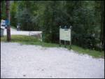
Access to starting point:
From the Trenta–Bovec road we drive to the village of Soča, where signs for Lepena direct us to the left (from the Bovec side to the right) steeply downhill. The road then crosses part of the Velika korita over a bridge and quickly brings us to a marked parking lot, where we park.
Route description:
From the parking lot, we head back along the road by which we arrived and follow it to the place where the road crosses the Velika korita. Here we will notice a tourist sign by the road that directs us onto an initially wide path that runs along the edge of the Velika korita Soče. The path mostly runs through the forest and approaches the gorges only at viewpoints (careful - danger of slipping into the raging river). A little further, the path from the main road between Trenta and Bovec also joins via a suspension bridge. We continue along the right side (left bank) of the Soča River and the path quickly brings us to the beginning of the gorges.
Photos:
 1
1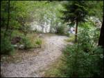 2
2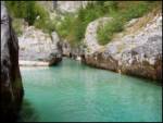 3
3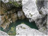 4
4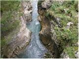 5
5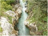 6
6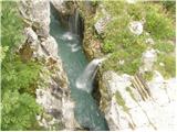 7
7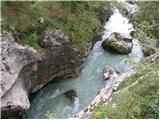 8
8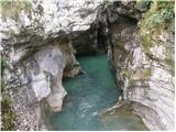 9
9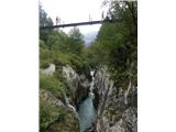 10
10 11
11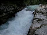 12
12
Discussion about the trip Lepena - Great Soča Gorge
To post a comment you must log in:
If you do not yet have a username, you must first
register.