Starting point: Lengar (699 m)
| Latitude/Longitude: | 46,4795°N 13,8696°E |
| |
Walking time: 3 h
Difficulty: partly demanding unmarked way, easy pathless terrain
Elevation gain: 1000 m
Elevation difference along the route: 1000 m
Map: Kranjska Gora 1:30.000
Recommended equipment (summer):
Recommended equipment (winter): ice axe, crampons
Views: 12.090
 | 1 person like this post |
Access to starting point:
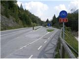
From Kranjska Gora, we drive towards Jesenice. Soon after the village Gozd - Martuljek, we will notice on the right side an old railway bridge (today a cycling path) and next to it an arranged parking lot.
If we come from the direction of Jesenice, we can't get to the mentioned starting point, because we are not allowed to turn left. Therefore we have to drive to Gozd - Martuljek (possibly also a little earlier), turn around there and then drive in the direction of Jesenice. Further, follow the above description.
Route description:
From the parking lot, we step on the cycling path, cross the railway bridge and then at the crossroads continue right. After a few steps of walking on the macadam road, we will get to a crossroads at the TNP sign. Here we continue right on the worse forest road, which after a few minutes of walking brings us to a mighty torrent. We cross the torrent, then step into a short stretch of forest, where we again find the forest road. We follow the road a few dozen steps, then it brings us to another torrent. Here the road finally ends, and we head slightly left across extensive scree fields, walking along the right edge of the torrent (viewed from bottom to top). After a few minutes of walking, we will notice on the right side of the torrent a forest path (at the beginning of the path there is usually a cairn), which first ascends beside the torrent, then turns right. Further, we ascend on a wide and easy-to-follow hunting path, which after a short ascent brings us to a smaller viewpoint.
Here the path turns slightly right and continues diagonally ascending gently. After a few minutes of traversing, we come to a partly marked junction, where we continue straight on the lower path (sharply right mountain pasture Zaprete and Ingotova brunarica), which a few steps further crosses a steep and slippery-dangerous torrent. When we cross the mentioned torrent, the path gets closer to Beli potok stream. During the further ascent we increasingly hear the roaring of the waterfalls of Beli potok (Skočniki), which higher up we approach completely (if we step a few meters left off the path we can also notice two waterfalls steeply falling into successive pools - risk of slipping!). Just a little further the path brings us above Skočniki, so we can view the upper waterfall from its outlet too.
Here the path turns sharply right past an old bench and begins to ascend moderately through the forest. We follow the easy-to-follow hunting path for about another 20 minutes, then leave it and continue the ascent left through easier pathless terrain. During the ascent through pathless terrain, we will here and there notice a poorly beaten path and a few smaller cairns. Higher the "path" brings us to smaller screes, where it becomes somewhat easier to follow. Further we steeply ascend over the mentioned scree, then pass into a belt of bushes, where the path is easy to follow but not passable. When we push through the belt of bushes we step again onto the scree, which we follow to a small saddle, where there is an unmarked junction. We continue right (left viewpoint on the walls of Martuljške gore - 20 minutes, straight downhill cirque Za Akom) and along an undemanding ridge path in a few minutes of further walking arrive at the summit of Rutarski Vršič.

Photos:
 1
1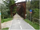 2
2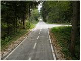 3
3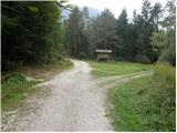 4
4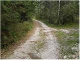 5
5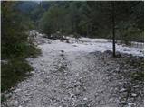 6
6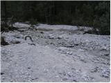 7
7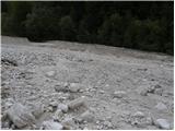 8
8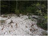 9
9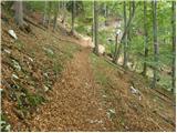 10
10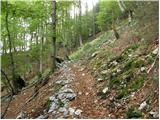 11
11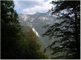 12
12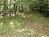 13
13 14
14 15
15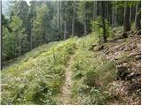 16
16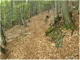 17
17 18
18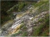 19
19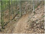 20
20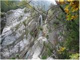 21
21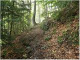 22
22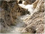 23
23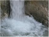 24
24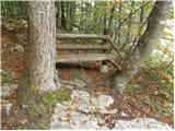 25
25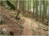 26
26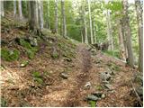 27
27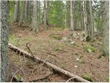 28
28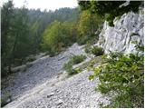 29
29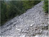 30
30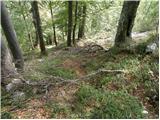 31
31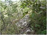 32
32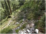 33
33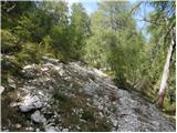 34
34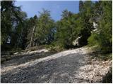 35
35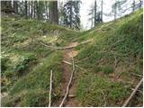 36
36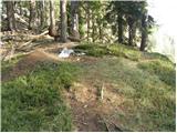 37
37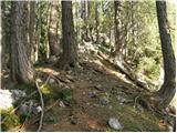 38
38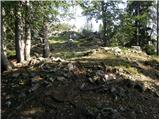 39
39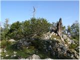 40
40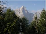 41
41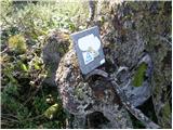 42
42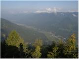 43
43
Discussion about the trip Lengar - Rutarski Vršič
|
| darh14. 07. 2010 |
We followed the described path to Skočniki at the end of June. Unfortunately, part of the path is heavily damaged due to forestry work - somewhere between the view of the Karavanke and crossing the clearing in the upper pictures. In addition, the beginning of the forest path along the stream bed is quite changed and we wouldn't have recognized it from the picture published here. A more detailed description of our path can be found here.
|
|
|
|
| tomaž branc18. 09. 2012 |
When you next visit Skočnike, don't miss the around 35 meters high highest waterfall that forms from that "one more spring" in front of the hunting hut. Just descend a few tens of meters through the forest on a faintly visible path and look over the edge - carefully! Undoubtedly one of the most beautiful Slovenian waterfalls!
|
|
|
|
| ljubitelj gora2. 06. 2013 |
This description doesn't include the path to the hunting hut and waterfall, the latter is on the left side of the jumps, I crossed above them and then climbed an unmarked trail to the hunting hut, further on there's a marked path, but I don't know where it leads, from the hunting hut I went back a bit, then descended along the jumps to the place where the view opens to one of the most beautiful waterfalls, in wet conditions risk of slipping and the view is quite deep. Then I descended my own way so as not to go straight back up, basically on unmarked paths there are various hunting trails, cairns, paths....Higher up picture say 30 even further right I went on one trail, more grass. Anyway I wrote this since I was already hiking there. These photos are before my floods, floods, How I got to the car GM along the left side of Sava Dolinka, in between I sank almost to my knees in mud, the trail is visible, forest path, at the end need to cross water and another minute and I closed the loop.
|
|
|
|
| Edina6. 07. 2014 |
Yesterday to RV via the mentioned path, but in the upper part differently, although I walked the path all the time or followed the markers. No newly felled trees here. On the descent to Za Ak, some new fallen trees joined the old ones. On both sides, passability is not in question, just need to be careful not to miss the continuation of the path during detours. Some impressions here
http://stezeinsledi.blogspot.com/2014/07/takoj-po-rojstvu-se-prekucnejo-v-brezno.html
and good luck on the paths.
|
|
|
|
| heinz10. 07. 2016 |
Since at the point on the path where, according to the above description (last paragraph), one should leave the hunting trail and turn left onto pathless terrain, there is no tangible orientation point except the mentioned 20 minutes from the bench at Skočnikih, I continued along the path all the way to the top. Note that below the summit the terrain is quite steep and requires some scrambling over scree and steep grass. (risk of slipping) The path fades, which means demanding pathless terrain!
I returned via the described variant. The point where one should leave the path and turn left is a few meters behind the wooden water trough with benches. This is quite a bit more than 20 minutes from the bench at Skočnikih. In this forest section all the way to the scree there are almost no cairns, nor traces of the "path" visible, so I suggest from here directing slightly left, while moderately ascending along the indistinct forest ridge beside the valley on the left, until you spot the scree slightly left above the horizon. After that, no orientation issues.
|
|
|
|
| suhy18. 11. 2018 |
Wonderful autumn excursion. From the railway bridge up the Beli potok valley, Za Akom dol, view of waterfall 2 and back along Sava to the railway bridge.
|
|
|
|
| Batistuta16. 08. 2020 |
All path descriptions in the Beli potok valley and access to Rutarski Vršič are downright catastrophic.
Today I did a circular tour, got lost a lot in between, walked by instinct etc. In the end I reached the goal and descended safely.
The problem is that the paths on the PZ map are drawn incorrectly, and there are tons of paths and abandoned forest tracks that mislead you. There are huge numbers of fallen trees on the paths, sometimes entire slopes fallen, making it impossible to follow the path. With a lot of fitness, patience and willingness to walk by instinct, it is possible to reach the top.
For those who don't like getting lost and orienting, I recommend the path from Za Akom, which is easier to follow, with cairns placed, some I placed today myself.
Rutarski Vršič actually has two summits, I don't know which is higher. I couldn't find a summit register on either today, maybe the marmot took it. 
|
|
|
|
| djimuzl17. 08. 2020 |
Given that the path descriptions on these pages are "fixed" - this one was created at least ten years ago; the first comment on this path is from July 2010), it is quite clear that since the comment was made, many changes could have happened on the path - especially if it's a path not maintained as a marked hiking trail.
That's exactly why commenting and "updating" information on current path conditions is provided here.
Your comment is more "catastrophic", as you blame poor descriptions for orientation problems first, but justify it with poor mapping and forestry works.. So what? 
There has never been a summit register or marmots there. 
|
|
|
|
| Pastirica17. 08. 2020 |
On July 5 and 10 this year the summit logbook box was there, that's where I also noticed the name Rutarški Vršič.
|
|
|
|
| JusAvgustin17. 08. 2020 |
Rutarski Vršič is an independent summit where the logbook box is located. The path past the hunting stand is perfectly traceable and poses no problem for anyone with at least a little sense of orientation.
|
|
|
|
| Jusk18. 08. 2020 |
I went along this path last year quite randomly, I read about it and decided to go check it out. At the beginning it was nicely traceable, higher up past some fallen trees, searching for the continuation.. but I made it to the top on the way back down I missed and went off-trail down the slope until I found this path that brought me to the one I took up.. lots of unmarked paths up there I mean..
|
|
|
|
| ppegan19. 08. 2020 |
I went to Rutarski Vršič past Skočnikov the first time with an expert, so it was simple. The second time I led a colleague, the third time my parents. On the third visit after the storm there was lots of fallen trees, actually whole slope as the previous one writes, so passage and path finding was quite difficult. But since I roughly knew where the path goes and in which direction, we had no major problems. We struggled most with crossings over, under and around trees. We descended then behind Ak, where the path is nicely traceable and marked.
|
|
|
|
| Pastirica19. 08. 2020 |
I got the descriptions here and GPS track from that site, then it was that, a bit after also that. Some searching both times but it was worth it. Solitary and remote areas.
|
|
|
|
| Jusk19. 08. 2020 |
When I was here last year, I don't even know which path I took, it wasn't the one in the description, the start was the same, but later some other path, I know I didn't go past skočnikov, there was another unmarked path, had to search for it a bit in between, also lots of fallen trees on the path.. just before the summit straight up steep grass.. the view from the top is really nice, mists were in the valley
|
|
|
|
| ppegan20. 08. 2020 |
@Jusk, from your description you went past the Skočnikovi falls, but just didn't find them  You probably walked above the stream for a while, but for the highest Skočnikovi waterfall you have to veer off the path a bit anyway to find it You probably walked above the stream for a while, but for the highest Skočnikovi waterfall you have to veer off the path a bit anyway to find it
|
|
|
|
| Jusk20. 08. 2020 |
That's possible too, yeah
|
|
|
|
| JusAvgustin21. 08. 2020 |
You can go along the left side of the stream bed past Katarza and Stiriofobija and push through the bushes to V Skočnikov. Descend along the hunting trail past the hunting stand.
|
|
|
|
| Majdag22. 08. 2020 |
When my sister and I went (blog above), we followed the path description. It's been about three years, but we had no problems. The little paths on the hunting trails are mostly visible for a while, then they disappear again. That's the charm. Only that little man on the left at the jumps was a bit scared..
|
|
|
To post a comment you must log in:
If you do not yet have a username, you must first
register.