Leibnitzbachbrücke - Hochschober (via Staniskascharte)
Starting point: Leibnitzbachbrücke (1656 m)
| Latitude/Longitude: | 46,91503°N 12,66483°E |
| |
Route name: via Staniskascharte
Walking time: 5 h
Difficulty: very difficult marked way
Elevation gain: 1584 m
Elevation difference along the route: 1610 m
Map:
Recommended equipment (summer): ice axe, crampons
Recommended equipment (winter): ice axe, crampons
Views: 4.747
 | 3 people like this post |
Access to starting point:
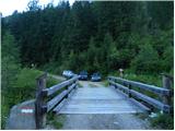
Through the Karawanks Tunnel, we drive to Austria, and then we continue driving towards Spittal and further towards Lienz (a little after Spittal the highway ends). Further, we drive on a relatively nice and wide road through the Drau valley. In the center of Lienz, at the roundabout, we continue right towards the settlement Matrei. From the roundabout we drive approximately 8 km through the valley by the river Isel, then we turn right towards the settlement Oberleibnig. On an ascending road we then all the time follow the signs for the mountain hut Hochschoberhütte. The road is otherwise most of the time ascending on steep slopes and is quite narrow. In the last part, the asphalt ends and we continue a few more kilometers on a macadam road to the parking lot by a bridge over the stream Leibnitzbach.
Route description:
From the parking lot, we continue a few more meters on a macadam road which is further closed for traffic, and then signposts point us to the right on a footpath. At first, we ascend through the forest by the left side of the stream Leibnitzbach. Later, the path named Eduard Jordan Weg brings us to somewhat flatter grassy terrain where we cross the bridge. Further, the path again ascends a little steeper by the stream and brings us to the mountain pasture Leibnitzalm.
On the mountain pasture the path crosses a stream and then joins the mountain road. Further, we walk for some time on a macadam road along the stream, then we get to a junction, where the macadam road turns left.
At the junction, we continue straight where signposts by the path direct us. From the junction, we at first walk on a wide cart track, which after crossing the stream soon turns into a footpath. Here the path again starts to ascend a little steeper and leads us through a short stretch of forest. The path continues along the stream and from the left side soon joins also a path from the end of the road. Further, the path turns a little to the right and increasingly beautiful views start to open up on surrounding peaks. Then the path runs on grassy slopes past a cross, and by the path there are also quite a few benches. When we reach somewhat steeper slopes, the path turns to the left and then in the ascent crosses the slopes all the way to the mountain hut Hochschoberhütte.
At the mountain hut, we continue slightly left (towards the north) following the signs »Hochschober über Staniskascharte«. The path first descends a little on a grassy slope and then crosses a stream. Further, the path again starts ascending and from the path increasingly beautiful views open up on surrounding peaks. The path continues ascending on the southern slopes near the stream and brings us to the lake Schoberlacke, which is located below the southern slopes of the peak Hochschober.
From the lake the path continues towards the north and ascends through the valley on the eastern side of the peaks Kleines Schöberl and Langes Schöberl. Further, the path ascends somewhat steeper towards the notch Staniskascharte. On this section there are also in late summer still possible snow fields, so the use of an ice axe and crampons is necessary.
At the notch where there are signposts, we continue right and start steeply ascending beside the rocky ridge. Higher, the path becomes somewhat less steep and bypasses the forepeak (3185m) on the southern side. The path then leads us along the ridge towards the main summit and follows a steep ascent again. On a shorter section, a steel cable assists us. In the last part, the path becomes less steep and along the panoramic ridge we soon reach the summit.
The described path is demanding mainly due to snow fields that persist long into summer, and for safe crossing of the snow fields crampons and ice axe are essential. At a few spots some easy climbing (1st grade) is also necessary.
We descend along the ascent path or along the path that runs along the eastern ridge of the mountain.

Photos:
 1
1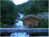 2
2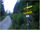 3
3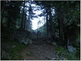 4
4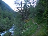 5
5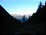 6
6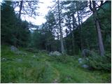 7
7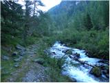 8
8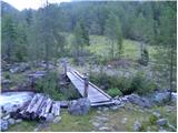 9
9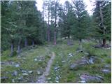 10
10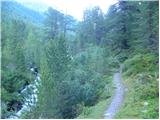 11
11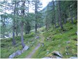 12
12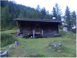 13
13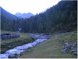 14
14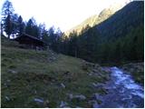 15
15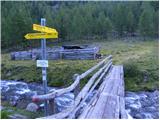 16
16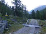 17
17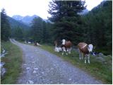 18
18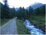 19
19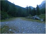 20
20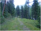 21
21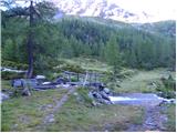 22
22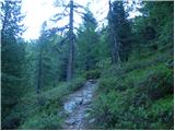 23
23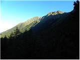 24
24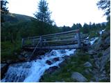 25
25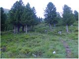 26
26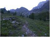 27
27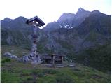 28
28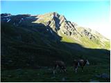 29
29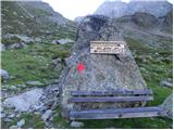 30
30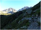 31
31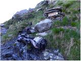 32
32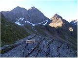 33
33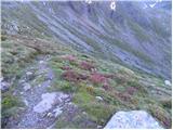 34
34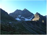 35
35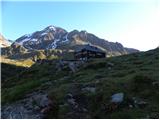 36
36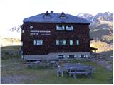 37
37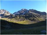 38
38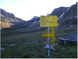 39
39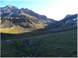 40
40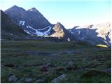 41
41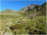 42
42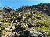 43
43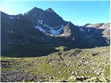 44
44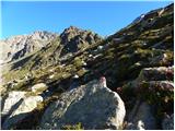 45
45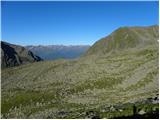 46
46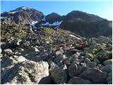 47
47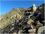 48
48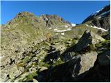 49
49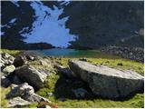 50
50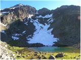 51
51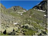 52
52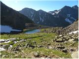 53
53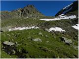 54
54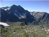 55
55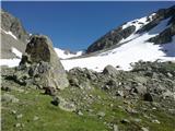 56
56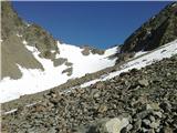 57
57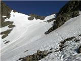 58
58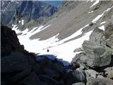 59
59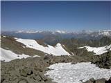 60
60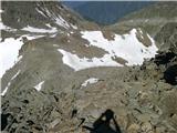 61
61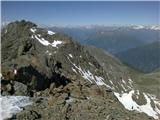 62
62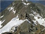 63
63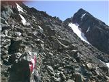 64
64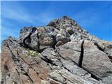 65
65
Discussion about the trip Leibnitzbachbrücke - Hochschober (via Staniskascharte)
|
| pohodnik3334. 09. 2023 16:26:05 |
 Hike on 1.9.2023. Hike on 1.9.2023.
As the author described. I'd add, on 1 September there was some snow above 3050m onwards and only on the west path, the east path dry. Probably it snowed a few days ago during the bad weather and hasn't melted yet. No need to use crampons, but you can call the hut and ask. Via ferrata kit not needed here. You need to climb a bit, grade I, somewhere, as the author said.
The east path is a bit easier and fewer snow issues IMO. One loop on the descent to the east, lower part before the scree. Markings on the steeper section, many miss them and go more to the right. But there is also a chain, loose and not fixed in the lower part. A couple of them didn't dare to go along the chain and turned back (continued where marked). Nice mountain, worth a visit, probably right behind Glödis in popularity in this narrow group. For me the nicest variant is left from the hut, so SW up and east down.
Compared to some nearby peaks, the path is flowing, no scrambling through loose stones, blocks.
Hut prices ok, large beer 5 eur, acceptable.
Regards
|
|
|
|
| Danijel Ž.17. 09. 2023 19:34:43 |
Really nice tour. Along the path to the hut, still lots of raspberries and blueberries. The circular variant clockwise is recommended.
|
|
|
To post a comment you must log in:
If you do not yet have a username, you must first
register.