Legastja - Sveti Jakob (north path)
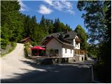
Starting point: Legastja (438 m)
| Latitude/Longitude: | 46,1072°N 14,3498°E |
| |
Route name: north path
Walking time: 1 h
Difficulty: easy marked way
Elevation gain: 368 m
Elevation difference along the route: 375 m
Map: Ljubljana - okolica 1:50.000
Recommended equipment (summer):
Recommended equipment (winter): crampons
Views: 8.075
 | 2 people like this post |
Access to starting point:
A) From Ljubljana, Kranj or Vodice we drive to Medvode, from there we continue driving towards Sora. At the crossroad at the beginning of Sora, immediately behind the small bridge we turn left in the direction of Katarina and village Trnovec. Further, we drive through the valley Ločnica towards Katarina (Topol), and we drive along it to the inn Legastja, near which we park on an appropriate place by the road (organized parking lot by the inn is intended for guests).
B) First, we drive to Škofja Loka, from there we continue driving towards Sora. At the end of Sora we turn right in the direction of Katarina and village Trnovec. Further, we drive through the valley Ločnica towards Katarina (Topol), and we drive along it to the inn Legastja, near which we park on an appropriate place by the road (organized parking lot by the inn is intended for guests).
Route description:
From the starting point at the inn Legastja at first we carefully cross the road, and then we go on a footpath in the direction of Sv. Jakob. The path first ascends on a grassy cart track which leads us among hay meadows and pastures, then it flattens and brings us to a smaller hamlet, where we step on an asphalt road. We continue the path among some houses, after which the asphalt road changes into a cart track, on which we ascend to the nearby hayracks. At the hayracks the blazes point us slightly left, on the path which then ascends on a meadow. Easy to follow, but in the time of high grass a little overgrown path, after a few minutes brings us to another asphalt road which we reach at a smaller crossroad, by which there is a cross. We continue on the left side of the cross, on an ascending road, on which we quickly arrive at a hamlet of a few houses and a marked junction there.
At the junction we leave the road and continue the ascent left in the direction of the 10 minutes shorter path to Sv. Jakob. When we step into the forest, at a poorly marked junction we continue on the left lower path, which then slightly descends towards the distinct torrent gully. On the other side of the gully, the path, which at first continues on a forest cart track, gradually starts to ascend somewhat more steeply. Higher the blazes point us right on the path which in a few minutes brings us out of the forest onto panoramic hay meadows. For a short time we continue on a poorly visible trail, which leads us across the hay meadows, then we already step on the next asphalt road, which we follow to the right (left Tehovec).
On the road, which leads us along a panoramic ridge, from which we have a nice view of the Kamniško Savinjske Alpe, we walk only a few dozen steps, then we continue slightly left on the mountain path, which quickly brings us to the next junction.
At the mentioned junction we leave the cart track, which bypasses the summit of Sv. Jakob on the eastern side, and continue the path right in the direction of the mentioned summit. The path ahead starts steeply ascending through a belt of bushes and forest, then flattens somewhat and brings us across a panoramic grassy slope to the cart track, which leads towards the summit of Sv. Jakob. We follow the cart track to the left, and in a minute of further walking we ascend to the panoramic summit.

Photos:
 1
1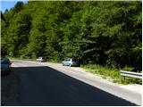 2
2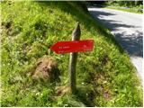 3
3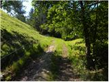 4
4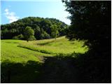 5
5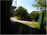 6
6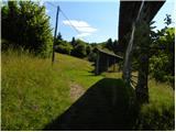 7
7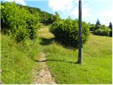 8
8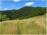 9
9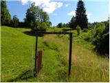 10
10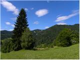 11
11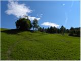 12
12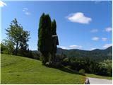 13
13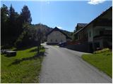 14
14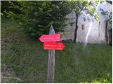 15
15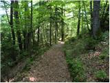 16
16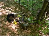 17
17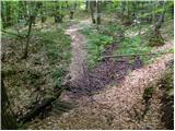 18
18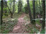 19
19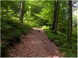 20
20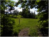 21
21 22
22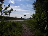 23
23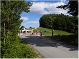 24
24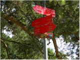 25
25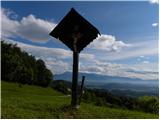 26
26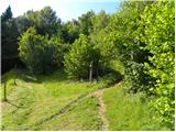 27
27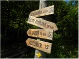 28
28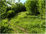 29
29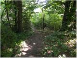 30
30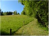 31
31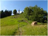 32
32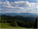 33
33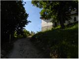 34
34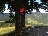 35
35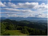 36
36
Discussion about the trip Legastja - Sveti Jakob (north path)
|
| balon22. 08. 2013 |
Is there also a stamp at the top besides the book?
|
|
|
|
| ločanka2. 03. 2017 |
I like this trail because you quickly step into a beautiful open world of meadows, where you simply can't hurry because there's so much to see, and if you hike at this time, you also hear the calls of many birds. When you continue to the left and emerge from the forest back into the open world, a pleasant ascent through a birch grove awaits you. For this peak, you don't need to pick a sunny day; it's beautiful even in cloudy and windy weather. But alas, it rarely gets its turn with so many peaks around.
|
|
|
To post a comment you must log in:
If you do not yet have a username, you must first
register.