Ladvenjak - Martinščak (lažja pot)
Starting point: Ladvenjak (170 m)
| Latitude/Longitude: | 45,41046°N 15,58806°E |
| |
Route name: lažja pot
Walking time: 30 min
Difficulty: easy marked way
Elevation gain: 175 m
Elevation difference along the route: 175 m
Map:
Recommended equipment (summer):
Recommended equipment (winter):
Views: 131
 | 1 person like this post |
Access to starting point:
We drive to Karlovac and continue towards Velika Kladuša. In the village Cerovac Vukmanićki, the road branches off to the right to Ladvenjak. We continue in this direction and after the end of the hamlet Selište turn slightly left onto a narrow asphalt road that gently ascends to a junction, where straight ahead there is already a parking lot or we drive a few more meters to the left to the parking lot by the cemetery, where there is some parking space.
Route description:
From the starting point, head onto the forest track which initially gently ascends through the forest then levels out. After about 5 minutes arrive at a junction, continue straight. The track is somewhat overgrown here. Soon reach the fork for the harder and easier path. Continue straight towards the easier path. The track rises slightly then gently crosses the slope to the left branch. From the right, the path from Ladvenjak center joins. Continue on the ascending path. The path widens back into a track and soon reach a narrow asphalt road with signposts beside it. Continue left on the road. Right Vinica. The road steeply ascends and in 5 minutes spot the chapel of St. Martin on Martinščak.
Description and photos refer to the condition in October 2025.
Photos:
 1
1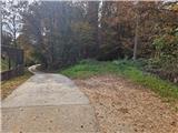 2
2 3
3 4
4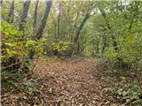 5
5 6
6 7
7 8
8 9
9 10
10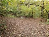 11
11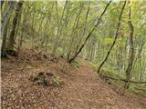 12
12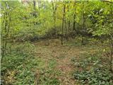 13
13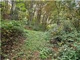 14
14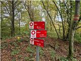 15
15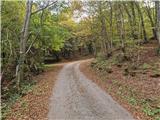 16
16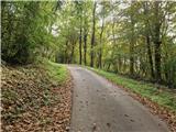 17
17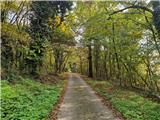 18
18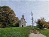 19
19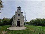 20
20
Discussion about the trip Ladvenjak - Martinščak (lažja pot)
To post a comment you must log in:
If you do not yet have a username, you must first
register.