Kurja vas - Kovinarska koča v Krmi
Starting point: Kurja vas (775 m)
| Latitude/Longitude: | 46,4235°N 13,9379°E |
| |
Walking time: 40 min
Difficulty: easy marked way
Elevation gain: 95 m
Elevation difference along the route: 100 m
Map: Kranjska Gora 1:30.000
Recommended equipment (summer):
Recommended equipment (winter):
Views: 12.409
 | 2 people like this post |
Access to starting point:
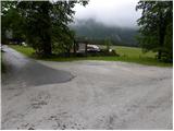
We leave the Gorenjska highway at the Jesenice-West (Hrušica) exit and continue driving in the direction of Kranjska Gora. A little before the settlement of Dovje, we leave the main road and continue driving left in the direction of Mojstrana and the valleys of Vrata, Kot and Krma. Still before crossing the Triglavska Bistrica, signs for Radovno, Kot and Krma direct us left onto a somewhat narrower road that ascends past a few houses. The road above the settlement of Mojstrana begins to ascend more steeply and brings us past the TNP sign to Kosmačev preval, where the road to the Kot valley branches off to the right. Here we continue straight ahead and follow the road, which begins to descend slightly, to the first intersection, where we continue right steeply downhill (direction Kovinarska koča, Grbinasti travniki and Pocarjeva domačija). The still-asphalt road quickly levels out, leads us past a few houses, then crosses a larger meadow. On the other side of the meadow we arrive at the hamlet of Kurja vas, where the Pocarjeva domačija also stands, and we follow the road for another 100 m to the marked parking lot at the junction with the road coming from the direction of Bled.
Route description:
From the parking lot we head onto the macadam road in the direction of Kovinarska koča v Krmi. The gentle road first leads along the edge of the forest, then enters the forest and ascends moderately. Along the path, where we always stick to the main road, we occasionally get a glimpse of the surrounding peaks and walls, otherwise the path has no special views. After a good half hour of walking from the starting point, we step onto the Zasipska planina, from where a beautiful view opens up towards the mountains above the Krma valley, and we continue left and after a short gentle ascent arrive at Kovinarska koča in the already mentioned valley.
Photos:
 1
1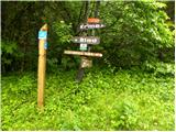 2
2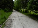 3
3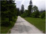 4
4 5
5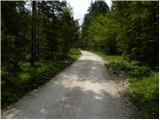 6
6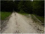 7
7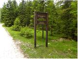 8
8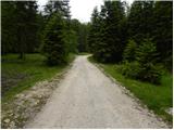 9
9 10
10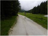 11
11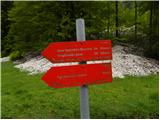 12
12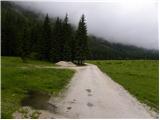 13
13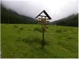 14
14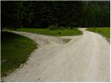 15
15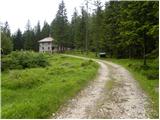 16
16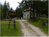 17
17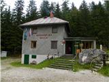 18
18
Discussion about the trip Kurja vas - Kovinarska koča v Krmi
|
| jetamp27. 03. 2017 |
Have the crocuses already started blooming in the Krma valley?
Thanks
|
|
|
To post a comment you must log in:
If you do not yet have a username, you must first
register.