Starting point: Kubed (233 m)
| Latitude/Longitude: | 45,5197°N 13,8699°E |
| |
Walking time: 45 min
Difficulty: easy marked way
Elevation gain: 218 m
Elevation difference along the route: 235 m
Map: Slovenska Istra - Čičarija, Brkini in Kras 1:50.000
Recommended equipment (summer):
Recommended equipment (winter):
Views: 11.752
 | 2 people like this post |
Access to starting point:
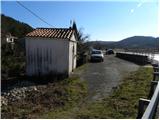
From the Ljubljana - Koper highway take the Črni Kal exit. From Črni Kal continue driving on the old road towards the coast, but drive along it only to the next somewhat larger crossroads, where turn left in the direction of the Sočerga border crossing. On the mentioned road drive to Kubed, where by the bus stop notice a chapel and next to it a suitable parking spot (starting point is located right next to the inn Jakomin).
To the starting point we can also come from the direction of the coast, namely through the settlements Prade, Pobegi, Čežarji, and Sveti Anton.
Route description:
Behind the chapel, we will notice on a power line pole blazes which point us to the right downwards to a stream, which we cross and then on the other side start first gently, then moderately ascending on flysch deposits. The path at first still offers some view on Kubed, then passes into a pine grove, through which it steeply ascends temporarily. Above a short rocky step the path flattens, and we ahead because of numerous junctions carefully follow the otherwise quite frequent blazes. Ahead the relatively gentle path continues through bushes, partly also through a pine grove and on karst meadows, but these are in summer quite overgrown. This gentle path, which is relatively well marked all the time, we follow all the way to the top of Lačna, which we reach after approximately 45 minutes of walking from the starting point.
From the top we can also ascend to a lookout tower, from which a nice view opens towards Slavnik, Učka, Gulf of Trieste, and in good weather all the way to the Dolomites and Julian Alps.

Photos:
 1
1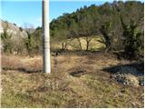 2
2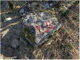 3
3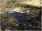 4
4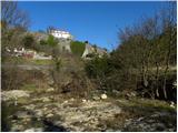 5
5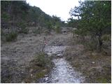 6
6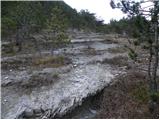 7
7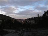 8
8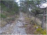 9
9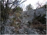 10
10 11
11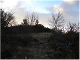 12
12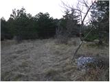 13
13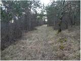 14
14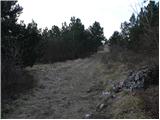 15
15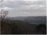 16
16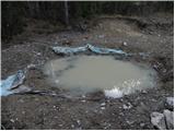 17
17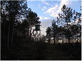 18
18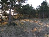 19
19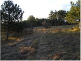 20
20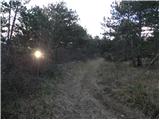 21
21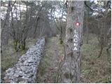 22
22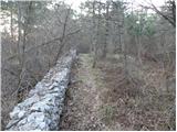 23
23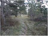 24
24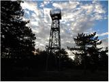 25
25 26
26 27
27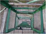 28
28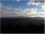 29
29
Discussion about the trip Kubed - Lačna
|
| wolphgang21. 02. 2011 |
Is it true that there is also a very difficult path leading to Lačna? I think I read something like that somewhere, but I don't remember where anymore.
|
|
|
|
| Tadej22. 02. 2011 |
You're probably thinking of the very difficult climbing route of the Ivančič brothers via Majina polica to Zjat (peak above Kraški rob, more precisely above Podpečja).
Picture
|
|
|
|
| wolphgang22. 02. 2011 |
aha, probably that's the one I was thinking of. Can someone compare it to another in terms of difficulty (e.g. with Gradiška Tura)?
|
|
|
|
| Tadej22. 02. 2011 |
I'm not entirely sure, but as far as I know, the mentioned climbing route is closed. Apparently due to nesting of rare bird species.
|
|
|
|
| janezz6. 05. 2012 |
If you continue the path into Komare doline and then to sv. Kvirika and Orlovega gnezda, be careful at the path junction to the right. That was our plan too, but the path led us to the village Smokvice. We pushed through the forest to the logging trail on the ridge ...
|
|
|
|
| B27. 05. 2012 |
I'm reporting a bit late. The path from Podpeči to Zjat (was) very demanding! But the path is closed because locals have cut the pegs and staples in the lower part and it's now impassable... The path through the Štrkljevica wall (along Majina polici) is also closed due to bird nesting. This path (was) also very demanding, the footholds are concreted by locals and pegs removed... On DOPS recommendation, the mountain path past the eagle's nest above Mlini pri Velem Badinu is neglected (and not closed)...
|
|
|
|
| vyjana5. 06. 2020 |
Easy, well marked, mostly on forest path.
Pleasant walk.
|
|
|
|
| montura6. 06. 2020 |
I'm glad you liked it 
|
|
|
To post a comment you must log in:
If you do not yet have a username, you must first
register.