Kropa - Sveti Primož in Felicijan (Jamnik)
Starting point: Kropa (494 m)
| Latitude/Longitude: | 46,2906°N 14,2047°E |
| |
Walking time: 1 h 10 min
Difficulty: easy marked way
Elevation gain: 337 m
Elevation difference along the route: 337 m
Map: Škofjeloško in Cerkljansko hribovje 1:50.000
Recommended equipment (summer):
Recommended equipment (winter): crampons
Views: 48.642
 | 2 people like this post |
Access to starting point:
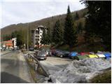
A) From Ljubljana, we drive on the Gorenjska motorway towards Jesenice, and we follow it to the Ljubelj (Podnart) exit. Further, we drive on the road towards Ljubelj and at the first junction we turn right, where we then quickly arrive at a roundabout, from which we continue in the direction of Podnart and Kropa. The road then leads us through the underpass below the motorway and a little further brings us to a crossroads, where the road from Naklo joins. Here we continue right, and we continue on the road which starts gradually descending. In the middle of the descent, we come to a crossroads, where we continue sharply left (direction Kropa) and then immediately behind the bridge over the Sava river again left (right Podnart). Further, we drive along the Lipnica stream and we follow the road to a crossroads, where a road towards Kamna Gorica branches off to the right. Here we continue left towards Kropa and we follow the road through the mentioned settlement. Only a few meters before the house with house number 7, we will notice on the left side a sports field and below it a parking lot, where we park.
B) From the Gorenjska side we leave the motorway towards Ljubljana at the Brezje exit and then we follow the signs towards Kropa. We park on the parking lot by the sports field in Kropa.
Route description:
From the parking lot, we walk to the house with house number 7 and here we continue left on the initially still asphalt road. The road quickly becomes macadam, and we ascend it to the church of Kroparska Mother of God.
From the church, we continue on a cart track which ascends transversely towards the left over a relatively steep slope. Higher up, we reach the forested ridge, where we continue sharply right in the direction of Jamnik (left Brezovica, straight ahead Češnjica). We continue on the cart track, which then ascends along a relatively gentle ridge. A little higher we come to the memorial, after which the path temporarily descends slightly, then starts to ascend more steeply. We follow the cart track for a few minutes, then the marked path turns slightly left into dense forest, through which it ascends along a torrent gully. The path then levels out and quickly brings us to the asphalt road which leads from Kropa towards Jamnik.
We follow the road to the left, and it quickly brings us out of the forest onto partly scenic slopes. We walk along the road for a few minutes, then at the sign for the beginning of the village Jamnik we continue left on a narrower macadam road which for some time continues parallel with the upper main road. The poorer road quickly brings us to a smaller hamlet, after which it changes into a wide cart track. The cart track then enters the forest and brings us onto a scenic grassy ridge, where the path from the village Jamnik joins from the right. Here we continue straight and follow the path, from which beautiful views open onto the Alps and Gorenjska plain, all the way to the church of St. Primož and Felicijan, which we reach after a few minutes of further walking.

Along the route: Cerkev Kroparske Matere Božje (525m), Berigla (685m)
Photos:
 1
1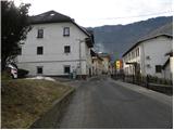 2
2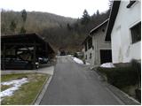 3
3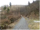 4
4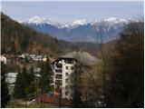 5
5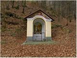 6
6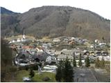 7
7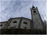 8
8 9
9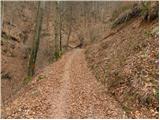 10
10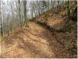 11
11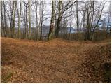 12
12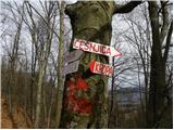 13
13 14
14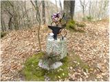 15
15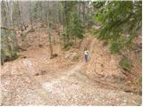 16
16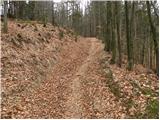 17
17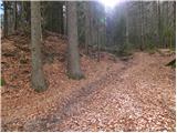 18
18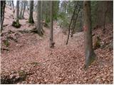 19
19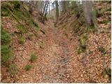 20
20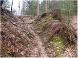 21
21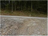 22
22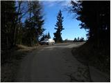 23
23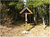 24
24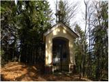 25
25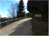 26
26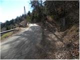 27
27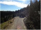 28
28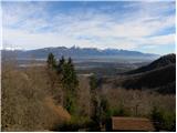 29
29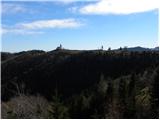 30
30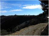 31
31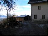 32
32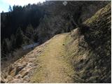 33
33 34
34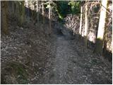 35
35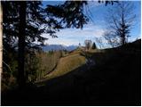 36
36 37
37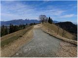 38
38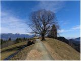 39
39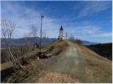 40
40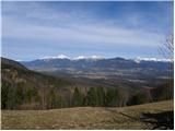 41
41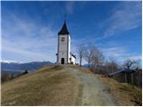 42
42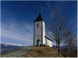 43
43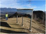 44
44 45
45
Discussion about the trip Kropa - Sveti Primož in Felicijan (Jamnik)
|
| getonce16. 01. 2012 |
I went on the path with my children. I really liked the trip, beautiful views on the upper part. If there wasn't that little road near the top, it would be a perfect ten.
I am also adding the track: www.mapmytracks.com/explore/activity/373020. During the ascent we turned from the asphalt to the cart track a bit late.
|
|
|
|
| katty16. 01. 2012 |
Does anyone perhaps know if you can go from Lajše near Selce to the top via some path ? It looks like an extremely nice vantage point worth visiting. ? It looks like an extremely nice vantage point worth visiting.
|
|
|
|
| skalar5016. 01. 2012 |
they (also) in the American National Geographic a few years ago already knew why to send a photographer to take a photo of the picturesque little church with the peaks and moon in the background...
|
|
|
|
| katty16. 01. 2012 |
yeah skalar50, if they sent someone, it's surely Arne
|
|
|
|
| GregorC16. 01. 2012 |
From Lajš you go (unfortunately) along the road Dražgoše - Jamnik. A nice path from Lajš leads to Sv. Mohor and is marked (part of the Loška mountain trail)
|
|
|
|
| KARAMELICA3. 03. 2013 |
Today went on this path. Fantastic day, great view. On the Podbrezje - Kropa section there is a road closure, so we went through Radovljica to Kropa (not so familiar to us, maybe we made too big a detour) On the Podbrezje - Kropa section there is a road closure, so we went through Radovljica to Kropa (not so familiar to us, maybe we made too big a detour)
|
|
|
|
| Jejž18. 07. 2023 09:30:10 |
The path is impassable due to fallen trees (result of the recent storm).
|
|
|
|
| michael6617. 11. 2023 16:14:45 |
Does anyone have information on how the path is now... is it passable?
|
|
|
|
| michael6618. 11. 2023 18:53:47 |
I went to check. Some fallen trees still there. But can be bypassed, so you reach the goal.
|
|
|
|
| Neza554. 12. 2024 19:43:44 |
Is the path newly marked since the last storm?
|
|
|
To post a comment you must log in:
If you do not yet have a username, you must first
register.