Starting point: Križovec (1222 m)
| Latitude/Longitude: | 46,4699°N 14,0838°E |
| |
Walking time: 1 h
Difficulty: easy unmarked way
Elevation gain: 328 m
Elevation difference along the route: 328 m
Map: Karavanke - osrednji del 1:50.000
Recommended equipment (summer):
Recommended equipment (winter):
Views: 13.882
 | 3 people like this post |
Access to starting point:
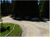
From the Ljubljana–Jesenice highway, take the Lipce exit and follow the road ahead towards Jesenice. When you come to the traffic-light crossroads, where you join the old road, continue right towards Žirovnica. Follow this road only for a short time, as at the next slightly larger crossroads (traffic lights) you continue left towards Javorniški Rovt. The road then goes through the underpass (railway) and then turns left (right Koroška Bela). Follow the road, which higher up starts to ascend steeply, towards Javorniški Rovt. The road ahead runs past the Dom Pristava mountain hut (the mountain hut is a little above the road) and behind the hut you come to the next (smaller) crossroads, where you go right. Ahead you drive on a macadam road all the way to Križovec, which you recognize by the crossroads of multiple roads (there are a few smaller parking spots and a cross by the crossroads).
Route description:
From Križovec we continue past the cross along the road in the direction of Pustega Rovt. The road at the beginning leads past a ramp and then slightly ascends through the forest. After approximately 15 minutes of walking, the road turns left and brings us out of the forest to the lower edge of Pustega Rovt. We continue on the road to which a marked path from the Dom Pristava hut in Javorniški Rovt joins from the right, and this after a few dozen steps of further walking brings us to the shepherd's hut at Pustem Rovtu.
From the shepherd's hut we continue on the road, which in the upper part of Pustega Rovt turns right into the forest. Only a little further we come to a marked junction, where we continue slightly right (left Golica) along a moderately steep path, which just a few meters higher crosses a relatively new road leading to Belska planina - Svečica. We merely cross the mentioned road and continue the ascent along the marked path, which soon emerges from the forest onto panoramic slopes below Sedlo Kočna. We continue the ascent past a small hunting hut, behind which we soon reach the watering place for animals. Only a short ascent follows and the path brings us to Sedlo Kočna, from which a nice view opens onto the Austrian side.
On the saddle we continue left (right Struška) and continue along the marked path towards Golica for a short time. After a shorter gentle ascent the marked path withdraws slightly to the left from the ridge, and we leave it right at that spot and continue the ascent along a poorly visible path that continues along the border ridge. The path ahead ascends a little more steeply for a short time, then levels off slightly and continues in a moderate ascent. We follow this path, from which increasingly beautiful views open up, all the way to the grassy summit.

Along the route: Pusti Rovt (1300m), Sedlo Kočna (1469m)
Photos:
 1
1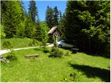 2
2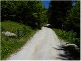 3
3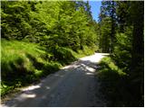 4
4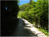 5
5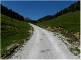 6
6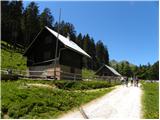 7
7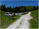 8
8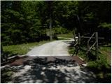 9
9 10
10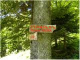 11
11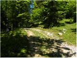 12
12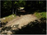 13
13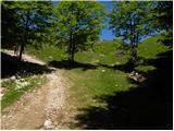 14
14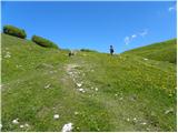 15
15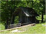 16
16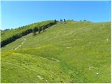 17
17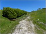 18
18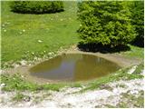 19
19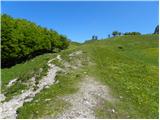 20
20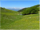 21
21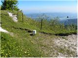 22
22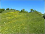 23
23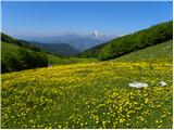 24
24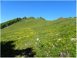 25
25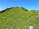 26
26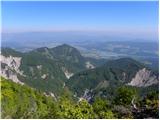 27
27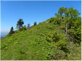 28
28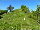 29
29 30
30
Discussion about the trip Križovec - Ptičji vrh
|
| meta ferjan8. 04. 2007 |
Nice easy, one could say a bit longer walk.
|
|
|
|
| ločanka10. 06. 2017 |
For me, the most beautiful visit to Golica is precisely via Ptičji vrh and then along the entire ridge to Jekljevo sedlo and return via the lower path to the hut . .
|
|
|
|
| grega_p23. 12. 2018 |
Really unusual that such easily accessible super viewpoints have so little visits and comments.
I went up from Križovec, as far as you can drive by car, although there's some lightly trodden snow on the road, which was still icy early in the morning, but had softened by the return.
From Pusti Rovt onwards the snow cover thickens and in some places there's quite deep wind-blown snow that collapses. Otherwise no special features, it's trampled almost to the top, where the wind covered the predecessors' footprints.
The summit offers views of a vast part of the Drava valley (and of course everything beyond it), the Karavanke ridge from Klek to Struška, the central Julian Alps with the Martuljek group and part of the upper Sava valley.
For the return I chose the shortest distance south to the lower road at Pusti Rovt through the forest. When there's enough snow like today and it doesn't slip too much, skiing down the white slopes is really a pleasure. You can also make a circular tour to the Suha saddle and then back to Križovec along the western side of Zdrtnik.
I recommend the trip, especially on a day like today, sunny, windless and not freezing!
Happy holidays,
lp Grega
|
|
|
|
| PUHIPUHI24. 12. 2019 |
Interested if the road to Križevec is normally drivable (potholes, snow, ice)? Is the path to Ptičji vrh already trodden? Thanks.
|
|
|
|
| Jusk14. 01. 2020 |
Started at Planina pod Golico, road to Križovec then to Pusti rovt and Suha saddle, from there to Ptičji vrh.. road from sledge run mostly icy, also Križovec to Suha, careful. Summit great views, very windy. Return via path past Markljev rovt. Regards
|
|
|
|
| Majdag23. 04. 2023 15:06:17 |
- Yesterday... there's still some snow past Pusti Rovt and through the forest. And up the slope to Ptičji vrh. In the morning the snow was icy and slippery on descent. It was cold yesterday, wind was blowing, views beautiful. Mala Golica is all white, but not from daffodils. Winter still reigns and spring chases it. Nice..
https://jelenkamenmajdag.blogspot.com/2023/04/na-pticji-vrh-pticke-poslusat.html
|
|
|
To post a comment you must log in:
If you do not yet have a username, you must first
register.