Križarka - Church of St. Anne in Boreča
Starting point: Križarka (413 m)
| Latitude/Longitude: | 46,82762°N 16,1332°E |
| |
Walking time: 35 min
Difficulty: easy unmarked way
Elevation gain: -18 m
Elevation difference along the route: 15 m
Map: Pomurje 1:40.000
Recommended equipment (summer):
Recommended equipment (winter):
Views: 330
 | 1 person like this post |
Access to starting point:
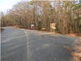
We drive to Murska Sobota, and then we continue driving towards the border crossing Hodoš. In the settlement Mačkovci we leave the main road towards the border crossing Hodoš and we continue left towards Grad and Vidonci. There follows some ascent and we arrive in Vidonci, where we follow the main road. When the settlement ends, the road passes into the forest and soon brings us to a crossroad, where signs for the church of St. Anne point us to the right. Immediately after the crossroad, we park at a suitable place by the road.
Route description:
We start on the macadam road which is lightly descending and leads us towards the east to southeast, and at smaller crossroads, we continue straight. After approximately half an hour of walking, we get to a marked crossroad, where we go left in the direction of St. Anne (road straight leads towards Stanjevci).
Next follows approximately 5 minutes of an easy ascent through a pine forest and we get to the approximately 500-year-old church of St. Anne.
Description and pictures refer to a condition in February 2021.
Photos:
 1
1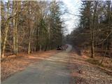 2
2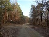 3
3 4
4 5
5 6
6 7
7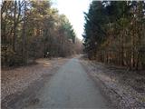 8
8 9
9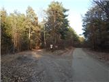 10
10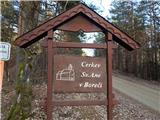 11
11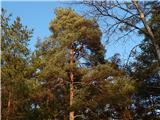 12
12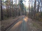 13
13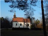 14
14
Discussion about the trip Križarka - Church of St. Anne in Boreča
To post a comment you must log in:
If you do not yet have a username, you must first
register.