Kriška planina - Kompotela
Starting point: Kriška planina (1480 m)
| Latitude/Longitude: | 46,2929°N 14,5369°E |
| |
Walking time: 2 h 15 min
Difficulty: easy marked way
Elevation gain: 509 m
Elevation difference along the route: 650 m
Map: Kamniške in Savinjske Alpe 1:50.000
Recommended equipment (summer):
Recommended equipment (winter): ice axe, crampons
Views: 95.245
 | 5 people like this post |
Access to starting point:
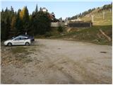
A) From the highway Ljubljana - Jesenice, take the Vodice exit, then continue driving to the first traffic-light intersection in Vodice, where you continue left in the direction of Cerklje na Gorenjskem and Brnik. When you arrive at the main roundabout in Spodnji Brnik, continue driving in the direction of Cerklje and the Krvavec ski resort. At the end of the settlement Cerklje na Gorenjskem, leave the main road, which continues towards Velesovo and Visoko, and continue driving slightly right onto the road in the direction of the Krvavec ski resort. Further on, you arrive at the village Grad, where signs for the settlement Ambrož pod Krvavcem direct you right onto a steep asphalt road (straight: lower station of the cable car to Krvavec and Štefanja Gora). When the gradient on the steep road eases somewhat, you arrive at an intersection, where you continue left in the direction of the settlement Ambrož pod Krvavcem (straight: settlements Ravne, Apno and Šenturška Gora). A little further on, the road temporarily descends a bit, then climbs through occasionally quite panoramic slopes. Higher up, you arrive at Ambrož pod Krvavcem, where you pass the church of St. Ambrož and the tourist farm Pr Ambružarju on the left side. From the tourist farm onwards, the road enters the forest and climbs through it all the way to the mountain pasture Jezerca, where there is a large arranged parking lot. Here the road levels out and turns left; about 500 m further on, it brings you to an intersection, where you continue right in the direction of Kriška planina (straight: upper station of the cable car and Planinski dom na Gospincu). Only a short steep ascent follows, and you arrive at the parking lot on the edge of Kriška planina.
The road from the mountain pasture Jezerca to Kriška planina is now closed to public traffic; this extends the route by approximately 15 minutes.
B) From the highway Jesenice - Ljubljana, take the Kranj - east exit, then continue driving towards Brnik, Komenda and Mengeš. When you arrive at the main roundabout in Spodnji Brnik, continue driving in the direction of Cerklje and the Krvavec ski resort. At the end of the settlement Cerklje na Gorenjskem, leave the main road, which continues towards Velesovo and Visoko, and continue driving slightly right onto the road in the direction of the Krvavec ski resort. Further on, you arrive at the village Grad, where signs for the settlement Ambrož pod Krvavcem direct you right onto a steep asphalt road (straight: lower station of the cable car to Krvavec and Štefanja Gora). When the gradient on the steep road eases somewhat, you arrive at an intersection, where you continue left in the direction of the settlement Ambrož pod Krvavcem (straight: settlements Ravne, Apno and Šenturška Gora). A little further on, the road temporarily descends a bit, then climbs through occasionally quite panoramic slopes. Higher up, you arrive at Ambrož pod Krvavcem, where you pass the church of St. Ambrož and the tourist farm Pr Ambružarju on the left side. From the tourist farm onwards, the road enters the forest and climbs through it all the way to the mountain pasture Jezerca, where there is a large arranged parking lot. Here the road levels out and turns left; about 500 m further on, it brings you to an intersection, where you continue right in the direction of Kriška planina (straight: upper station of the cable car and Planinski dom na Gospincu). Only a short steep ascent follows, and you arrive at the parking lot on the edge of Kriška planina.
The road from the mountain pasture Jezerca to Kriška planina is now closed to public traffic; this extends the route by approximately 15 minutes.
Route description:
From the parking lot, head onto the road in the direction of planina Koren. The road then brings you through the underpass to a quarry, where you leave it. Continue ascending on a pleasant but otherwise poorly visible mountain path that runs along the edge of the pasture fence. The path, which becomes more visible, then leaves the grazing areas of Kriška planina and enters terrain overgrown with brushwood. After a short ascent, the path brings you to a nice vantage point from which a beautiful view opens onto the Korošica valley. Further on, the path begins to descend more steeply and after a few minutes you are already 60 m lower. The path then levels out and a path from the previously mentioned valley joins from the right. Further on, you cross a belt of forest, and the path then begins to ascend again. During the ascent, an unmarked path branches off to the left leading to the Razor saddle; continue on the marked path, which after a further few minutes brings you to the southern part of planina Koren. The path then descends past the watering place for animals to the shepherd's hut on the planina. Here, our path continues slightly left (slightly right: planina Košutna) across meadows at the valley bottom (the path is initially poorly visible). The path then becomes steeper and after less than 30 minutes of walking brings you to a small puddle, where there is a poorly marked junction. Continue straight ahead (right: Košutna) and follow the gentle path to the next junction, where you take the right path in the direction of Kompotela (left: Vrh Korena). From here, orientation is somewhat more difficult, and in fog very challenging. Ahead, the path slowly begins to ascend gently up the grassy slope overgrown with brushwood. The narrow path then brings you to the summit of Kompotela amid fine views.
Kriška planina - planina Koren 1:15, planina Koren - Kompotela 1:00.

Photos:
 1
1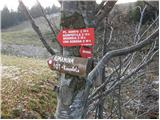 2
2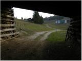 3
3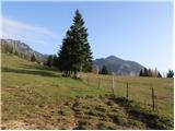 4
4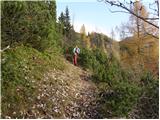 5
5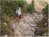 6
6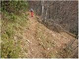 7
7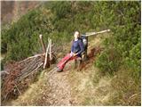 8
8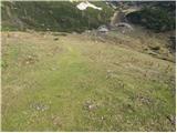 9
9 10
10 11
11 12
12 13
13 14
14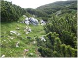 15
15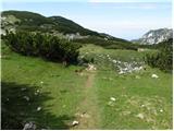 16
16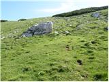 17
17 18
18
Discussion about the trip Kriška planina - Kompotela
|
| Gost4. 09. 2006 |
Excellent tour for all types of hikers. Magnificent view from the top, cows and horses along the path up to 1900 m. Return via Zvoh, where you get just the right amount of climbing.
|
|
|
|
| Gost12. 11. 2007 |
Is the path to Zvoh marked?
|
|
|
|
| Gost13. 11. 2007 |
The path to Zvoh is marked and nice. It's great if you extend the excursion to the top of Korena - you go along the ridge, everything is nicely marked, in between there is another gully secured with a cable. At the top of Korena you can choose the path to Kalški greben or to Kompotela. There is no stamp at Kompotela, but there is a fantastic view of the Grintovci. At Kompotela there is the famous Kompotelski dedec, which is a rock formation resembling the silhouette of a man. Nice. Best regards, Tadeja
|
|
|
|
| Gost13. 11. 2007 |
Today I wanted to go to Kompotela, but I ended up at Košutna. At Planina Koren I didn't see where to go to Kompotela, but for Košutna it was marked. Then I got a bit lost, and it was terribly windy, but visibility was great.
|
|
|
|
| Gost13. 11. 2007 |
To Kompotela you should just go straight. Yes, if you go through Planina Koren to Kompotela, it's a bit harder. Better to go first to Zvoh, Vrh Korena, descend to Kompotela. Possibly there is no stamp. Then you descend back to Planina Koren by feel and continue to Krvavec. But the views make up for everything, even if you go to Košutna and it's very windy. Tadeja
|
|
|
|
| Gost13. 11. 2007 |
Thanks. Next time I will perhaps really go first to Zvoh.
|
|
|
|
| Gost15. 11. 2007 |
You can make a wonderful circular tour up there, really (of course there are more)!
The area is very attractive even in winter time, where the pleasure is 'doubled' (with skis). 
Zvoh, greben Ježa, Vrh Korena, Kompotela, Košutna, Mokrica ... I always gladly come back.
|
|
|
|
| hajdiga4. 10. 2011 |
Excellent and easy tour, crowned with one of the best views of the Kamnik-Savinja Alps.
Many possible routes, all nicely marked, we were with the dog who had no problems either.
|
|
|
|
| Nuši4. 10. 2011 |
Beautiful tour, magnificent views... I did a circular tour on Sunday. We started at the parking lot on Kriška planina, then to planina Koreno, then right to Košutna, then to Kompotela, where we had a little snack and enjoyed the views of the Kamnik-Savinja Alps peaks. Then on to Vrh Koreno, through Ježe to Zvoh and then back down to Kriška.
Beautiful weather, few people, well marked (unlike 1-2 years ago). One really recharges the batteries. I'll go up there again!
|
|
|
|
| metod4. 10. 2011 |
Nuši, if it goes, next time extension to Kalški greben. Best views in Kamniške.
|
|
|
|
| Nuši4. 10. 2011 |
Yes Metod, I have that in plan too. But on Sunday somehow it didn't work out. Next time.
|
|
|
|
| Kokta20. 05. 2012 |
Really nice path. Definitely visiting again. At the top wonderful view of KSA, like on the palm of your hand. The path is well marked and not difficult.
|
|
|
|
| velkavrh21. 05. 2012 |
Krvavec really offers countless options. Just drive to Planina Jezerca and walk to the left of Kriška planina as you went. It's nice to go from Kompotela left to Vrh Korena and across the Ježa ridge to Veliki Zvoh and back to the parking lot. Beautiful - try it once!
|
|
|
|
| AnzeKozjek22. 02. 2013 |
Nice mountain greeting!
Are crampons and ice axe really so necessary for the winter ascent to Kompotela? Or rather, I'm interested in what the path to Kompotela is like in winter conditions? Is it well visited?
|
|
|
|
| Gost22. 02. 2013 |
If you're only going to Kompotela, crampons and ice axe are not necessary, especially now in fresh snow. The visits depend mostly on conditions. I myself have broken trail in deep snow several times. But if you're doing a circular tour via Jež to Zvoh, take both with you. That ridge section is also exposed, and the descent to the notch causes problems for some even in summer. Caution, if you go through Košutna pasture, there is a memorial plaque for a mountaineer who was once carried away by an avalanche in March. I recommend ascent directly from Koren pasture (at the hut turn slightly left, right is Košutna) Best regards Miro
|
|
|
|
| _sandra_24. 02. 2013 |
winter is.. ice axe and crampons are not for decoration.. you never know what can surprise you, so don't go without winter gear;
|
|
|
|
| bostjanp25. 02. 2013 |
@sandra: finally a sensible statement. Bravo. Whoever doesn't take an ice axe and crampons on a winter tour, better stay home (use depending on conditions). When will we finally get a law that properly fines those inadequately equipped for winter conditions. I hope as soon as possible.
|
|
|
|
| Daaam25. 02. 2013 |
No need to exaggerate either.. I think Mr. Miro explained it nicely how and what.. best regards
|
|
|
|
| _sandra_25. 02. 2013 |
@Daaam: when were you last at Kompotela?
|
|
|
|
| Daaam25. 02. 2013 |
in summer 
|
|
|
|
| _sandra_25. 02. 2013 |
well I in winter, that's why I wrote that above..
|
|
|
|
| Lavendel25. 09. 2013 |
nice path for everyone, unfortunately today at the top there were no views due to fog, next time
|
|
|
|
| gogx16. 11. 2015 |
Yesterday on Kompotela. Wonderful path. Highly recommend. Especially the view of the Kamnik Alps is WAUUUU!
A little before the summit met an angel (woman). Maybe I was already a bit delirious from lack of oxygen.
If you recognize yourself in the above lines, reply something.
|
|
|
|
| BorStenar14. 03. 2023 20:12:41 |
Can someone tell me if the summit is accessible in early March when the ski resort is still operating?
|
|
|
|
| bongo15. 03. 2023 07:24:52 |
Why not? The summit itself has little to do with the ski resort, access from the parking lot (one at Jezercih or the other at Kriški) to the hiking trail just requires careful crossing of the ski slope in the appropriate section. I hope you don't really need instructions for everything in life.
|
|
|
To post a comment you must log in:
If you do not yet have a username, you must first
register.