Kranjski Rak - Gradišče (Velika planina) (below on road)
Starting point: Kranjski Rak (1029 m)
| Latitude/Longitude: | 46,283°N 14,6884°E |
| |
Route name: below on road
Walking time: 2 h 15 min
Difficulty: easy marked way
Elevation gain: 637 m
Elevation difference along the route: 637 m
Map: Kamniške in Savinjske Alpe 1:50.000
Recommended equipment (summer):
Recommended equipment (winter):
Views: 185.993
 | 4 people like this post |
Access to starting point:
A) First, we drive to Kamnik, and then we continue driving in the direction of the Črnivec Pass. Just a few hundred meters before the mentioned pass, we notice signs for Kranjski Rak, which direct us sharply left onto a narrow and initially quite steep road. The road levels out higher up and then brings us to the Volovljek Pass, where near the Kranjski Rak inn we also park (parking in front of the inn is permitted only for guests).
B) From Gornji Grad we drive towards Kamnik, then just a few hundred meters after the Črnivec Pass we continue right in the direction of Kranjski Rak. Further, we follow the above description.
C) From the Savinja Valley we first drive to Luče, and then we continue driving towards Kamnik. When we arrive at the Volovljek Pass, we park in a suitable spot near the Kranjski Rak inn (parking in front of the inn is permitted only for guests).
Route description:
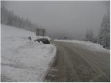
From Kranjski Rak we continue on a macadam road in the direction of Velika planina. The road first slightly descends, then passes into the forest, where it starts to ascend moderately. After approximately half an hour of walking, we come to a somewhat larger crossroads, where we continue right in the direction of Konjščica and planina Dol (straight or slightly left planina Kisovec). The road then brings us to a large parking lot (possible starting point), and we continue on the forest road, which is closed to public traffic. From the parking lot, we follow the mentioned road for another approximately 10 minutes, then the marks direct us left onto a grassy slope, over which a relatively steep path leads. Soon the path flattens for a short time and bypasses an isolated shepherd hut on the right side. Behind the hut the path enters the forest and starts to ascend steeply. Higher up, we join a wider and less steep path from planina Marjanine njive. We follow the mentioned path to the left, which quickly brings us out of the forest onto the grazing areas of Mala planina. Here the path completely flattens and after a few minutes of further walking brings us to a marked but in fog poorly visible junction. We continue slightly right in the direction of Jarški dom, to which a 5-minute ascent over an increasingly panoramic slope remains.
We bypass the mentioned hut on the left side, then continue the ascent on a wide path that gently ascends through sparse forest. Already after a few minutes, a path to Črnuški dom branches off to the left, and we continue straight and follow the wide path all the way to Domžalski dom na Mali planini.
The path then descends into a small valley, where we step again onto a wide path (almost a road). We continue right and follow the path to a poorly marked path junction, where a path branches off to the left in the direction of the Gradiščkovi shepherd settlement. After a short ascent, the path brings us to the mentioned settlement, from which we continue on a poorly visible but marked path. The path further leads us past numerous benches, moderately upward along an unvegetated slope. Soon the path brings us between two peaks, where we continue slightly right. In the middle of the ascent, we notice the sign "chairlift" to the right (to the left, in the direction of our ascent, is the shepherd settlement). We continue in the direction of the chairlift on the path, which quickly brings us to the summit slope of Velika planina. Here we continue right on the marked path, which after a few steps of ascent brings us to Gradišče.

Photos:
 1
1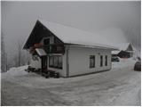 2
2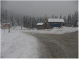 3
3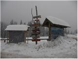 4
4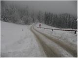 5
5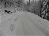 6
6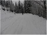 7
7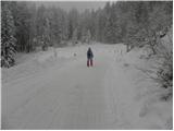 8
8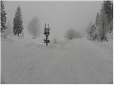 9
9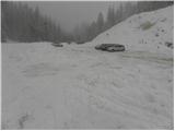 10
10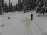 11
11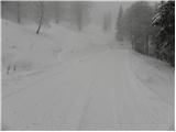 12
12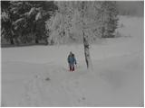 13
13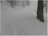 14
14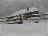 15
15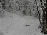 16
16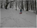 17
17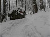 18
18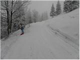 19
19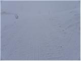 20
20 21
21 22
22 23
23 24
24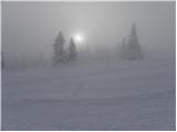 25
25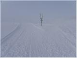 26
26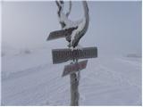 27
27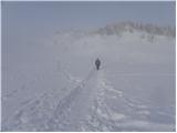 28
28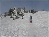 29
29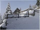 30
30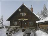 31
31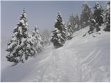 32
32 33
33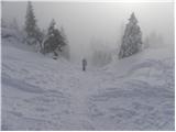 34
34 35
35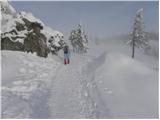 36
36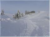 37
37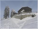 38
38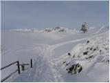 39
39 40
40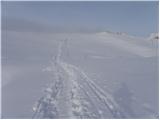 41
41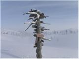 42
42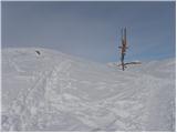 43
43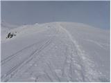 44
44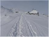 45
45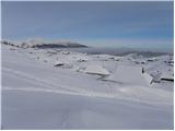 46
46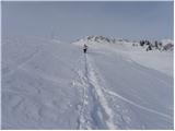 47
47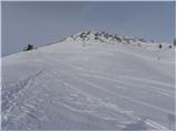 48
48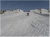 49
49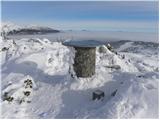 50
50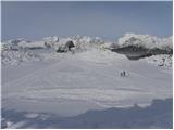 51
51
Discussion about the trip Kranjski Rak - Gradišče (Velika planina) (below on road)
|
| šlapa7. 05. 2010 |
I haven't been to Velika planina yet, but I'm very tempted, so I won't give an opinion, but I'd like to ask what the current conditions on Velika planina are and when you most recommend visiting.
Thank you very much for the answer.
|
|
|
|
| babim24. 05. 2011 |
Today my husband and I took advantage of the nice weather and went on this "stroll". Beautiful views, easy trail and wonderful nature. We met four Englishmen and a couple of our hikers, otherwise silence, flowers ... The only thing that bothered us a bit were the signposts. Although there are a lot of them, they are in poor condition - faded and rotten. Several times we didn't know if it pointed straight or right or left, so we got a bit lost once. Well, it wasn't bad. At this time the trip is very nice.
|
|
|
|
| TFerarri14. 08. 2011 |
With wife and family friends I was today one of the thousands-strong crowd besieging the beautiful area of Mala and Velika Planina. Signposts are renewed, i.e. NEW. What this large crowd of visitors misses is probably important for all us mortals, NOT ENOUGH TOILETS on the entire plateau.
|
|
|
|
| Marky13. 09. 2011 |
On Sunday with the group on Velika Planina.. We started a bit above the guesthouse, as we didn't feel like walking along the road. A bit higher there's a nicely arranged parking area. After a couple of 100m the path leads into the forest where we slowly start ascending. The path is ideal for everyone.
Pictures from the trip or Velika Planina can be viewed at M-foto.si
|
|
|
|
| kat7. 12. 2015 |
Keys!! This weekend we found Peugeot keys on the path from Kranjski Rak to Velika Planina. If anyone misses them, contact me at 031250758. Regards
|
|
|
|
| plaNinaPirsMajcen12. 02. 2026 19:07:19 |
Hi,
attaching a video from this most beautiful alpine pasture of magically snow-covered shepherd huts 🥰❄️
https://youtu.be/G7YuIqB9wVs?si=H_I0HE-1vXZCtcdq
We parked at Rakovih ravneh. I filmed Mala planina, Velika planina, the chapel of Marija Snežna, the path to Gradišče and back.
For the mystical atmosphere, clouds, sun and fog took care. Wonderful!
Best, Nina
|
|
|
To post a comment you must log in:
If you do not yet have a username, you must first
register.