Kraljev hrib - Gradišče (Velika planina) (via Rigelj)
Starting point: Kraljev hrib (540 m)
| Latitude/Longitude: | 46,3061°N 14,6088°E |
| |
Route name: via Rigelj
Walking time: 3 h
Difficulty: difficult unmarked way
Elevation gain: 1126 m
Elevation difference along the route: 1130 m
Map: Kamniške in Savinjske Alpe 1:50.000
Recommended equipment (summer):
Recommended equipment (winter): ice axe, crampons
Views: 27.451
 | 3 people like this post |
Access to starting point:
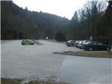
First, we drive to Kamnik, then we continue driving towards Kamniška Bistrica and the cableway to Velika planina. In Stahovica, we continue left (towards Kamniška Bistrica and the Velika planina cableway) and follow the moderately ascending road to the large parking lot near the lower cableway station to Velika planina (the parking lot is located on the right side of the road).
Route description:
The path over Rigelj is a partly marked hunting footpath.
From the parking lot, we go on a wide and well-maintained macadam road, which leads to the inn Kraljev hrib. We leave the road right before it turns into the inn's yard and step onto a cart track that starts beside the transformer. Here a couple of cars can park. We follow the cart track to a large feed barn, where it turns sharply left, and we continue straight on a nicely beaten and routed footpath. It gently crosses the slope on the right and later starts to ascend more steeply in zigzags. We must be careful not to miss the junction, which is nicely marked but more in a hunting style. We recognize it by a thick beech tree all covered with carved marks. Here the footpath turns sharply left and right. The right one goes towards Sivnik and further over Gamsove streže to Kisovec and Mala planina. Here we turn left towards Rigelj. That we are really on the right path is indicated by the bent beech tree, which is the first tree under which we pass.
The footpath steeply ascends in zigzags across grassy slopes and through the forest. On the left, a mighty rocky massif surrounds us, and several times a really nice view opens up onto the valley of Kamniška Bistrica and the peaks above it. The footpath has no junctions for a long time and is easy to follow.
Already quite high up, the footpath splits into two parts, but they are only a few meters apart. One branch leads to a viewpoint that is definitely worth visiting. From there is a nice view of Konjska dolina, the lower part of Kamniška Bistrica, and the Ljubljana basin.
When we leave the viewpoint, after a few meters on the saddle the footpath splits. Right goes gently downhill towards Sivnik, straight ahead steeply uphill towards Rigelj. Uphill it is hard to get lost, but downhill much easier, as the footpath splits and each branch goes its own way into the valley.
To avoid confusion, from the viewpoint we go straight steeply uphill. The footpath is even secured with a wooden fence in one place. Soon we also reach the border of Velika planina, which we recognize by the fence over which we must go. From there the first cottages above Šimnovec are already visible. The footpath gradually splits into at least three branches, but it doesn't matter which one we take, because after a couple of minutes we reach open pastures and spot the chairlift, which runs almost perpendicular to our direction.
To here we needed just under two and a half hours.
From here we have at least three options. We can turn left under the chairlift and in under ten minutes we are at the upper station of the gondola. We can take the cable car down to the car. The second option is to go straight, perpendicular under the chairlift, right past Komatarjeve bajte on an unmarked footpath to planina Konjščica and then on a marked footpath over planina Dol back to the starting point (about two hours).
If we have more time, we can turn right along the chairlift uphill towards Zeleni rob and continue to the summit (Gradišče), for which half an hour should suffice. From the summit we can continue the circular tour via Planšarsko naselje, past Domžalski dom and Mala planina on the hunting footpath over Gamsove streže, Kačjek, and Sivnik back to that famous beech tree at the junction and back to the starting point at Kraljev hrib.

Photos:
 1
1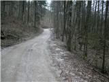 2
2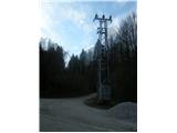 3
3 4
4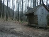 5
5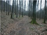 6
6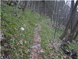 7
7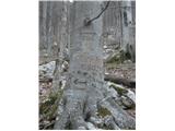 8
8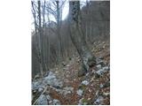 9
9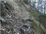 10
10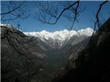 11
11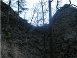 12
12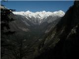 13
13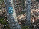 14
14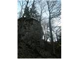 15
15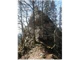 16
16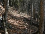 17
17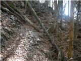 18
18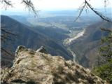 19
19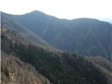 20
20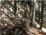 21
21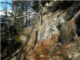 22
22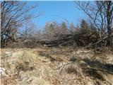 23
23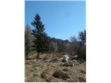 24
24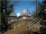 25
25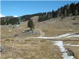 26
26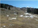 27
27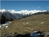 28
28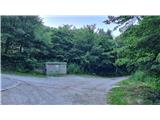 29
29 30
30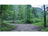 31
31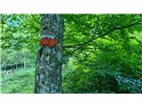 32
32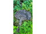 33
33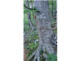 34
34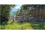 35
35
Discussion about the trip Kraljev hrib - Gradišče (Velika planina) (via Rigelj)
|
| pohodnik386. 05. 2013 |
On May 1st I hiked this trail, it's really nice, not too demanding, just be careful when wet. I was alone the whole time on the trail, in the shepherd settlement it was like an anthill, on the descent again no living soul anywhere, which I particularly like. Velika planina is in full bloom in spring and I recommend a visit. As an introductory tour for this season
Some snapshots in VIDEO
Best! Tone
|
|
|
|
| andi26. 10. 2014 |
Today in the second part of the hike on the hidden paths to Velika Planina. In the lower part up to the beech the path looks more like an attempt at Slovenian army training (one hour of really difficult jumping over fallen trees). Above it is beautiful and very skilfully laid out, easy to follow practically without difficulty. Slight exposure in some places.
|
|
|
|
| alyas2. 11. 2014 |
Kraljev hrib - through Rigelj - Velika planina - Zeleni Rob - pl.Konjšica - pl.Dol - Dolski graben - Kraljev hrib (conditions 2.11.2014)
In the lower part (unmarked paths) there is still a real "disaster" of fallen trees after this year's ice and storm; therefore the starting point is quite hard to find. But all honor to the people who took on the clearing and all who maintain the hiking trails, so that in the middle part and further on, the path is almost normally passable. In the upper part, through the forest where there is a lot of leaves on the ground, orientation is harder, but some new blazes help with better orientation and path following.
From Zeleni rob via Vel. planina, through Konjšica and through Dol and Dolski graben to the valley, the path is without peculiarities.
|
|
|
|
| garmont7. 02. 2016 |
The feeding trough in picture No. 5 is no longer there.
|
|
|
|
| kotnk24. 02. 2016 |
How is this path in the current conditions?
|
|
|
|
| alpin25. 02. 2016 |
All passable, not much snow at the moment but orientationally possibly a bit demanding.
|
|
|
|
| lijaneja27. 04. 2018 |
A pearl in the description of one of the most beautiful approaches to Velika planina.
Ten to nine I park next to the only vehicle, a Novo Mesto kangoo, on the huge parking lot opposite the gondola cable car. After three and a half hours, when I complete the loop, it would be hard to find any more space!?!. True, it's a holiday and people like to sleep in and I was already late...
First past the gypsy camp meadow, then a plantation of lilies of the valley follows, above them cheerfully uphill. The path is always nicely traceable, fallen trees from recent disasters mostly cleared, viewpoints in the upper part still excellent and I'm already at the provisional fence on the edge of Planina. Another fifteen minutes and I'm in the Zeleni rob guesthouse drinking tea for an extortionate 1.9€. I head towards planina Konjščica, where there's still snow on the path for another week, but towards Dol it's no longer an obstacle. Obviously I was the first there, as I scare two capital mouflons. As always, the path through Dolški graben drags on for me, going down I met almost 50 people. Really nice tour for a spring morning.
|
|
|
|
| ločanka3. 05. 2019 |
The trip is nice in combination with descent past Pl.Dol, even nicer
I would correct the description in that the transformer from picture 3 is no longer there, but it has been replaced in a different form on the left side of the path.
For picture 14, I would change it so that the junction to this hunting path from the forestry road you're on is to the right. Because straight ahead there is now a logging trail that perhaps wasn't there then.
Of course, the feeding trough, as already said, is no longer there.
|
|
|
|
| parenzo24. 02. 2021 |
This time for coffee at Zeleni rob via Rigelj, return via Dol. Didn't need crampons. Sunglasses mandatory.
|
|
|
|
| Andi199427. 02. 2021 |
Hi, I have one question. I live literally under Velika planina but have never gone via Rigelj. How difficult or steep is the path? Can it be compared to Kamniški vrh or Konj in steepness? And approximately how long does it take to the summit. I like hiking in late afternoon hours, so I'm back at dark but need at least some info to time it. Thanks for answers
|
|
|
|
| garmont27. 02. 2021 |
Everything is nicely described above.
But I absolutely do not recommend descending this path in the dark. Especially not the first time...
|
|
|
|
| M E S A19. 04. 2022 08:14:16 |
On 16.4. there were no special features. Small patches of snow are only above 1500m. The path can be nicely followed. Some attention is needed at junctions. For me, it's more suitable for ascent than descent. In wet conditions, extra caution is needed in places in the lower part (slip).
|
|
|
|
| Viper15. 05. 2022 12:33:20 |
Description wrong in a few places. Nothing new for this website. Only if you know it do you arrive or find it by chance. Then you come via this path over Rigelj to Velika planina. Only on the 4th attempt did I find the right path. Previously lost 2 hours.
But unfortunately I've lost interest. Where is the feeding trough in the 5th picture. There isn't one. Already from the 5th picture you see something's wrong with the description. Already at the start it's wrong, it says when we almost reach the courtyard of Kraljev hrib we go straight on the cart track. No cart track. It's a macadam road. That is, right at the transformer. Continue mainly on this road to the sharp left bend. There choose the straight right cart track. Follow the cart track further. Soon after this the cart track disappears. It becomes a path. Where we reach the marked beech tree. There left. That's still fine. These grassy slopes aren't soon. Only after 15 minutes. Right up to here you can easily miss it and turn right towards Sivnik or the climbing crag. Not talking at the marked beech. Higher up another path goes right. There are more paths. Now you know which is the right one.
|
|
|
|
| franca15. 05. 2022 21:32:12 |
Viper, in nature changes keep happening all the time, paths adapt to them. If you read the comments too, not just the description, you'd already know most of it. The path is simply unmarked, has quite a few forks, but is well-trodden and easy to follow.
|
|
|
|
| Žan5. 07. 2023 21:03:33 |
Time has done its work, some things have really changed, so I added some new photos. The trail is in good condition and well-trodden, but not like the one to Kamniško sedlo. Need to be careful.
|
|
|
|
| mjk20. 01. 2024 18:57:32 |
How is it now? Did the floods destroy the path anywhere?
|
|
|
|
| Žan20. 01. 2024 20:57:29 |
I think the path over Rigelj is good. I haven't walked it myself this autumn. But the path from the lower station to Kisovec is definitely in a desperate state
|
|
|
|
| velocy21. 01. 2024 08:28:43 |
The path over Rigelj is generally in good condition. You need to cross one new torrent gully fairly at the beginning. Traceability is also OK, just before the exit some orientation is needed. Last Saturday everything was very hard, from approx. 1200 m a.s.l. some snow - this has probably changed after the last snowfall. The path over Kuklarje is much more "messy" (2 somewhat annoying crossings over gullies, somewhere a bit of zig-zag is needed), but both paths are passable with a bit more caution. Definitely crampons recommended in the current conditions.
|
|
|
|
| Sarak5. 09. 2025 11:03:15 |
Hi, is there a circular path from this tour to return to the same starting point and make it all about 4 - 4.5 hours of walking? I'm thinking of an afternoon tour and maybe wouldn't want to go down the same path.
** I still want to "bite" a bit uphill, all other paths to the plateau look very easy...
|
|
|
|
| franca5. 09. 2025 16:20:39 |
Following the path through Dolski graben you almost reach the starting point.
I usually leave the car at the parking lot behind the gondola on Velika planina.
|
|
|
|
| pantharej5. 09. 2025 17:56:53 |
Up via Kuklarje or Martinj path, down via Rigelj. Via Martinj path you reach Planina Dol, so the path is a bit longer.
|
|
|
|
| garmont8. 09. 2025 09:40:48 |
All three paths mentioned above are unmarked. If you are not skilled in hiking and especially in following such paths, I do not recommend them to you.
|
|
|
|
| glorija6. 11. 2025 06:15:55 |
Viper and Garmont's comments are the most realistic.
|
|
|
To post a comment you must log in:
If you do not yet have a username, you must first
register.