Kožljek - Leskovica (above Stražišče)
Starting point: Kožljek (792 m)
| Latitude/Longitude: | 45,84350°N 14,37900°E |
| |
Walking time: 30 min
Difficulty: easy unmarked way
Elevation gain: 155 m
Elevation difference along the route: 155 m
Map: Snežnik 1:50.000
Recommended equipment (summer):
Recommended equipment (winter):
Views: 643
 | 1 person like this post |
Access to starting point:
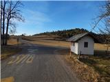
A) We drive to Rakitna, and then continue driving towards Cerkniča. After the settlement of Pikovnik, the road starts to descend more steeply, then follows driving through the settlements of Kržišče, Beč, Župeno and Gorenje Otave. A little further on, we leave the main road that leads towards Begunje pri Cerknici and continue driving straight onto the side road in the direction of the settlement Stražišče. We bypass Stražišče on the right bypass road, then the road starts descending again. When the road flattens, we quickly arrive at the settlement Kožljek, where the described path begins by the bus stop. We park somewhere nearby in a suitable place.
B) We drive to Cerkniča, and then continue driving in the direction of Begunje pri Cerknici. In Begunje we continue left, then through the settlements Bezuljak and Dobec, we drive to the settlement Kožljek, where the described path begins by the bus stop. We park somewhere nearby in a suitable place.
Route description:
From the crossroad in Kožljek we continue towards the north, where we first walk on a marked path, first on the road that leads towards Pokojišče. We leave the mentioned marked road after approximately 200 meters, where in the hamlet with a few houses we continue right onto the yard. Behind the yard the road changes into a cart track, on which we first continue across a meadow, then, when the path enters the forest, we also start to ascend. After a few minutes we arrive at a spacious clearing, in the middle of which stands a hunting observatory, and we a little further ahead, at the smaller junction, continue right upwards. There follows an ascent through the forest, and when the cart track reaches below the route of the high-voltage power line Beričevo - Divača, we leave the cart track and continue the ascent on a poorer footpath that continues along the power line. There follows an ascent with ever more beautiful views, and when the ascent ends, we reach the summit of Leskovica, on the top of which there is a trigonometric point.
The description and pictures refer to the condition in the year 2016 (December).

Photos:
 1
1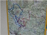 2
2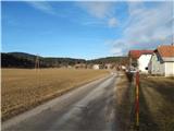 3
3 4
4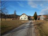 5
5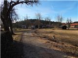 6
6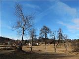 7
7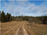 8
8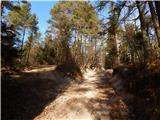 9
9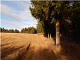 10
10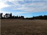 11
11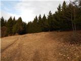 12
12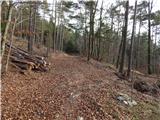 13
13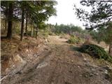 14
14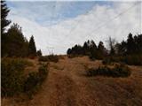 15
15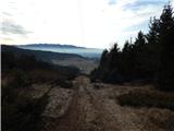 16
16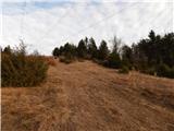 17
17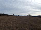 18
18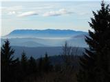 19
19 20
20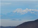 21
21
Discussion about the trip Kožljek - Leskovica (above Stražišče)
To post a comment you must log in:
If you do not yet have a username, you must first
register.