Starting point: Kozji hrbet (1290 m)
| Latitude/Longitude: | 46,2503°N 13,9872°E |
| |
Walking time: 50 min
Difficulty: easy unmarked way
Elevation gain: 284 m
Elevation difference along the route: 284 m
Map: Škofjeloško in Cerkljansko hribovje 1:50.000
Recommended equipment (summer):
Recommended equipment (winter): ice axe, crampons
Views: 5.711
 | 2 people like this post |
Access to starting point:
A) From Železniki or Podbrdo we drive to Soriška planina and continue driving towards Bohinjska Bistrica. After approximately 400 meters of descent a macadam road branches off sharply to the left, which we then follow for approximately 2 km to a slight right turn, where there is a smaller parking lot.
B) From Bohinjska Bistrica we drive towards Soriška planina. Just about 400 meters before the parking lot on Soriška planina a forest road branches off to the right. Then we follow the description above.
Route description:
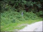
At the turn, we look for a footpath which in a moderate ascent through the forest in 15 minutes brings us to the mountain pasture Planina za Šavnikom.
Ahead we cross the mountain pasture and the path leads us into a short stretch of forest. A little higher, the path brings us to wide grassy slopes between Šavnik on the right and Možic on the left. And only a little further ahead of us, we notice a hunting observatory, near which is a junction.
Signpost for Šavnik directs us sharply right (sharply left Možic) onto the path which goes into a stretch of forest and ascends somewhat more steeply. When we come out of the forest, there follows a shorter ascent along a wide and increasingly panoramic ridge, which we follow to the top.
Photos:
 1
1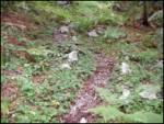 2
2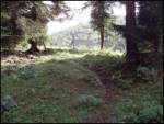 3
3 4
4 5
5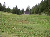 6
6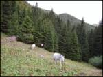 7
7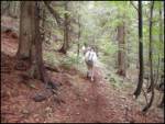 8
8 9
9 10
10 11
11 12
12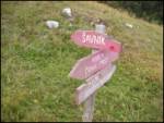 13
13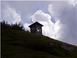 14
14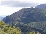 15
15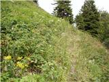 16
16 17
17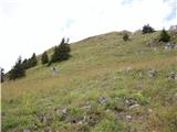 18
18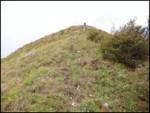 19
19 20
20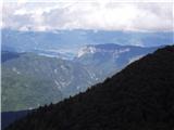 21
21
Discussion about the trip Kozji hrbet - Šavnik
To post a comment you must log in:
If you do not yet have a username, you must first
register.