Kozje - Raskože (Bohor) (via Vetrnik)
Starting point: Kozje (276 m)
| Latitude/Longitude: | 46,0727°N 15,5571°E |
| |
Route name: via Vetrnik
Walking time: 1 h 15 min
Difficulty: easy marked way
Elevation gain: 374 m
Elevation difference along the route: 405 m
Map: Posavsko hribovje Boč - Bohor 1:50.000
Recommended equipment (summer):
Recommended equipment (winter):
Views: 2.897
 | 3 people like this post |
Access to starting point:
Kozje is the main settlement of Kozjansko and well accessible from several directions. In the center of the settlement there are enough parking spaces available.
A) Exit at Dramlje on the highway and through Šentjur and Lesično to Kozje.
B) From the direction of Podčetrtek right in the settlement Prelasko through Buč to Kozje.
C) From the direction of Bistrica ob Sotli left in the settlement Prelasko through Buč to Kozje.
D) From the direction of Brestanica, Senovo and Podsreda to Kozje.
Route description:
After a short tour of the settlement Kozje head from the center in the direction of Bistriški graben on the asphalt road to the turn-off to the left towards Vetrnik. In the part to the turn-off for Vetrnik the path is also Mary's pilgrimage path and is marked with the signs of that path. The path higher towards Vetrnik is a well-surfaced forest road which winds quite steeply uphill and is easy to follow. When you reach the asphalt, which leads somewhere on the upper ridge, you turn right and you also step on the Zasavska mountain trail. Follow its signs and to the panoramic summit Raskože is not far.
Photos:
 1
1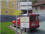 2
2 3
3 4
4 5
5 6
6 7
7 8
8 9
9 10
10 11
11 12
12 13
13
Discussion about the trip Kozje - Raskože (Bohor) (via Vetrnik)
|
| šoni14. 10. 2013 |
I don't know when this was written, but on 13.10.13 I searched for Oslica and must say the marks are very sparse, overgrown and faded, so I didn't find this hill at all, the description is poor too. It seems the path is meant only for locals, others should forget it...
Mirko
|
|
|
|
| zico1014. 10. 2013 |
I live near Oslica myself and it is really very poorly marked. If you go to these parts again, let me know and I'll show you around :-)
|
|
|
To post a comment you must log in:
If you do not yet have a username, you must first
register.