Kočiška planina / Koutschitz Alm - Starhand (by road)
Starting point: Kočiška planina / Koutschitz Alm (1165 m)
| Latitude/Longitude: | 46,579°N 13,4481°E |
| |
Route name: by road
Walking time: 2 h 15 min
Difficulty: easy marked way
Elevation gain: 800 m
Elevation difference along the route: 800 m
Map: Tabacco 19
Recommended equipment (summer):
Recommended equipment (winter): ice axe, crampons
Views: 3.119
 | 1 person like this post |
Access to starting point:
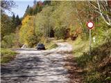
Access from Trbiž / Tarvisio: From Trbiž / Tarvisio we drive on the old road to Austria. Behind the village Vrata / Thorl a road branches off to the left, which through the underpass crosses the railway. We follow the road ahead to the village Bistrica / Feistritz, where in the center of the village at the sharp right turn the road branches off towards the village Blače / Vorderberg (at the crossroad we continue straight). In the village Blače / Vorderberg we turn left towards the church and follow the road ahead to the next crossroad, where we continue right in the direction of the mountain pasture Donice / Dolinza Alm. The asphalt road then runs past the cottage on Kočiška planina / Koutschitz Alm and only a little further brings us to the next crossroad, where we continue on the upper road and drive approximately 2 km to the parking lot at the next junction. Further driving is forbidden.
Access from Beljak / Villach: We drive on the old road towards Trbiž / Tarvisio and after the village Megvarje / Maglern we turn right under the railway. Then we follow the above description.
Access from Slovenia: Through the border crossing Rateče to Trbiž / Tarvisio, then follow the above description.
Route description:
From the parking lot we continue on the left lower road, which already after a few meters crosses a stream. On the other side of the stream across the road we notice a ramp behind which the road starts to ascend. Next follows an ascent through the forest and a sharp right turn. The road then ascends parallel to the stream, which we hear right below us. Ahead the road crosses an electric cable and soon after that brings us to a crossroad of two roads. We continue left on the upper road, which a little higher brings us to some panoramic slopes. At the next crossroad we again continue left and follow the path to the mountain pasture, where we continue on the right road, which ascends diagonally above the mountain pasture.
After the mountain pasture we leave the road and head left upwards on a steep cart track, which brings us to the upper part of the mountain pasture. Here the road and the cart track end, and we continue upwards across the mountain pasture, where we notice a nice footpath, which ascends diagonally. The path then goes into the forest after a few minutes, where it crosses a torrent and ascends to the panoramic ridge, where there is a junction.
We continue left upwards on the grassy slope, in the middle of which we notice an arrow that directs us right below the cliffs. Here a sign on the rock for "Starhand" directs us right and the path ascends first through a short stretch of forest and then along the ridge to the panoramic summit.

Photos:
 1
1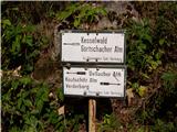 2
2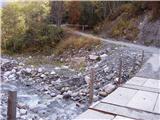 3
3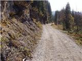 4
4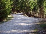 5
5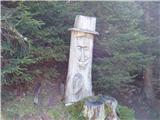 6
6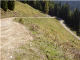 7
7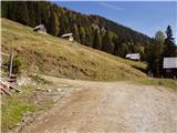 8
8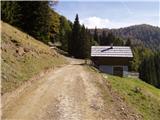 9
9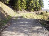 10
10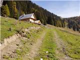 11
11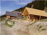 12
12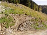 13
13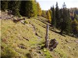 14
14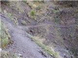 15
15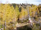 16
16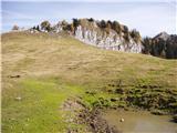 17
17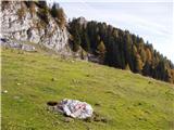 18
18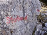 19
19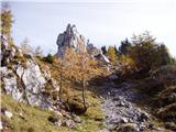 20
20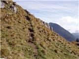 21
21 22
22
Discussion about the trip Kočiška planina / Koutschitz Alm - Starhand (by road)
To post a comment you must log in:
If you do not yet have a username, you must first
register.