Kosmačev preval - Požgana Mlinarica
Starting point: Kosmačev preval (847 m)
| Latitude/Longitude: | 46,4369°N 13,9308°E |
| |
Walking time: 6 h 15 min
Difficulty: very difficult unmarked way
Elevation gain: 1021 m
Elevation difference along the route: 1450 m
Map: Triglav 1:25.000
Recommended equipment (summer): helmet
Recommended equipment (winter): helmet, ice axe, crampons
Views: 6.169
 | 2 people like this post |
Access to starting point:
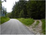
We leave the Gorenjska highway at the Jesenice - west (Hrušica) exit and continue driving in the direction of Kranjska Gora. A little before the settlement Dovje, we leave the main road and continue driving left in the direction of Mojstrana and valleys Vrata, Kot and Krma. Still before we cross Triglavska Bistrica, signs for Radovna, Kot and Krma point us to the left onto a somewhat narrower road which ascends past a few houses. The road above the settlement Mojstrana starts ascending more steeply and past the TNP sign brings us to Kosmačev preval, where the road branches off to the right into valley Kot. Here we park at an appropriate place by the crossroad.
Route description:
From the parking lot, we go on a cart track which in a gentle ascent runs parallel with the road. At the beginning we continue on the right cart track, and after two minutes of walking another cart track branches off to the left and we go on it. At the crossings are also placed cairns, which help us with orientation. Further, the cart track ascends on a slope straight upwards and later turns into a footpath which starts ascending steeply. The path is poorly visible, but we get help from smaller cairns. The path then turns a little right and brings us on an indistinct small ridge. Here the path turns left and then follows this small ridge straight upwards. The path soon from the ridge brings us on steep slopes and ascends in zigzags to the main ridge. Here the path once again turns left and continues ascending through the forest. For a short time the ascent becomes less steep but the path soon again steeply ascends. The last part of the path towards the bivouac runs mostly on slopes above the valley Vrata or on the ridge. The path then flattens and on the right side we notice a smaller cottage. This is bivouac on Črna gora.
From the bivouac, we continue on the ridge and at first, we slightly descend. Further, we then for a long time walk on the ridge through the forest and we several times ascend and descend a little. In doing so we also ascend on some less known peaks, namely on Predelov vrh, Nizka dolina and then also on Lengarjeva glava, where there is also a viewpoint, from which for the first time a view opens up towards the east. Because before that we were all the time walking through the forest and therefore the view was very limited.
From Lengarjeva glava we continue still on the ridge and out of the forest, the path brings us into dwarf pines, where wonderful views open up on all sides. Further follows a few more short ascents and descents through dwarf pines, and the ridge is on some spots a little steeper. Follows an ascent through a short stretch of forest and then also a short ascent through dwarf pines, which brings us on a panoramic peak Požar.
From the top on which stands a large cairn we continue on the ridge and then on the path through the forest we soon come to a junction, where from the left joins a hunting path from the valley Kot.
The path continues to run on a steep and relatively narrow forest-covered ridge (in wet danger of slipping). To here not very demanding path then brings us on the forepeak Rušnata Mlinarica, where less experienced can also end the trip (peak is recognizable by a big cairn).
We continue on the ridge, which is more and more overgrown with dwarf pines, but passages are nice because dwarf pines are cut. A little further, the path brings us to a shorter steep step (at torn steel cable), where we have to ascend with the help of dwarf pines 5 meters steeply upwards. The path which runs on a relatively steep slope and occasionally narrow ridge then over numerous forepeaks and gullies brings us on unvegetated and panoramic peak Rušnata Mlinarica.
From Rušnata Mlinarica we still continue on narrow and in some parts exposed ridge. Difficulty further does not decrease and on the path follows a few more steep ascents and exposed traverses. We mostly avoid difficulties on the left side of the ridge. Such a path leads us all the way to panoramic summit Požgana Mlinarica.

Photos:
 1
1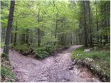 2
2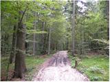 3
3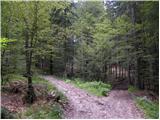 4
4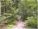 5
5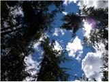 6
6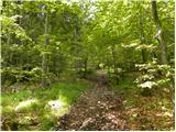 7
7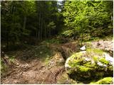 8
8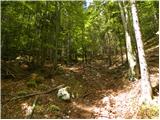 9
9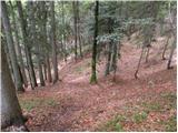 10
10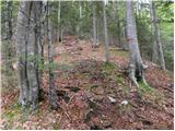 11
11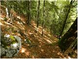 12
12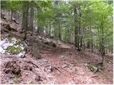 13
13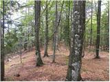 14
14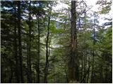 15
15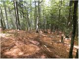 16
16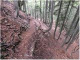 17
17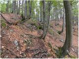 18
18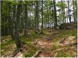 19
19 20
20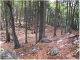 21
21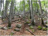 22
22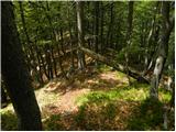 23
23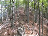 24
24 25
25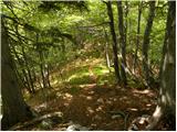 26
26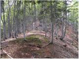 27
27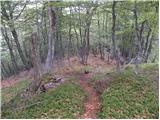 28
28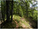 29
29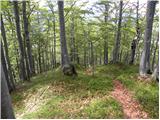 30
30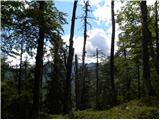 31
31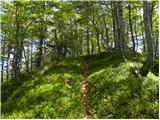 32
32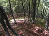 33
33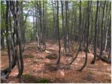 34
34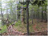 35
35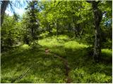 36
36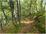 37
37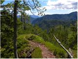 38
38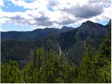 39
39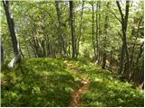 40
40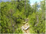 41
41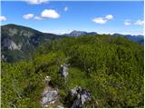 42
42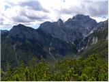 43
43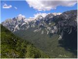 44
44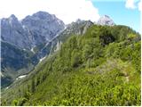 45
45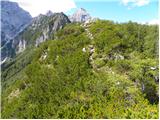 46
46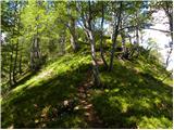 47
47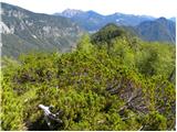 48
48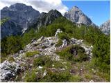 49
49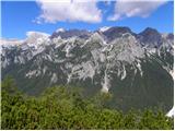 50
50 51
51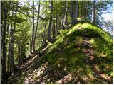 52
52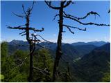 53
53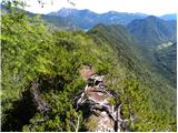 54
54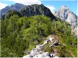 55
55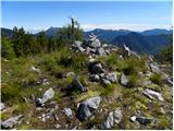 56
56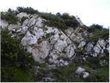 57
57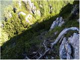 58
58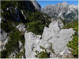 59
59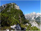 60
60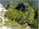 61
61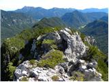 62
62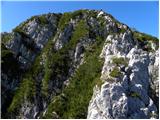 63
63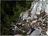 64
64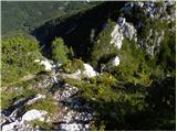 65
65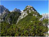 66
66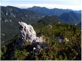 67
67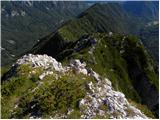 68
68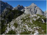 69
69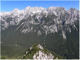 70
70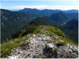 71
71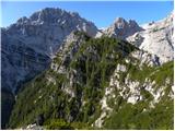 72
72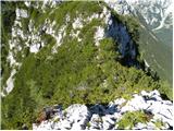 73
73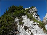 74
74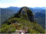 75
75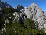 76
76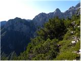 77
77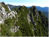 78
78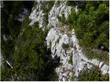 79
79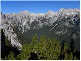 80
80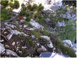 81
81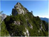 82
82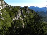 83
83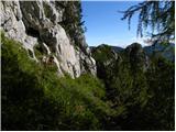 84
84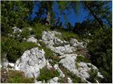 85
85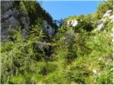 86
86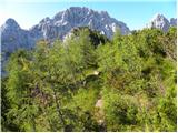 87
87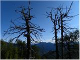 88
88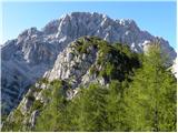 89
89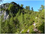 90
90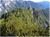 91
91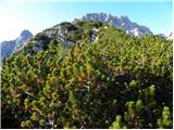 92
92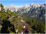 93
93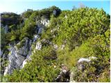 94
94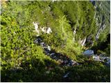 95
95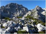 96
96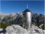 97
97
Discussion about the trip Kosmačev preval - Požgana Mlinarica
|
| JusAvgustin12. 05. 2013 |
Beautiful tour for today. At the top of PM the sun even awaited us. We took 3.5 hours for the path. We descended via the ledge of PP to Kot
|
|
|
|
| Batistuta23. 08. 2020 |
Yesterday we did a tour from Kosmačev preval along the entire ridge between Kot and Vrati to Požgana Mlinarica, then descent to Turkov rovt in Vrati.
Total duration 8.5 h. This is possible only with two cars, one left in Kot, the other in Vrati. We three very experienced hikers fully rated the tour as very demanding.
1. Orientation: already at Kosmačev preval it's hard to choose the right path (see pictures, they show it best, description is good too), the path to Črna Gora is difficult to follow for a while. Once on the ridge the path is fairly logical due to the ridge itself, but still difficult to follow in places. Occasionally we go a bit by guesswork and find the path again. When approaching Rušnata Mlinarica climbing begins, there it's often unclear which side to climb.
2. Technical difficulty: the path is demanding because it goes up and down a lot, so we lose much more energy than promised by a ''mere'' 1868 m high mountain. In the last third there is a lot of scrambling, no fixed protection, rocks can be very loose, those in shade also slippery. We have to push through overgrown scrub a lot, recommend long pants and helmet to ''deflect'' branches at head height, also goggles so a branch doesn't hit us. In some places the scrub has almost completely overgrown the trail. Some scratches from branches are inevitable.
So maximum caution applies.
Overall this path is completely wild and recommended for adventure-minded experienced hikers with very good fitness. Somewhat ironically I looked to the right towards much higher Škrlatica and wondered why I'm struggling much more with Požgana Mlinarica ...
For the path to Požgana Mlinarica we took 5 hours and 20 minutes. We descended to Turkov rovt in Vrati (I described the problems of this descent in the description of that path, read carefully if you want to descend that way!).
Views on the ridge are phenomenal, from Rjavina to Kukova Špica and everything in between. Happy trails! 
|
|
|
|
| Trobec20. 11. 2023 10:30:58 |
Regarding the description and difficulty, I agree with the predecessor. Most of the path is technically easy, but certain shorter sections definitely deserve ZZ rating. And not only that, you need to master ZZ terrain without help of fixed protection.
And yes, recommend 2 cars, otherwise long slog on the plain/asphalt follows... which almost happened to us yesterday due to forgotten keys...
|
|
|
|
| Rok21. 11. 2023 17:53:58 |
I have changed the difficulty to very demanding.
|
|
|
To post a comment you must log in:
If you do not yet have a username, you must first
register.