Koroška Bela - Potoška planina (via Spodnji rovti)
Starting point: Koroška Bela (600 m)
| Latitude/Longitude: | 46,4264°N 14,1031°E |
| |
Route name: via Spodnji rovti
Walking time: 2 h
Difficulty: easy unmarked way
Elevation gain: 670 m
Elevation difference along the route: 670 m
Map: Karavanke - osrednji del 1 : 50.000
Recommended equipment (summer):
Recommended equipment (winter): ice axe, crampons
Views: 2.884
 | 3 people like this post |
Access to starting point:
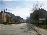
From the Ljubljana-Jesenice motorway, take the Lipce exit (Jesenice east) and turn right towards Jesenice. At the first traffic-light intersection (Slovenski Javornik), turn right towards Lj. The second intersection with traffic lights follows, where we turn left and drive under the railway underpass. At the next smaller intersection, turn right towards Koroška Bela. At the chapel on the left, follow the signs "cerkev, park talcev" and turn left. The road, higher up after the double bend, brings us to the centre of the village, where a chapel stands. From here, continue driving straight to the bridge over the Bela stream on the right, cross it, and continue straight along the narrow road between houses (appearance of a courtyard). Then, when a little higher the road flattens, it brings us to a smaller parking lot below the slope on the left, beside which we encounter a marked path in the forest.
Route description:
After a few meters in the forest, we step onto a cart track which turns left and ascends steeper into the slope to a spring, where we step onto another cart track and turn right. The marked path, which leads us eastwards, ascends only occasionally at first, somewhat steeper only thereafter when, a little higher, it turns left and briefly gets a stony surface. When the gentle slope eases, we continue right along a section of unmarked path, which soon turns slightly left, while at the same time some views into the valley open up. A little higher, the marked path turns slightly right back into the forest, where it leads us along and beside the cart track eastwards for some time. When the path starts to take on the appearance of a forest road, we cross the Sevnik stream on the flat. A little higher, after a left bend, there is a junction: first right - path to Ajdna (sign), second right - continuation of the marked path to Valvasorjev dom (marked), straight - Spodnji Rovti (unmarked). Here we leave the marked path and continue straight uphill along the cart track beside the stream on the left. When higher we encounter a forest track, we leave the cart track and head left towards the hut which we spot there. In front of it, we cross the stream on a small bridge and continue a few meters straight to the hayrack on the left. Here we turn at right angles right onto the grassy slope of Spodnji Rovti, where a less noticeable path takes us uphill. On these beautiful, hummocky meadows, we now enjoy ever better views back towards the valley and the Julian Alps with every step. At the top of the open grassy slope, the path takes us back into the forest, where after crossing a streamlet it first turns slightly left and ascends more steeply. A little higher, our path crosses a short track and then turns only slightly right, soon bringing us to the southern edge of the pasture, where (if necessary) we cross the grazing fence. From here on, we walk for a short time along the path by the forest edge on the right. Soon we step onto the expansive grassy slopes of Potoška planina, a little higher we cross the grazing fence for the last time, and along the streamlet we continue to the shepherd's hut on Potoška planina.

Photos:
 1
1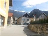 2
2 3
3 4
4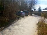 5
5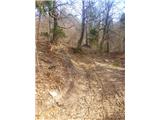 6
6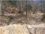 7
7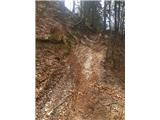 8
8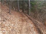 9
9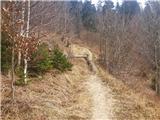 10
10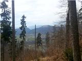 11
11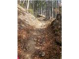 12
12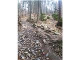 13
13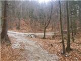 14
14 15
15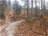 16
16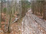 17
17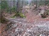 18
18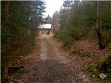 19
19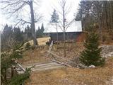 20
20 21
21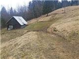 22
22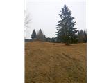 23
23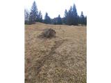 24
24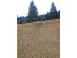 25
25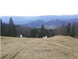 26
26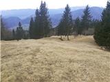 27
27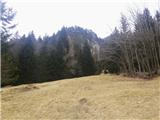 28
28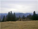 29
29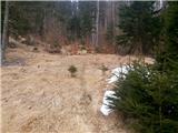 30
30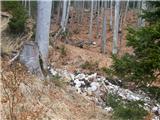 31
31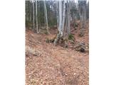 32
32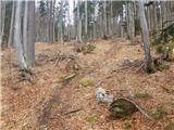 33
33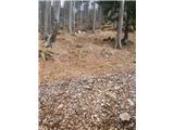 34
34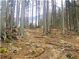 35
35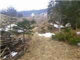 36
36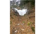 37
37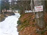 38
38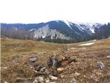 39
39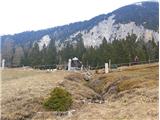 40
40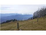 41
41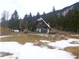 42
42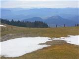 43
43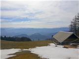 44
44
Discussion about the trip Koroška Bela - Potoška planina (via Spodnji rovti)
|
| Majdag31. 03. 2015 |
... Nice path, I've already gone along it in the opposite direction. On the lower rovte cowslips are also blooming when it's time for that.
|
|
|
|
| heinz31. 03. 2015 |
True, Majda. The Spodnje rovte are also very dear to my heart.
|
|
|
|
| milenula30. 01. 2022 19:47:14 |
Today we hiked this trail with friends. Just one correction: there is no longer a parking lot at the mentioned place, because they are building a house there. The friendly local from the last house told us to park in the bushes, which we did. They also kindly allowed us to turn the cars in their yard, for which we thank them kindly! For the future, it might be wise to consider parking by the church.
|
|
|
To post a comment you must log in:
If you do not yet have a username, you must first
register.