Koroška bela (Jesenice) - Valvasorjev dom pod Stolom
Starting point: Koroška bela (Jesenice) (600 m)
Walking time: 1 h 30 min
Difficulty: easy marked way
Elevation gain: 581 m
Elevation difference along the route: 581 m
Map: Karavanke - osrednji del 1:50.000
Recommended equipment (summer):
Recommended equipment (winter): ice axe, crampons
Views: 17.890
 | 2 people like this post |
Access to starting point:
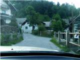
From the Ljubljana - Jesenice highway, take the Lipce exit and drive right towards Jesenice. At the first traffic-light intersection (Javornik), drive right in the direction of Lj. There follows the second intersection with traffic lights, where we turn left and drive under the railway underpass, and at the next smaller intersection we head right towards Koroška Bela. We drive into the village, which heads towards the northeast, where at an appropriate place (e.g. block settlement near the fire station) we park. We can also continue driving.
Route description:
(On foot or by car) we look for the intersection in the center of the village, where a church landmark stands. From here we go along the main road through the village, which goes barely noticeably uphill towards the northeast. After approx. 100 m on the right we cross the bridge over the stream Bela, where nearby (Stranska pot street) we can notice the first blazes. We continue on the asphalt road between two houses (courtyard appearance), which here turns right.
After a short time, when it flattens and after the left turn almost ends, on the left we notice a smaller parking lot (second starting point option), next to which is the entrance into the forest i.e. the marked path, which we head towards. After a few tens of meters we encounter a timber slide, up which we ascend steeply left uphill to a spring, where a poorer cart track begins, but we continue to the right. The path, which leads eastwards, ascends only occasionally; only after 10 min, when it turns left and loses the cart track appearance, does it become steeper. When the steepness eases we step back onto the cart track and head left uphill (right - unmarked path). The path first turns right and soon also left. Here we leave the cart track and step onto the trail from the right, which later brings us to the junction of cart tracks. Here we head onto the main one (northeast direction), along and beside which we continue for some time. When the path starts to take on the appearance of a forest road, on the flat we cross the Sevnik stream.
All the time we stick to the widest path. When we come to the forest clearing, a view opens onto the western slope of Ajdna. After some time the forest road brings us first to the junction for Ajdna (Na Sušeh), and then to the road that leads to Potoška planina, which we cross.
A relatively nice forest path, which ascends and occasionally flattens, brings us to Valvasorjev dom pod Stolom in good 20 minutes of walking.

Photos:
 1
1 2
2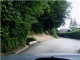 3
3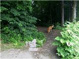 4
4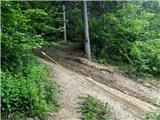 5
5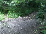 6
6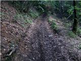 7
7 8
8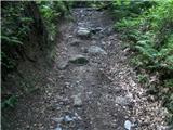 9
9 10
10 11
11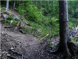 12
12 13
13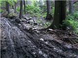 14
14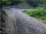 15
15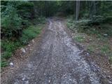 16
16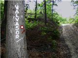 17
17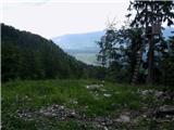 18
18 19
19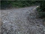 20
20 21
21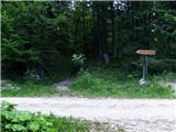 22
22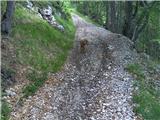 23
23 24
24 25
25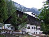 26
26
Discussion about the trip Koroška bela (Jesenice) - Valvasorjev dom pod Stolom
|
| Gorska planika29. 05. 2017 |
The path is very pleasant, nicely traceable and excellently marked! I recommend 
|
|
|
|
| di2. 01. 2023 16:08:52 |
The trail from Javorniški Rovt to Valvasorjev dom is officially marked.
But like too many other marked (even transversal) trails, it also lacks markings where they are needed (e.g., at junctions).
You will find three "paws" in places where they are not necessary at all).
|
|
|
|
| Kafetarca3. 01. 2023 08:05:48 |
Apparently, at junctions we have to intuitively know where and how. I myself wondered several times about the right path when I found myself at a junction of two paths, there was no marking, or it was in the middle between both paths, then of course you don't know whether left or right. I wonder why mark it at all if it's in such an ambiguous place...
|
|
|
To post a comment you must log in:
If you do not yet have a username, you must first
register.