Koprivna (Kumer) - Feistritzer Spitze (slovenska pot)
Starting point: Koprivna (Kumer) (1172 m)
| Latitude/Longitude: | 46,4903°N 14,7284°E |
| |
Route name: slovenska pot
Walking time: 3 h 40 min
Difficulty: easy marked way
Elevation gain: 941 m
Elevation difference along the route: 1035 m
Map: Kamniške in Savinjske Alpe 1:50.000
Recommended equipment (summer):
Recommended equipment (winter): ice axe, crampons
Views: 5.348
 | 1 person like this post |
Access to starting point:
A) First, we drive to Luče (to here from Kamnik over the Volovjek pass (Kranjski Rak) or from the Styrian motorway past Mozirje and through Ljubno ob Savinji), then we continue driving towards Logarska dolina. When we arrive in Solčava, we leave the main road and continue driving right towards Črna na Koroškem. Further, we drive on an ascending road, which we follow at the crossroads towards Črna na Koroškem and the Spodnje Sleme pass. From the pass onwards, the road starts descending, and we follow it to the place where we join the road Črna na Koroškem - Koprivna. Here we continue left, then at the next crossroad approximately 1 km ahead right towards the mountain hut on the Kumer farm. Further, we ascend alongside the Koprivna stream, and we follow the road to the crossroad where the road branches off sharply to the left towards the earlier-mentioned mountain hut, straight ahead the road continues towards the mountain pasture Luža, and to the right a marked path branches off to Peca (the latter at first runs along the road as well). We park in a suitable place by the road.
B) From Koroška, we first drive to Črna na Koroškem, then continue driving towards Podpeca and Koprivna. At the crossroad where the road towards Podpeca branches off to the right, we continue slightly left, and likewise at the next crossroad where the road into the Topla valley branches off to the right. Further, we drive along the Meža river for a while, then first arrive at the crossroad where the road branches off to the left towards the Spodnje Sleme pass and further towards Logarska dolina. Here we continue straight, then at the next crossroad approximately 1 km ahead right towards the mountain hut on the Kumer farm. Further, we ascend alongside the Koprivna stream, and we follow the road to the crossroad where the road branches off sharply to the left towards the earlier-mentioned mountain hut, straight ahead the road continues towards the mountain pasture Luža, and to the right a marked path branches off to Peca (the latter at first runs along the road as well). We park in a suitable place by the road.
C) First, we drive to Šoštanj, then continue driving along a winding road towards Črna na Koroškem. In Črna na Koroškem, we continue left towards Podpeca and Koprivna. At the crossroad where the road towards Podpeca branches off to the right, we continue slightly left, and likewise at the next crossroad where the road into the Topla valley branches off to the right. Further, we drive along the Meža river for a while, then first arrive at the crossroad where the road branches off to the left towards the Spodnje Sleme pass and further towards Logarska dolina. Here we continue straight, then at the next crossroad approximately 1 km ahead right towards the mountain hut on the Kumer farm. Further, we ascend alongside the Koprivna stream, and we follow the road to the crossroad where the road branches off sharply to the left towards the earlier-mentioned mountain hut, straight ahead the road continues towards the mountain pasture Luža, and to the right a marked path branches off to Peca (the latter at first runs along the road as well). We park in a suitable place by the road.
Route description:
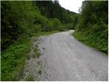
From the starting point, we continue on the right road, alongside which we notice signs for Peca (left: mountain hut on the Kumer farm, straight: mountain pasture Luža). We continue along the ascending macadam road for about 10 minutes, then on the left side of the road we notice a signpost for Peca, which directs us left across a meadow. On the other side of the relatively overgrown meadow, the cart track along which we continue the ascent turns left and begins to ascend transversely. Here a little view opens up from the path; higher, the cart track joins a poorer forest road, which we follow left. The poorer road, already almost a cart track, splits higher into two parts, and we continue straight along the ascending cart track, which higher turns sharply right. The poorer cart track higher joins the next forest road, which we reach right at a bend. At the end of the bend, we leave the road and continue on the marked path, which first ascends gently, then ever steeper through the forest. Higher, the path turns slightly right and gradually leads us along the edge of sheer cliffs, from which a nice view opens onto the Topla valley and surrounding peaks. The path ahead leads along the edge of the cliffs for a while, transitioning from increasingly sparse forest into a belt of dwarf pines. We then ascend along a path running by the border line, with ever more beautiful views opening from the path. Higher, the path levels out and turns right, while the border line continues approximately in the same direction.
When the path turns right, it returns entirely to the Slovenian side for a while, crossing the slopes of Končnikov vrh. On somewhat less trodden but well-marked sections, the path brings us higher onto the expansive summit ridge of Peca, which we reach just a little above Knipsovo sedlo.
Upon reaching the ridge, the path branches right towards the Topla valley and Kordeževa glava, straight it continues towards the Peca ski area, and we continue left towards Bistriška špica / Feistritzer Spitze. The path ahead climbs a panoramic slope, then gradually transitions onto the ridge, along which we quickly ascend to the grassy Končnikov vrh.
From Končnikov vrh, a short descent follows along a grassy path, after which we cross back entirely to the Austrian side of the mountain. There follow some shorter ascents and descents and a panoramic path, from which beautiful views open onto Raduha and the central Kamnik-Savinja Alps, leading us to Bistriška špica.

Photos:
 1
1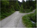 2
2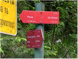 3
3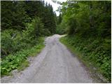 4
4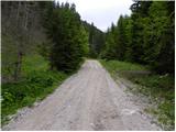 5
5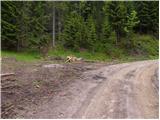 6
6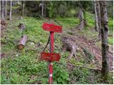 7
7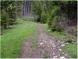 8
8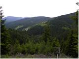 9
9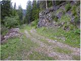 10
10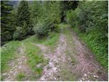 11
11 12
12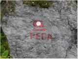 13
13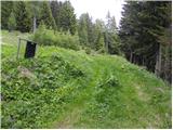 14
14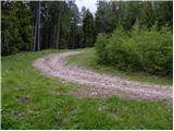 15
15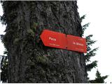 16
16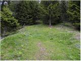 17
17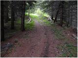 18
18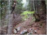 19
19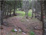 20
20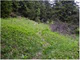 21
21 22
22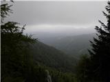 23
23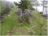 24
24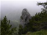 25
25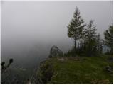 26
26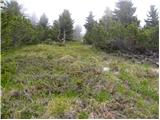 27
27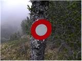 28
28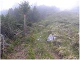 29
29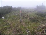 30
30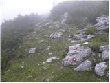 31
31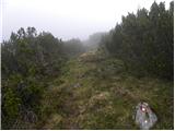 32
32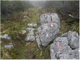 33
33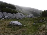 34
34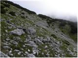 35
35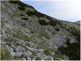 36
36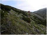 37
37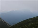 38
38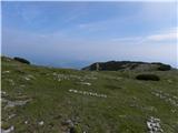 39
39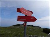 40
40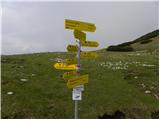 41
41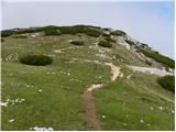 42
42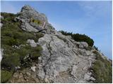 43
43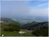 44
44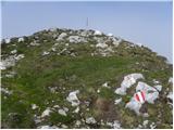 45
45 46
46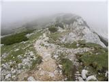 47
47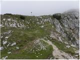 48
48 49
49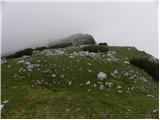 50
50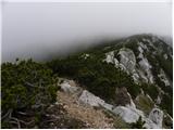 51
51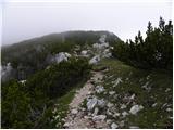 52
52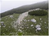 53
53 54
54 55
55 56
56 57
57
Discussion about the trip Koprivna (Kumer) - Feistritzer Spitze (slovenska pot)
|
| luka8717. 09. 2016 |
yesterday I went on this path.. the path is well marked, easy, the last part along the Peča ridge is phenomenal...
|
|
|
To post a comment you must log in:
If you do not yet have a username, you must first
register.