Konec ceste na Vogar - Planina Lopučnica (via Prodi)
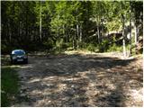
Starting point: Konec ceste na Vogar (1350 m)
| Latitude/Longitude: | 46,2956°N 13,8412°E |
| |
Route name: via Prodi
Walking time: 3 h 50 min
Difficulty: easy marked way
Elevation gain: 208 m
Elevation difference along the route: 750 m
Map: TNP 1:50.000
Recommended equipment (summer):
Recommended equipment (winter): ice axe, crampons
Views: 2.236
 | 1 person like this post |
Access to starting point:
From the Ljubljana-Jesenice motorway take the Lesce exit and follow the road towards Bled and further towards Bohinjska Bistrica. Continue driving towards Lake Bohinj (Ribčev laz), where we reach a junction, continuing right towards Stara Fužina. In Stara Fužina at the junction by the chapel turn sharply left onto the ascending road towards planina Blato, planina Vogar and dolina Voje. The road further takes us to the place where toll and parking fees are collected; we follow it to the next junction, continuing left (right Voje). Then follow the road to the next junction (driving for quite some time), continuing straight (sharply right planina Blato). Then follow the road past planina Vogar, driving along it to the parking lot at the end of the road.
From the toll collection point to the starting point is less than 11 km of driving; the last half or slightly less is entirely gravel road.
Route description:
At the parking lot we notice signs for Planina Viševnik directing us right onto a wide and initially quite steep tractor track. After a few minutes of steep ascent the track levels out, then continues without major elevation changes further through the forest. When the track turns right we continue straight on the marked footpath, which initially ascends gently for a short time. When the path becomes steeper we will notice a cairn on the left side and next to it a path leading to Pršivec (the path later joins the usual path from Vogar), but we continue straight on the steep mountain path. The path ahead ascends steeply through the forest for some time, then temporarily levels out, bringing us to Brezno pri Gamsovi glavici (the pit is explored to 817 m depth). Above the pit the path turns into an indistinct and steeper valley in the upper part, up which we ascend to a small pass between Pršivec (1761 m) on the left and Gornji Viševnik (1722 m) on the right. Here the path completely levels out, then continues for some time across the pastures of Gornji Viševnik. On the other side the path returns to the forest and brings us down in a few minutes to Planina Viševnik, in the middle of which stands Bregarjevo zavetišče.
From Planina Viševnik continue slightly left (sharply left Pršivec, left Črno jezero, slightly right Planina pri Jezeru past Krištofojca, right Planina pri Jezeru) on the path towards Planina Ovčarija and Triglav Lakes. The path first ascends transversely left across a steeper slope, then gradually levels out bringing us to more plateau-like terrain. Continue southwest of Griva (1758 m) for some time without major elevation changes. A bit further, at the direction signs, an unmarked trail continues straight towards Planina Dedno polje; we, however, turn sharply left towards Planina Ovčarija. From the signs the path descends slightly, then turns right continuing for some time along a kind of contour or hollow. On the other side of the hollow the path begins to ascend moderately again, then levels out bringing us to the shepherd huts on Planina Ovčarija.
Continue between the huts on the marked mountain path which begins to descend moderately. A bit lower the path leads past a few more huts, then in a few minutes of further walking brings us to the point where the wider path from Planina Dedno polje joins. Here continue left arriving in a few steps at the next junction.
From the fork follow signs for the path via Prodi (right path via Štapce) and after a few more minutes arrive at a nice vantage point from which a beautiful view opens onto the Komna plateau and Bohinj-Tolmin mountains.
Here the path turns right descending from the plateau to steep grassy slopes across which we descend transversely left at moderate descent. Lower the path enters dense forest, the slope becomes less steep and we ascend steeply for a short time. A few minutes further we reach a marked junction above Lopučniška dolina where we join the path from Koča pri Savici starting point or the path past Črno jezero.
Continue straight towards Koča pri Triglavskih jezerih (left Koča pri Savici) on the path which continues ascending gently bringing us to a point from where a beautiful view opens onto Dvojno jezero. Here we pass the branch to Ruski grob, then the path leads along the right, eastern side of Dvojno jezero where from the right joins the path from Planina Blato, namely via Štapce.
Continue straight and when leaving the lake shore only a few dozen easy steps separate us from Koča pri Triglavskih jezerih.
After resting and enjoying the views continue on the path towards Dom na Komni. The path ahead leads along the right (western) side of the lake ascending transversely. A little further near the hunting hut (not visible from the path) the path curves semicircularly right beginning to descend gradually. Somewhere midway on the descent to Planina Lopučnica, on a small flat where the marked path we follow turns left, an unmarked trail branches right leading towards Zgornje Komne plateau and Gladki and Debelem Lašt (the mentioned path higher up gets lost in the karst world).
When lower reaching Planina Lopučnica, where there is a junction, continue right towards Planina Za skalo (slightly left Dom na Komni) on a poorly trodden path crossing the planina slopes northwestwards. The path running through high grasses (in summer months) higher up crosses a belt of sparse forest then turns somewhat left. The path ahead ascends steeply bringing us in a few minutes of further walking to the karst world of sinkholes and scree. Here the path levels out beginning to fade in the rocky world (carefully follow marks). On this section a wonderful view opens onto the mountains surrounding Dolina Triglavskih jezer. Follow the marked path only to pass Velika vrata reaching it after a few more minutes of gentle ascent.
On the other side of Velika vrata leave the already little-visited path continuing right through pathless terrain. Initially passages through bushes and scree terrain are relatively easy as cairns help find the "path", though sparse. Continue ascent roughly northwards but no direct passages due to karst world. Due to fissures occasionally make large detours. When "path" finally brings us to the ridge orientation loops end. Continue ascent along increasingly scenic ridge, "path" quickly bringing us to indistinct summit Glava za Bajto.
Further descend slightly then ascend grassy slope of Čela to little-known and even less visited summit.
Parkirišče Hebed - Brezno pri gamsovi glavici 0:55, Brezno pri gamsovi glavici - Gornji Viševnik 0:10, Gornji Viševnik - Planina Viševnik 0:15, Planina Viševnik - Planina Ovčarija 0:50, Planina Ovčarija - razpotje na Planini Ovčarija 0:10, razpotje na Planini Ovčarija - Prodi 0:15, Prodi - razpotje nad Lopučniško dolino 0:30, razpotje nad Lopučniško dolino - Dvojno jezero 0:10, Dvojno jezero - Koča pri Triglavskih jezerih 0:05, Koča pri Triglavskih jezerih - Planina Lopučnica 0:30.

Photos:
 1
1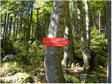 2
2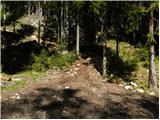 3
3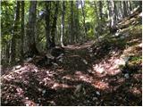 4
4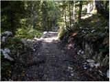 5
5 6
6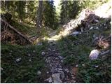 7
7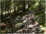 8
8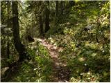 9
9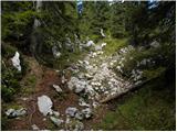 10
10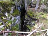 11
11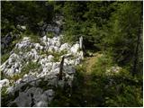 12
12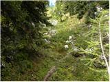 13
13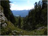 14
14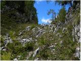 15
15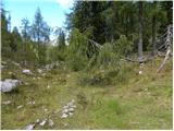 16
16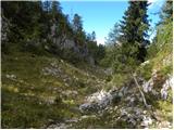 17
17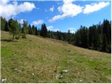 18
18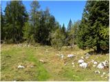 19
19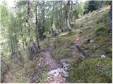 20
20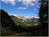 21
21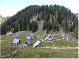 22
22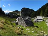 23
23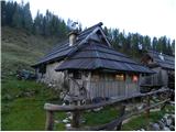 24
24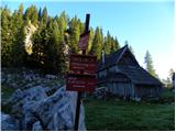 25
25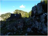 26
26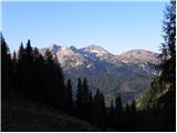 27
27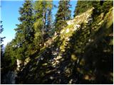 28
28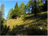 29
29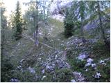 30
30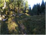 31
31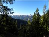 32
32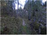 33
33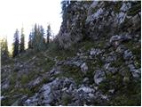 34
34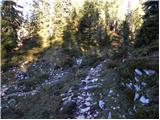 35
35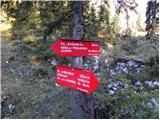 36
36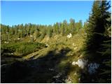 37
37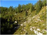 38
38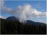 39
39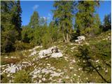 40
40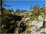 41
41 42
42 43
43 44
44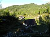 45
45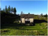 46
46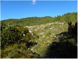 47
47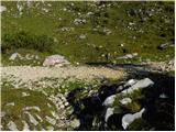 48
48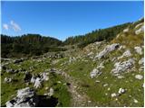 49
49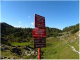 50
50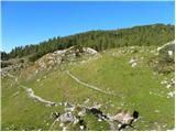 51
51 52
52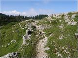 53
53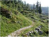 54
54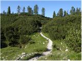 55
55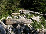 56
56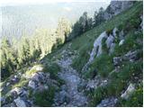 57
57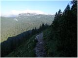 58
58 59
59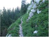 60
60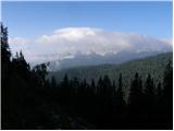 61
61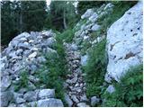 62
62 63
63 64
64 65
65 66
66 67
67 68
68 69
69 70
70 71
71 72
72 73
73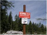 74
74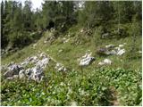 75
75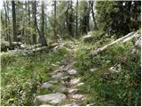 76
76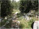 77
77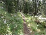 78
78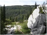 79
79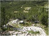 80
80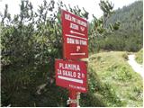 81
81
Discussion about the trip Konec ceste na Vogar - Planina Lopučnica (via Prodi)
To post a comment you must log in:
If you do not yet have a username, you must first
register.