Komare doline - Orlovo gnezdo (Veli Badin)
Starting point: Komare doline (297 m)
| Latitude/Longitude: | 45,4951°N 13,8875°E |
| |
Walking time: 2 h 20 min
Difficulty: easy marked way, difficult marked way
Elevation gain: 62 m
Elevation difference along the route: 185 m
Map: Slovenska Istra - Čičarija, Brkini in Kras 1:50.000
Recommended equipment (summer): helmet
Recommended equipment (winter): helmet
Views: 30.505
 | 1 person like this post |
Access to starting point:
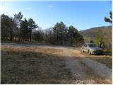
From the Ljubljana - Koper highway, take the Črni Kal exit. From Črni Kal, continue driving on the old road towards the coast, but drive along it only to the next somewhat larger junction, where we turn left towards the Sočerga border crossing. On the mentioned road, we drive past the place Kubed to the village Gračišče, where at the junction we turn left in the direction of Rakitovec, Movraž and Smokvica. From Gračišče we drive approximately another 1 km, then we arrive at a smaller junction, where we continue right onto the side asphalt road. On the mentioned road we drive another 50 m, then on the left side we notice a suitable parking space and next to it the hiking signs for the church of St. Kvirik.
Route description:
The described old path is closed in its final section for some time due to the nesting of rare bird species. The new path in the final section runs somewhat more to the left and is not technically demanding.
From the starting point, head onto the forest road towards the natural bridge, bunker and St. Kvirik. The road first ascends gently through a pine grove and bushes, then ascends somewhat more steeply and leads us for some time over partly panoramic slopes, from which a beautiful view opens towards Lačna and Gračišče. Higher, the path brings us into the more level terrain named Vela griža. Here the path, or road, levels out completely and then continues with some shorter ascents and descents above the village Lukini. Somewhat further, we bypass the summit Gradec (413 m) on the right side, and the gentle and occasionally quite panoramic path quickly brings us to the church of St. Kvirik above Sočerga.
From the chapel of St. Kvirik, continue on the marked path towards the bunker and natural bridge. The path initially follows a gentle, partly grassy cart track, along which we walk to the nearby RTV repeaters in a few minutes.
From the repeaters, the path begins to descend gradually, leading us partly over panoramic slopes, partly along and beside the occasionally precipitous ridge (the path is always kept back from the precipices). After a few minutes, we reach a small junction, where a 50 m long path to the nearby bunker (small natural window) branches off to the right, while we continue straight on the path, which, except for a few shorter ascents, mostly descends gently to moderately. Lower, we cross a strip of forest, and the path brings us to the edge of the ridge. Here the path continues to descend slightly, crossing some slightly exposed spots. The path then levels out and brings us to the precipitous viewpoint Orlovo gnezdo.
From Orlovo gnezdo, continue on the secured mountain path, which first descends to the nearby gully with the aid of a cable, then with the aid of staples. During the descent through the gully, a few more safety devices assist us, after which the path levels out and turns sharply to the left. A short traverse follows, then the path brings us to the mighty rock shelters of Veli Badin. From the rock shelters, continue in the same direction, but a little further notice the signs for the natural bridge, which direct us left. We quickly reach the mentioned bridge, continue under the arch, and then ascend back to Orlovo gnezdo along an unmarked but clearly visible path.

Photos:
 1
1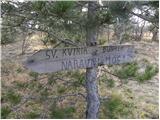 2
2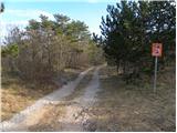 3
3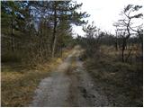 4
4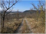 5
5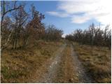 6
6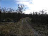 7
7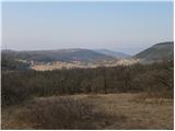 8
8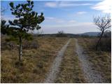 9
9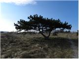 10
10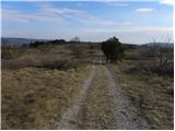 11
11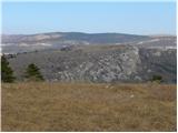 12
12 13
13 14
14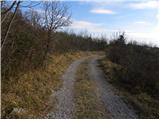 15
15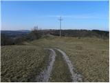 16
16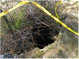 17
17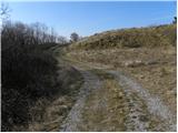 18
18 19
19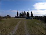 20
20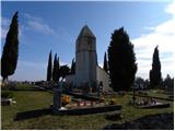 21
21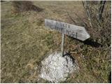 22
22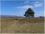 23
23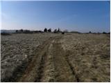 24
24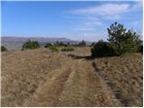 25
25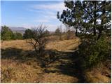 26
26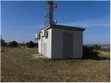 27
27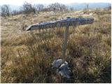 28
28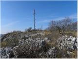 29
29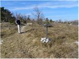 30
30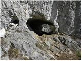 31
31 32
32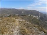 33
33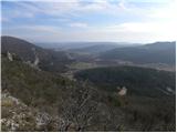 34
34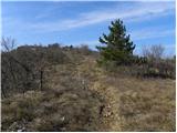 35
35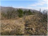 36
36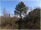 37
37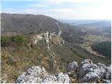 38
38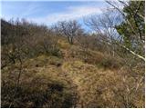 39
39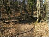 40
40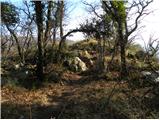 41
41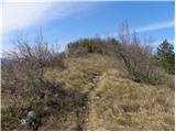 42
42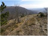 43
43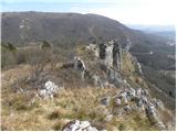 44
44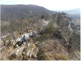 45
45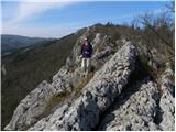 46
46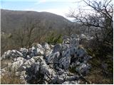 47
47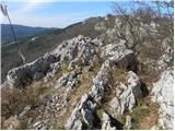 48
48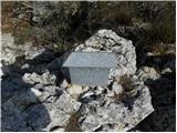 49
49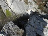 50
50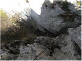 51
51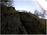 52
52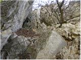 53
53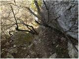 54
54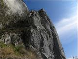 55
55 56
56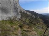 57
57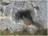 58
58 59
59 60
60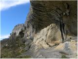 61
61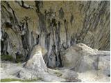 62
62 63
63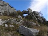 64
64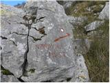 65
65 66
66
Discussion about the trip Komare doline - Orlovo gnezdo (Veli Badin)
|
| starakapa26. 03. 2011 |
With friends I was on Thursday March 24 on this path. I must say that we were all enthusiastic about the path route and the views and attractions on the path itself. It's good if you have Ježek's guide to Slovenian Istria with you. The path is well maintained and nicely marked. Don't go on this path in summer, but if you do, take a lot of liquid and start very early. Next on the other side namely from Hrastovlje to Črni kal. Let me tell you that we returned to the starting point by road past the villages Movraž and Smokvica. Along the way we picked EKO regrad
|
|
|
|
| zvezdana23. 10. 2011 |
We didn't find the secured mountain paths from Orlovo gnezdo at all and continued on the path indicated in the description for the return. It's easy, descends gradually, somewhat overgrown but easily followable. You reach the overhangs at Naravno okno. Only on the way back did we notice the rusted steel cables at Orlovo gnezdo, which don't inspire much confidence... I recommend the easier path. These days, glowing dogwood accompanies you along the entire path...
|
|
|
|
| Lj23. 10. 2011 |
Our group also caught some Istrian sunshine today and huge quantities of fiery glowing dogwood. We did this big loop around Movraška vala: Komare doline-Vrh križa-Kuk-Veliki Gradež-crossing the road to Sočergo-past the natural bridge-below the overhangs of Ušesa Istre-after a short via ferrata to Orlovo gnezdo-Sv. Kvirik-Velika griža-starting point, total about 7 hours of walking. The unclear markings also confused us, when you cross the road to Sočergo you see signs for the natural bridge and overhangs, a little later the path splits into two marked paths - and now where? We took the lower, more trodden one and reached the natural bridge and overhangs and then to the climbing path to Orlovo gnezdo. The rope is completely safe, just one bracket is missing (intentionally?) so it's a bit tricky if you have short legs. Otherwise, wonderful landscape, paradise for leisurely hiking.
|
|
|
|
| VanSims20. 11. 2011 |
The cables on the climbing path are slightly overgrown, still usable but dangerous due to rust if we cut ourselves. Also one bracket is pulled out. Criticism to the mountaineering association that maintains this via ferrata.
|
|
|
|
| darh3. 01. 2012 |
On New Year's Day we went to the natural bridge and overhangs via the extended circular path starting from Hrastovlje: Hrastovlje - Zanigrad - Zazid - V. Gradež - Tri učke - natural bridge and overhangs - Sv. Kvirik - Komare doline - Lačna - Hrastovlje. Just under 8 hours walking in pleasant, almost spring-like weather. Detailed report.
|
|
|
|
| korab24. 01. 2014 |
Well, one would think that warnings and scoldings help the PD with renewing the blazes. Important that they know the path.
Two days ago we set off on the circular path. Already at the start of the path there is no sign for St. Kvirik church or for Orlovo gnezdo. There are blazes we said and went. The path leads to the pipe even without signs. At the church there is a signboard, at the transmitters also for the bunker, then nothing more. And if you're not a bit inventive you descend towards Mlinom and continue towards Movraš, Smokvica and the starting point.
The trip was nice, even though it was shorter than planned. The landscape is wonderful. I recommend
|
|
|
|
| franca24. 01. 2014 |
On picture 63 there is a visible written request not to continue the path - continuation leads to a secured path and to Orlovo gnezdo - but to continue under the natural bridge. It would be nice and friendly to respect the request.
|
|
|
|
| laik30. 01. 2014 |
Is there an easy path to the overhangs of Veli Badin?......Thanks
|
|
|
|
| laik30. 01. 2014 |
*what kind of easy ....... 
|
|
|
|
| SunnyDay20. 02. 2014 |
The description needs a little correction. The trail is namely led lower down the slope, away from the rock overhang, the wire rope and footrests are also in poor condition, walking under the overhangs is prohibited due to birds.
When descending from the church or transmitter downwards, you come to a small forest, a small valley, there is also the stamp box. And the blue arrows + markers point LEFT towards the valley (if I'm not mistaken, the name of a village is also written on one rock), the trail (slightly less noticeable) also goes straight ahead - that's the old trail, where you walk directly above the overhang, on locally exposed rocks, the trail gets lost a bit in between ... In the small forest/valley at the stamp box, you therefore need to follow the arrow or path left downwards, it leads moderately down through the forest and when you come "to the bottom" out of the forest to the crossroads near the wide macadam, go right and then straight ahead for a couple more minutes (the path then turns slightly right), and you reach the natural bridge and overhangs.
The description describes the old path: "Lower we cross a strip of forest, but the path brings us to the edge of the ridge. Here the path continues slightly descending, crossing some slightly exposed spots. The path then levels out and brings us to the sheer vantage point of Orlovo gnezdo."
And then it mentions the ledge and footrests further, which are probably not safe to use at all. Besides, movement directly above/under the overhangs naturally disturbs the birds (rare, endangered species, some live only here).
|
|
|
|
| SunnyDay20. 02. 2014 |
Layman, the path to Veli Badin is very easy, especially the new trail has no exposed spots.
|
|
|
|
| laik20. 02. 2014 |
Thank you very much for the clarifications.. the description of the descent from Orlovo gnezdo confused me a bit....
|
|
|
|
| gustavs20. 05. 2014 |
Recently we checked out the overhangs along the repaired path as described by SunnyDay.
I would like to add the following detail: "...and when you come "to the bottom" out of the forest to the intersection near the wide macadam, go right..." - you have to go right on the grassy path that branches off in the clearing - BEFORE the macadam road. If you go right on the macadam you reach the barrier at the SLO-HR border and not the overhangs.
This turn to the right in the clearing is not marked/signposted so we missed it at first.
Given the changed path and the poor condition of the fixed cables (or what's left of them) it would be correct for the editors to update the path description.
|
|
|
|
| Tadej20. 05. 2014 |
After the post by user SunnyDay (20.2.2014) it is stated in the path description that the old path is described.
Best regards, Tadej
|
|
|
|
| Hribolazec8128. 04. 2025 21:58:22 |
What's the status of this trail now, is it still relevant, has the trail description been updated?
Thanks
|
|
|
|
| Hribolazec8120. 10. 2025 22:43:04 |
The path is well marked, you can't miss it, from the bunker onwards, when you reach the junction, right is shorter, left is longer, just choose the left longer one, also back on the same, I went down the left longer, back I planned to go on the right shorter and harder one, couldn't find it at all, got lost, walked through thicket, on very difficult terrain, if I didn't have experience, it wouldn't have ended well, barely reached the top to the path towards the bunkers.
So choose the left path up and also down.
|
|
|
To post a comment you must log in:
If you do not yet have a username, you must first
register.