Kokra (Podlebelca) - Planina Dolga njiva (Krvavec)
Starting point: Kokra (Podlebelca) (559 m)
| Latitude/Longitude: | 46,319°N 14,4986°E |
| |
Walking time: 3 h
Difficulty: partly demanding marked way
Elevation gain: 1129 m
Elevation difference along the route: 1129 m
Map: Kamniške in Savinjske Alpe 1:50.000
Recommended equipment (summer): helmet
Recommended equipment (winter): helmet, ice axe, crampons
Views: 11.513
 | 1 person like this post |
Access to starting point:
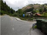
A) We drive to Preddvor or to the settlement of Tupaliče, which is located along the main road Kranj - Zgornje Jezersko, then we continue driving towards Jezersko. When we arrive in the settlement of Kokra, at the road sign between 8.5 km and 8 km, we turn right over the bridge to the hamlet Podlebelca, where the described path begins. There are no designated parking spaces at the starting point; we park in a suitable place nearby.
B) From Jezersko we drive towards Preddvor, at the road sign between 8 km and 8.5 km, we turn left over the bridge to the hamlet Podlebelca, where the described path begins. There are no designated parking spaces at the starting point; we park in a suitable place nearby.
Route description:
After the bridge, we notice red mountain direction signs that direct us to the road that ascends through the hamlet Podlebelca. Past the houses we follow the blazes; above the hamlet the asphalt ends. After a short ascent through the forest we arrive at a larger chapel, behind which we go left onto a marked cart track. The cart track splits immediately, and we choose the right one, along which the blazes also continue. A little higher we reach an asphalt road that leads towards the farms Roblek, Pestotnik and Lovrin, and we walk along it to the first right bend. After the bend the footpath continues, which quickly ascends to the place where we cross the road that leads to the farm Lovrin. We continue through the forest, and the path gradually transitions to an indistinct forested ridge, along and beside which it then ascends. Higher we also cross an asphalt road that leads towards the farm Roblek, and we ascend more steeply for a few more minutes, then join the cart track that leads from the farm Roblek.
We continue straight ahead along the initially wide cart track, which we soon leave as the blazes direct us right onto a footpath. Further on, the not too steep path then brings us to a larger rock, where there is the next marked junction this time. We continue straight (right Krvavec) along the path, which gradually begins to ascend more steeply and brings us higher below an extensive rocky scree that is visible already from the valley of the Kokra river. The path moves slightly to the left of the scree, then, when we are already a bit higher, turns right and approaches the rocky cliffs on our right completely. The path ahead brings us in a moderate ascent to a short stretch of dwarf pines, behind which we reach Lojtra. Lojtra is a slightly exposed passage along a wide and well-secured ledge. After crossing this section, only a short traverse of the slopes (cable) follows, after which the steepness of the slopes eases. Further on we continue along the path that ascends through the dwarf pines. After 15 minutes the dwarf pines end and the path brings us to the expansive pastures of Dolga njiva, where we reach a junction. We continue straight (right Krvavec) and after a few more steps the path brings us to the old shepherd's hut on the mentioned mountain pasture.

Photos:
 1
1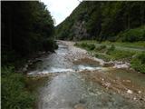 2
2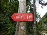 3
3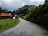 4
4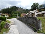 5
5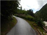 6
6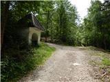 7
7 8
8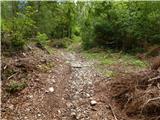 9
9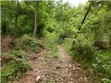 10
10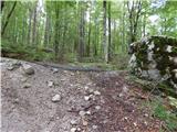 11
11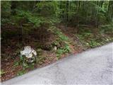 12
12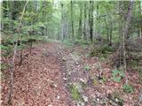 13
13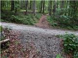 14
14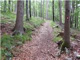 15
15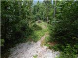 16
16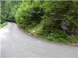 17
17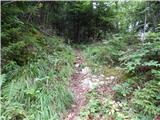 18
18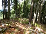 19
19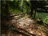 20
20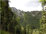 21
21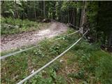 22
22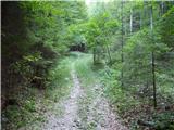 23
23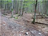 24
24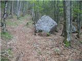 25
25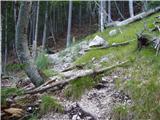 26
26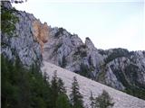 27
27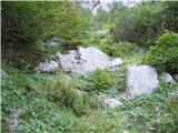 28
28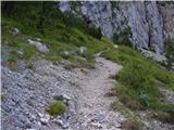 29
29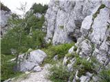 30
30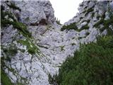 31
31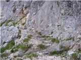 32
32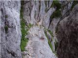 33
33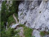 34
34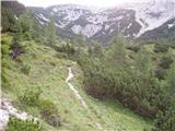 35
35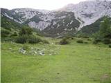 36
36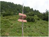 37
37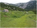 38
38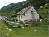 39
39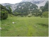 40
40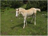 41
41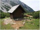 42
42
Discussion about the trip Kokra (Podlebelca) - Planina Dolga njiva (Krvavec)
|
| karlin25. 05. 2009 |
Today I set off on this path - I can say that the path is very nice, varied, in the first part through Roblekov kot it's a real knee-grabber 
At the same time, I appeal to PD Onger, which is supposed to be the maintainer of the path, that the undergrowth has overgrown a lot and is a big obstacle on the path, so it needs to be trimmed a bit
I continued the path to Škrbina, over Vrh Korena to Veliki zvoh and back to the planina on the crossing path and down to the starting point...
|
|
|
|
| velkavrh21. 08. 2009 |
I started from the church, to the high mountain farm Roblek is three-quarters of an hour. I went through their courtyard on the forest path. After twenty minutes you reach the signs, where we turn right. We walk for a whole hour through pleasant beech and mixed forest. The path becomes steep. We reach the rocky section, where three wire ropes await us. There is a lot of scree on the path. The upper part is really overgrown with scrub. All the effort is rewarded when we arrive at the pasture. For me, this is the most beautiful Krvavec pasture. It even has a spring that doesn't dry up even in the greatest drought. Currently, a herd of horses is grazing up there. Back of course the same way. For variety in the morning hike, I also viewed the beautiful waterfall of the Kokra river tributary, which is right behind the bridge on the right side, described on the panel as a viewpoint.
|
|
|
|
| anak14. 08. 2011 |
Parked at the lot in the picture and followed path start. This path not marked at all, only notice cairn. Left variant probably to marked path (dashed trail on map), but went too right and turned back. Marked trail crosses road higher, top of hill under Roblek, small parking there. Higher easy to follow. On pasture greeted by horses, soft grass and cold spring.
|
|
|
To post a comment you must log in:
If you do not yet have a username, you must first
register.