Kočna - Žerjavec (Kavče) (steep north path)
Starting point: Kočna (660 m)
| Latitude/Longitude: | 46,4179°N 14,0831°E |
| |
Route name: steep north path
Walking time: 25 min
Difficulty: easy unmarked way
Elevation gain: 145 m
Elevation difference along the route: 145 m
Map: TNP 1:50.000
Recommended equipment (summer):
Recommended equipment (winter): ice axe, crampons
Views: 1.626
 | 5 people like this post |
Access to starting point:
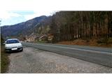
From highway Ljubljana - Jesenice we go to the exit Lipce, where we turn left in the direction of Blejska Dobrava and Spodnje Gorje. Soon after we drive past the railway underpass, we are at the next crossroad, where we turn right - Bled, Kočna. At first, a serpentine road ascends straight towards the west and soon at the left turn reaches the top or settlement Kočna. Our starting point is located on the left side of the road, a few meters before the settlement sign. Because of continuous line we drive ahead past first houses, where on the right we notice a bus stop. Here we turn around and return, almost to the turn, where we would descend back into a valley. We stop on a macadam parking lot.
Route description:
Turned towards the valley, after a few steps from the starting point, we step on the path which leads into the forest on our right. After a few meters in the forest, we turn left. At first gentle path soon slightly ascends to the edge of a slope over which we can look into a valley, and where there is also a crossing. Here we go perpendicularly right, uphill (straight path, which ends). After a few meters of a light ascent among trees we come to the open. Here we have to pay attention. When right after that part we slightly ascend to the first tree, which is situated by the left side of the path, we turn sharply right onto a steep slope of Žerjavec (we leave indicated path). Occasionally a little hard to follow path zigzags steeply towards the summit, mainly sticking to the right edge of the northern slope of the hill. Steep path then leads us past rocky area on the left, the peak of which we can enjoy the view towards Jelenkamen and part of Jesenice. From here we can already observe also Kres nad Kočno and famous Poljanska Baba. Further our path is for a short time still pretty steep, whereupon steepness starts decreasing. When the path almost flattens, we walk for a short time on the upper ridge of Žerjavec towards the south. Soon, on the south end of the peak we come upon a nice, panoramic rocky promontory with a bench, which represents the peak, where we rest and enjoy the view of settlement Kočna, Poljanska Baba, Gorje with Pokljuka, Boršt, and part of Karavanks on our right.

Photos:
 1
1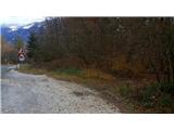 2
2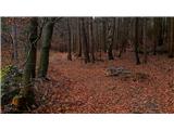 3
3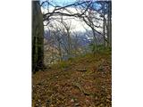 4
4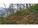 5
5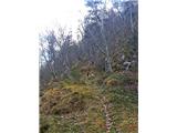 6
6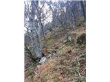 7
7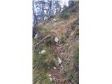 8
8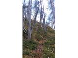 9
9 10
10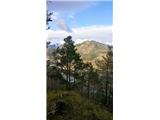 11
11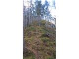 12
12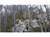 13
13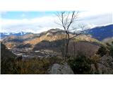 14
14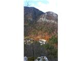 15
15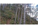 16
16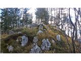 17
17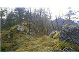 18
18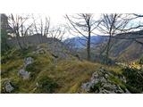 19
19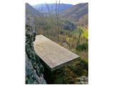 20
20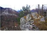 21
21
Discussion about the trip Kočna - Žerjavec (Kavče) (steep north path)
To post a comment you must log in:
If you do not yet have a username, you must first
register.