Kočna - Žerjavec (Kavče) (south path)
Starting point: Kočna (660 m)
| Latitude/Longitude: | 46,4179°N 14,0831°E |
| |
Route name: south path
Walking time: 30 min
Difficulty: easy unmarked way
Elevation gain: 145 m
Elevation difference along the route: 145 m
Map: TNP 1:50.000
Recommended equipment (summer):
Recommended equipment (winter): crampons
Views: 1.587
 | 3 people like this post |
Access to starting point:
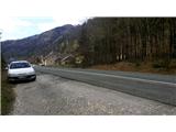
From the highway Ljubljana - Jesenice we take the exit Lipce, where we turn left in the direction of Blejska Dobrava and Spodnje Gorje. Soon after we drive past the railway underpass, we are at the next crossroads, where we turn right - Bled, Kočna. Initially, the serpentine road ascends straight towards the west and soon in the left bend reaches the top or settlement Kočna. Our starting point is located on the left side of the road, a few meters before the settlement sign. Because of the continuous line we drive ahead past the first houses, where on the right we notice a bus stop. Here we turn around and return back, almost to the bend before we would descend back into the valley. We stop on a macadam parking lot.
Route description:
From the starting point, we go back along the road towards the settlement. After 250 meters, a few meters before the bus stop we turn right onto the narrower side asphalt road on our left, which takes us past a few houses uphill. When after the left turn the road flattens and loses the asphalt surface, it brings us to a larger meadow. Here we turn perpendicularly left towards the abandoned building, past which we go on the right into the forest. The wide path in the forest slightly ascends, and soon at the junction turns almost perpendicularly right. Further along the moderately ascending path we come across a bench, a little higher (near the saddle between the hills Žerjavec and Vrše) a new junction, where we enjoy a partial view on the other side of the hill towards Žirovnica. Here we turn sharply left and step onto the wide path, which slightly ascends back in the direction from where we came. After a few tens of meters we ignore the right branch and continue straight along the path uphill. It soon brings us to the TV transmitter, past which we continue in the same direction towards the top of the hill. Soon a nice path through a small forest, across a few smaller rocks, brings us to the southern edge of the summit ridge of Žerjavec. From here only a few meters separate us to the rocky promontory with a bench, which represents the summit, where we rest and enjoy the view of the settlement Kočna, Poljanska Baba, Gorje with Pokljuka, Boršt, and part of the Karawanks on our right.

Photos:
 1
1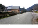 2
2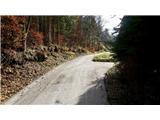 3
3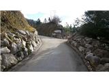 4
4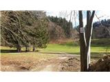 5
5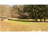 6
6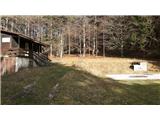 7
7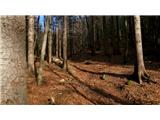 8
8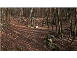 9
9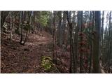 10
10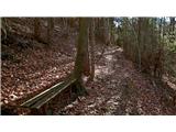 11
11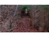 12
12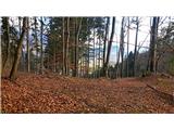 13
13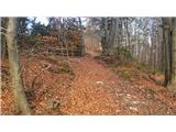 14
14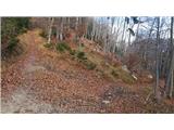 15
15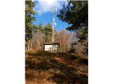 16
16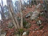 17
17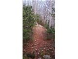 18
18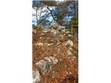 19
19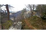 20
20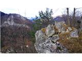 21
21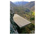 22
22
Discussion about the trip Kočna - Žerjavec (Kavče) (south path)
|
| grega_p27. 12. 2024 18:33:06 |
Another mini-hill jewel, perhaps hidden by Poljanska baba or just its modest height and short approach.
It offers a nice circular path from Kočna (southern, northern path), varied rocky terrain on top, nice views, pines and mostly sunny location. If not enough, can continue to Vrše.
Thank you for the post.
|
|
|
To post a comment you must log in:
If you do not yet have a username, you must first
register.