Kočna - Planina Obranica (via Baba)
Starting point: Kočna (660 m)
Route name: via Baba
Walking time: 1 h 15 min
Difficulty: easy marked way
Elevation gain: 375 m
Elevation difference along the route: 375 m
Map: TNP 1:50.000
Recommended equipment (summer):
Recommended equipment (winter): ice axe, crampons
Views: 10.681
 | 3 people like this post |
Access to starting point:
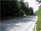
From the highway Ljubljana - Jesenice, we take the exit Lipce, where we turn left in the direction of "Blejska Dobrava and Spodnje Gorje". Soon after, when we drive into the railway underpass, we are at the next intersection, where we go right - towards Bled, Kočna. The initially serpentine road ascends straight towards the west and soon in the left bend reaches the top i.e. the settlement Kočna. Our starting point is otherwise located 100 m before the place sign, but due to the continuous line we drive past the first houses, where on the right we notice the bus stop. Here we turn around and return all the way to the bend i.e. the spot - a few m before we would descend back into the valley. Next to the road on a macadam surface we park.
Route description:
From the spot where we have parked, first we carefully cross the road and on the opposite side return 20 m towards the valley. Here we notice a green sign with the inscription "pohodniška pot 6", where in the direction it indicates we continue into the forest. Here we turn right, where soon we encounter the first blaze, which directs us left uphill onto an indistinct ridge. Here the path ascends more steeply, but after a few minutes it turns even more left towards the south and thereby flattens. For a short time the path gradually even descends, then turns right uphill and thereafter left across rocks. From here onwards it first takes us out of the forest for a short time, then back into a predominantly deciduous forest, where it ascends moderately to steeply.
After a good 20 min of walking from the starting point along the path we encounter a smaller sign with the inscription "baba 5 min", where we can turn right and view the famous "Poljansko babo".
The path towards the mountain pasture continues here straight i.e. left uphill. Soon we encounter a larger number of fallen trees that obstruct us on the path, after which it turns right and after the left turn reaches the ridge, where there is also "Dedec" - (rocky balcony), onto which we can climb. The path continues right, in the direction west, increasingly steeply uphill. Some smaller zigzags follow, after which the path starts to lead us again more and more left towards the south. When the steepness starts to ease, we are roughly at the top of the plateau. Here the winding path at times descends slightly and ascends again, and occasionally seems to disappear, but all the time more or less runs along the eastern edge of the plateau. When we approach the goal but are still in the forest, we descend slightly, and at the same time encounter a wooden fence with a gate. When we step out of the forest, we are on Planina Obranica. Left we notice the monument, SE behind it the top of the mountain pasture with a cross on the trunk of a tree (this one is not visible from here), where we head for the view. From here we descend back - westwards, slightly uphill, across the meadow towards the rear part of the mountain pasture with the shepherd's hut. We reach it in a further 5 minutes of walking.

Along the route: Poljanska baba (889m)
Photos:
 1
1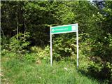 2
2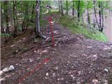 3
3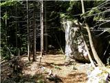 4
4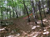 5
5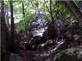 6
6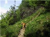 7
7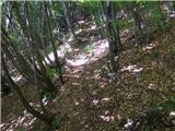 8
8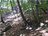 9
9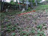 10
10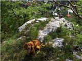 11
11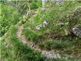 12
12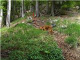 13
13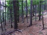 14
14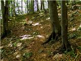 15
15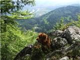 16
16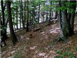 17
17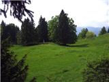 18
18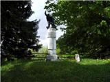 19
19 20
20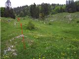 21
21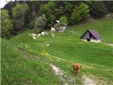 22
22 23
23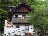 24
24 25
25 26
26 27
27 28
28
Discussion about the trip Kočna - Planina Obranica (via Baba)
|
| Jusk12. 11. 2019 |
Also a good trail for maintaining fitness, it's occasionally steep, but you can get up and back in 1 hour and a few minutes, especially if you go late afternoon when darkness is chasing you. Otherwise be careful, already on Saturday when I went up it was very slippery, trail full of wet leaves, underneath roots and tree roots.
|
|
|
|
| heinz4. 12. 2019 |
.. because of which it's not worth rushing so much, unless you're training for mountain running
|
|
|
|
| Jusk4. 12. 2019 |
Not exactly mountain running, but I'm used to walking fast best regards best regards
|
|
|
|
| Jusk10. 02. 2020 |
From Obranca down to Kočna the path is unremarkable, except wet and slippery, quite a bit of newly felled trees from the last storm, but no obstacle as it's beside the path
|
|
|
|
| anica.zu19. 07. 2020 |
Can someone tell me why I can't open the path map (above), neither for this path nor for any other? It used to be possible sometimes.
|
|
|
|
| Jusk19. 07. 2020 |
The map won't open for me either, but if you're already heading on this path, it's well marked. At the junction towards Baba there's a sign directing you there, to Obranica you continue straight on the marked path. Regards
|
|
|
|
| anica.zu27. 07. 2020 |
I didn't get lost, at the beginning there are really nice little men (cairns), then markers. But since I have older special maps, it bothers me because the newer marked trails there aren't drawn yet. That's why it would be very helpful if I could open trail maps. I don't know where to turn for advice or help.
|
|
|
|
| biba29. 07. 2020 |
It rarely opens these maps for me too. Neither on computer nor on phone. Maybe someone knows why?
|
|
|
|
| Majdag29. 07. 2020 |
Thanks Tadej, they didn't open for me either..
|
|
|
|
| anica.zu1. 08. 2020 |
Tadej, a thousand thanks. On this site now I can see all hiking trails. I'm glad you've helped not only me, but I believe many others too.
|
|
|
|
| Majdag27. 07. 2022 19:42:48 |
After a long time back on the alpine pasture. I did a circular route, it's more varied. The path is well marked with large cairns. The new path from the main road is also marked with signposts, in the bushes with cairns. Baba is still waiting for her prince, but there's a bench and info board next to it. It's getting steeper and steeper and there are no more geraniums. The hut has a new roof that matches the green surroundings. The caretakers are friendly and enjoy the pasture. Obranca is beautiful.
https://jelenkamenmajdag.blogspot.com/2022/07/planina-obranca.html
|
|
|
|
| diana.jug25. 05. 2025 08:27:55 |
After a long time on the alpine pasture, this time only descent on this path, ascent via the one from the monument up (quite steep).  The alpine pasture enchants every time, this time with intense green color of spring, trees were glowing, meadows too, lots of flowers... Special energy up there, calm, one really rests the head, soul and heart. 🩷🫶💫🌼🍀 The alpine pasture enchants every time, this time with intense green color of spring, trees were glowing, meadows too, lots of flowers... Special energy up there, calm, one really rests the head, soul and heart. 🩷🫶💫🌼🍀
|
|
|
To post a comment you must log in:
If you do not yet have a username, you must first
register.