Kočevje - Fridrihštajn Castle (climbing way)
Starting point: Kočevje (464 m)
| Latitude/Longitude: | 45,63300°N 14,85850°E |
| |
Route name: climbing way
Walking time: 1 h 30 min
Difficulty: very difficult marked way
Elevation gain: 506 m
Elevation difference along the route: 506 m
Map:
Recommended equipment (summer): helmet, self belay set
Recommended equipment (winter): helmet, self belay set
Views: 15.207
 | 1 person like this post |
Access to starting point:
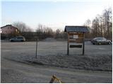
First, we drive to Kočevje, and then we look for Podgorska ulica (which branches off to the right from the main road - direction of travel towards Delnice). At the end of the mentioned street, we will notice the mountaineering signposts and next to them a nicely arranged parking lot.
Route description:
From the parking lot, we walk to a well-marked junction, and then we continue left in the direction of Grajska pot (right Kalanova pot). At first, we bypass a house, and then the path turns to the left and ascends diagonally across a grassy slope. The path then goes into the forest, where it continues in a moderate ascent on a relatively wide cart track. Higher, the cart track crosses a forest road and gradually turns into a somewhat steeper footpath. The well-marked path higher up crosses the road a few more times and then brings us to a junction, where we continue slightly left in the direction towards Livoldski vrh and castle Fridrihštajn (right Mestni vrh and mountain hut Koča pri Jelenovem studencu). The still well-marked path higher up crosses a road (left Livoldski vrh) and a little further on splits into two parts. We continue right in the direction of Fridrihštajnska stena (left the usual path) along the path that soon brings us to the start of the climbing section of the path (here a marked path branches off to the right towards Požgani hrib).
The well-secured path first crosses an exposed ledge, then turns left and ascends vertically upwards. With the help of numerous brackets and steel cables, we ascend one level higher, then the path turns to the right, where it crosses an otherwise secured but very exposed ledge. The path then turns to the left once again and brings us in a moderate ascent after a few more steps to the summit.

Photos:
 1
1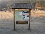 2
2 3
3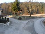 4
4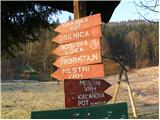 5
5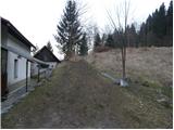 6
6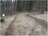 7
7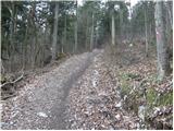 8
8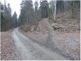 9
9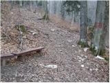 10
10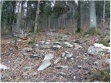 11
11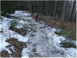 12
12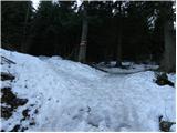 13
13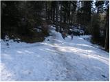 14
14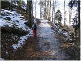 15
15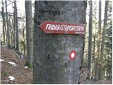 16
16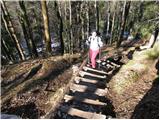 17
17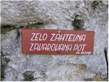 18
18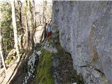 19
19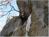 20
20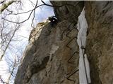 21
21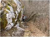 22
22 23
23
Discussion about the trip Kočevje - Fridrihštajn Castle (climbing way)
|
| Tadej3. 03. 2009 |
I recommend the ascent to Fridrihštajn via the climbing path to all those who already miss secured paths in the Alps due to the long winter.
|
|
|
|
| fpetel13. 03. 2009 |
How long is the secured section? Comparison with Pogačnikova path on Šmarna gora and Furlanova on Nanos?!
|
|
|
|
| Tadej3. 03. 2009 |
A bit shorter than Pogačnikova on Grmada.
|
|
|
|
| NejcTrpin5. 03. 2009 |
So as a local climber, I can tell you more about it. It's a wall sector located left of the climbing crag. It's a "ladder" 50m high, followed by a shorter passage to the right and exit from the wall. For the less secure, a steel cable is installed for self-belaying. After rain, it's very slippery and icy there, so great caution is needed, as we've already had some rescues. But it's a very short path.
Regards Nejc
|
|
|
|
| pamy26. 03. 2012 |
Nice regards
A couple of days ago I was at the castle and checked the climbing routes below it, I'm only interested in information about the grading of those five routes.
Many thanks
|
|
|
|
| Medvedi27. 03. 2012 |
We're fine, thanks for the concern.
|
|
|
|
| pamy28. 03. 2012 |
Bears up there, bears down there. I'm interested in the grades and names of the routes 
|
|
|
|
| Zenfinio28. 03. 2012 |
route grades go like this from far left to right.
1.route for tits 6a 10m
2.grad 5c+ 10m
3.Peetka 6b 10m
4.no name 5b 10m
5.vajenška 5a 10m
there are also two routes further right graded 5b and one route left of the via ferrata on the wall where a few pegs are bolted....
Best, Boštjan
|
|
|
|
| pamy29. 03. 2012 |
Many thanks ...
Now you can talk about bears at length ...
Lp
|
|
|
|
| nanica31. 08. 2012 |
In the last vacation days, my husband and I ventured around Kočevje. In Kočevje, the starting point of hiking trails is nicely marked, where we parked. Since it's our first time here, we carefully followed the signs and marks ;-Fridrihštajn. The trail runs through the forest all the way, crosses forest road several times and ascends moderately. I would praise the local mountaineering society for the exemplary marked trail. We walked the castle trail, which brought us right under the castle to a junction. Husband went up the climbing one, I the normal one.
We also went to Koča pri Jelenovem studencu, which is very nice with scenic surroundings - unfortunately closed. Back to Kočevje we descended via the steeper Kalanova pot. On the entire circular trail we didn't meet anyone, didn't see bears either, but lots of squirrels.
In short - really nice trip.
|
|
|
|
| Zenfinio31. 08. 2012 |
the hut is open only on weekends and holidays, of course all year round
|
|
|
To post a comment you must log in:
If you do not yet have a username, you must first
register.