Koča pri Savici - Lanževica (via Bogatinsko sedlo)
Starting point: Koča pri Savici (653 m)
| Latitude/Longitude: | 46,2896°N 13,8022°E |
| |
Route name: via Bogatinsko sedlo
Walking time: 5 h
Difficulty: easy marked way
Elevation gain: 1350 m
Elevation difference along the route: 1385 m
Map: TNP 1:50.000
Recommended equipment (summer):
Recommended equipment (winter): ice axe, crampons
Views: 24.477
 | 5 people like this post |
Access to starting point:
From the motorway Ljubljana - Jesenice, take the Lesce exit and follow the road towards Bled and on to Bohinjska Bistrica. Continue driving towards Lake Bohinj (Ribčev Laz), where you will come to a crossroads, where you continue straight along the left (south) side of the lake in the direction of Ukanc and the Savica waterfall. Follow this increasingly narrow road to the large parking lot at the Savica Hut. There is a charge for parking.
Route description:
From the parking lot, we head onto the wide footpath in the direction of Savica Waterfall and Dom na Komni (right the path over Komarča). After a short gentle ascent, the path brings us to a marked crossroads, where the tourist path to Savica Waterfall branches off to the right, and we continue slightly left or straight on the wide footpath in the direction of Komna. The path ahead continues to ascend along the Savica for a short time, then brings us to the first of the marked 48 switchbacks. After an hour and a half of moderate ascent through the forest, the path brings us to the aforementioned 48th switchback, from which a beautiful view of Lake Bohinj opens up. Here the path turns slightly to the right and enters the valley called Pekel, where it ascends gently for some time, then turns right and ascends somewhat steeper again. After just a few dozen steps, the path turns left again and continues to ascend parallel to the valley. The further gentle to moderately steep path gradually enters a sparser forest, from which we soon see Dom na Komni. The path ahead leads us past a small interesting cave, higher up it brings us to a crossroads, where the path to Black Lake branches off to the right, and we continue left and further on the wide path. Follows some transverse ascent, at the natural abyss, which is fenced for safety, the path turns right, then ascends to the next crossroads, where the path from Black Lake joins us.
A little further on, the path splits once more, and we choose the left path in the direction of Dom na Komni, or we can also take the somewhat shorter path that continues straight and bypasses Dom na Komni (right Koča pri Triglavskih jezerih).
Follows the ascent past the hut Pri Hubertu and in a few minutes we reach Dom na Komni.
From Dom na Komni we go past a small chapel and follow the signs for Koča pod Bogatinom (left Vogel, Tolminski Kuk and Planina Govnjač), but we soon merge with the aforementioned somewhat shorter path.
We continue slightly left in the direction of Koča pod Bogatinom and along the wide and quite scenic path we quickly arrive at Planina na Kraju, where past the pyramid (ossuary at Koča pod Bogatinom - mountain memorial) we reach Koča pod Bogatinom, which is located in the middle of the alpine pasture.
We bypass the hut on the right side and quickly arrive at a marked crossroads, where the path over Lepa Komna branches off to the right, which leads further to Lanževica or Oslove škrbina, but we continue straight, further on the wider gentle path in the direction of Bogatinsko sedlo. On the western part of Planina na Kraju, another path to Planina Govnjač branches off to the left, but we continue for a few minutes in a gentle ascent along the southern side of Kozji rob. The path ahead becomes completely flat for some time and passes to the edge of the Gracija valley, where we begin to ascend transversely, first along the slopes of Srednji vrh, later along the slopes of the forepeak of Vrh nad Gracijo. In the continuation, the path becomes somewhat steeper and brings us with beautiful views to the place where it splits.
We can continue further on the mule track, which makes a longer switchback or on the somewhat shorter steep path that ascends directly to Bogatinsko sedlo, where both paths merge.
From the crossroads at Bogatinsko sedlo, from where a beautiful view of Krn and the surrounding mountains opens up, we head right in the direction of Lanževica (left Bogatin and Mahavšček, straight down Lepena, Prehodci, Krn, Krnsko jezero and Koča pri Krnskem jezeru).
In the continuation, with beautiful views, we mostly moderately ascend, in the part where the path flattens, we bypass Vrh nad Gracijo on the left side. A little further, the path via Lepa Komna joins us from the right, and we have another good 20 minutes to the summit of Lanževica, mostly moderate ascent along the scenic southeast ridge of Lanževica.
Starting point - branch to Black Lake 2:15, branch to Black Lake - Memorial plaque to Matej Koblar 0:10, Memorial plaque to Matej Koblar - Dom na Komni 0:05, Dom na Komni - Koča pod Bogatinom 0:15, Koča pod Bogatinom - Bogatinsko sedlo 1:15, Bogatinsko sedlo - saddle under Vrh nad Gracijo 0:40, saddle under Vrh nad Gracijo - Lanževica 0:20.

Along the route: Jama ob poti na Komno (1303m), Odcep k Črnemu jezeru (1411m), Brezno pod lovsko kočo na Komni (1430m), Spominska plošča Mateju Koblarju (1481m), Pri Hubertu (1492m),
Dom na Komni (1520m), Piramida (1520m),
Koča pod Bogatinom (1513m), Bogatinsko sedlo (1803m), Sedlo pod Vrhom nad Gracijo (1878m)
Photos:
 1
1 2
2 3
3 4
4 5
5 6
6 7
7 8
8 9
9 10
10 11
11 12
12 13
13 14
14 15
15 16
16 17
17 18
18 19
19 20
20 21
21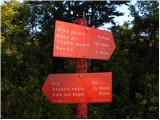 22
22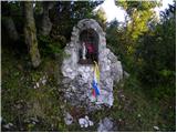 23
23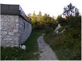 24
24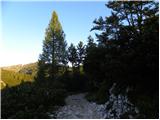 25
25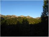 26
26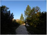 27
27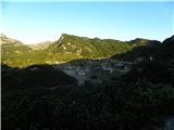 28
28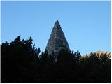 29
29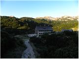 30
30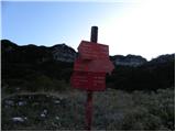 31
31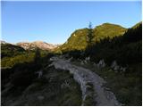 32
32 33
33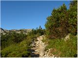 34
34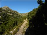 35
35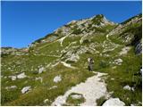 36
36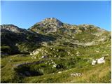 37
37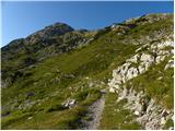 38
38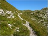 39
39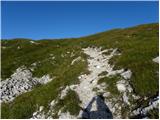 40
40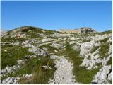 41
41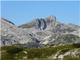 42
42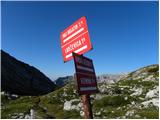 43
43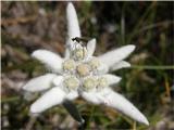 44
44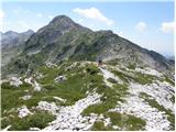 45
45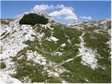 46
46 47
47 48
48 49
49 50
50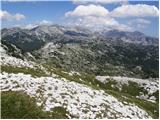 51
51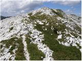 52
52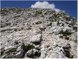 53
53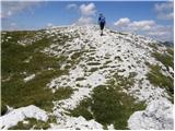 54
54 55
55
Discussion about the trip Koča pri Savici - Lanževica (via Bogatinsko sedlo)
|
| Damijan25. 07. 2007 |
I was there on Sunday. I went up via Bogatinsko sedlo and down via Lepo komno. It was blowing like crazy. The path via Bogatinsko sedlo is much nicer than the one via Lepo komno, because the path via Lepo komno is too overgrown, even though they are practically equal in difficulty.
|
|
|
|
| Gost23. 08. 2007 |
A few days ago I was at Lanževica from Bogatinsko sedlo in nice weather. Easy approach, still full of edelweiss and fantastic view. Trip suitable also for less experienced and fit!
The summit can be the goal of a one-day "trip" also from Lepena or the source of Tolminka. You just need a good half hour more than from the Bohinj side.
|
|
|
|
| maučez409. 11. 2008 |
Today Bogatin was in snow and fog, so my husband and I turned towards Lanževica at Bogatinsko sedlo instead. A bit of snow, fog and wind spiced up the path, the descent through Lepa Komna was beautified by the sunshine with a few warm rays.
An interesting hike that surely offers wonderful views in clear weather.
|
|
|
|
| anč30. 07. 2009 |
In August I plan from Komna over Bogatinsko sedlo to Lanževica towards the hut at Krnsko jezero, where I would overnight and in the morning to Krn and back. I'm interested what the path from Lanževica over Velika Baba to Krnsko jezero is like. Is it marked? Back I would go over Batognica.
|
|
|
|
| triglavski30. 07. 2009 |
From Lanževica to Velika Baba the path is not marked, but follows nicely and there are no difficulties (cca 30 minutes), from Baba down the path is nicely marked and leads near Dom pri Krnskem jezeru.
|
|
|
|
| malimiha27. 05. 2015 |
I'm wondering if you can get directly from Lanževica to the Seven Lakes? If yes, is the path marked. thanks and best, Miha
|
|
|
|
| pabo28. 05. 2015 |
Of course you can get there directly, but the path is overgrown and unmarked, and it's a "paradise" for vipers on this path, ... I walked this path last year in the opposite direction, good luck on the way
|
|
|
|
| malimiha28. 05. 2015 |
thanks for the reply. So from the top, can you see where the path goes and is it hard to follow given that it's overgrown? Did you encounter many vipers?
|
|
|
|
| pabo28. 05. 2015 |
from the top it's not visible, a bit lower on Lepa Komna there are remains of stone huts on the left side, there you can already see a faintly traceable path towards the Planina na Kalu, ... on this path three surprised me
|
|
|
|
| Zgembo30. 04. 2017 |
Does anyone know where one can get the stamp?
|
|
|
To post a comment you must log in:
If you do not yet have a username, you must first
register.