Koča pri Savici - Krn (via Prehodci)
Starting point: Koča pri Savici (653 m)
| Latitude/Longitude: | 46,2896°N 13,8022°E |
| |
Route name: via Prehodci
Walking time: 7 h 55 min
Difficulty: partly demanding marked way
Elevation gain: 1591 m
Elevation difference along the route: 2035 m
Map: TNP 1:50.000
Recommended equipment (summer): helmet
Recommended equipment (winter): helmet, ice axe, crampons
Views: 23.123
 | 1 person like this post |
Access to starting point:
From the Ljubljana–Jesenice motorway, take the Lesce exit and follow the road towards Bled and further towards Bohinjska Bistrica. Continue driving towards Lake Bohinj (Ribčev Laz), where you reach a crossroads and continue straight along the left (southern) side of the lake in the direction of Ukanc and the Savica waterfall. Follow this increasingly narrow road to the large parking lot at Koča pri Savici. The parking lot is paid.
Route description:
From the parking lot, head onto the wide footpath in the direction of the Savica waterfall and Dom na Komni (to the right, the path over Komarča). Already after a short gentle ascent, the path reaches a marked junction, where the tourist path to the Savica waterfall branches off to the right, and we continue slightly left or straight on the wide footpath towards Komna. The path ahead ascends for a short time along the Savica, then reaches the first of the marked 48 switchbacks. After an hour and a half of moderate ascent through the forest, the path reaches the mentioned 48th switchback, from which a nice view opens onto Lake Bohinj. Here the path turns slightly right and enters the valley called Pekel, where it ascends gently for a while, then turns right and ascends a bit steeper again. After a few dozen steps, the path turns left again and continues ascending parallel to the valley. The gentle to moderately steep path ahead gradually enters sparser forest, from which we soon see Dom na Komni. The path leads past a small interesting cave, higher up it reaches a junction where the path to Črno jezero branches off to the right, and we continue left on the wide path. Some transverse ascent follows; at the natural abyss (fenced for safety) the path turns right, then ascends to the next junction where the path from Črno jezero joins.
A little further the path splits again; we choose the left path towards Dom na Komni, or we can take the slightly shorter path that continues straight and bypasses Dom na Komni (right Koča pri Triglavskih jezerih).
The ascent continues past the bajta Pri Hubertu and in a few minutes we reach Dom na Komni.
From Dom na Komni we pass a small chapel and follow signs for Koča pod Bogatinom (left Vogel, Tolminski Kuk and Planina Govnjač); we soon join the previously mentioned slightly shorter path.
We continue slightly left towards Koča pod Bogatinom and quickly reach Planina na Kraju along the wide and scenic path, passing the pyramid (ossuary at Koča pod Bogatinom – mountain memorial) to reach Koča pod Bogatinom in the middle of the pasture.
We bypass the hut on the right and quickly reach the marked junction where the path over Lepa Komna branches right (leading further to Lanževica or Oslova škrbina); we continue straight on the wider gentle path towards Bogatinsko sedlo. On the western part of Planina na Kraju another path branches left to Planina Govnjač; we continue for a few minutes in easy ascent on the southern side of Kozlov rob. The path ahead flattens completely for a while and reaches the edge of the Gracija valley, where we begin transverse ascent, first on the slopes of Srednji vrh, later on the slopes of the pre-peak Vrh nad Gracijo. Further on the path becomes slightly steeper and, with nice views, reaches the point where it splits.
We can continue on the mule track that makes a longer switchback or on the slightly shorter steep path that ascends directly to Bogatinsko sedlo, where the two paths join.
From the junction at Bogatinsko sedlo, from where a nice view opens to Krn and the surrounding mountains, we head straight downhill towards Lepena, Prehodci, Krn, Krnsko jezero and Dom pri Krnskih jezerih (left Mahavšček and Bogatin, right Lanževica) on the path that gradually begins to descend.
The path leads along an old military mule track that soon reaches slopes covered with dwarf pine; a bit lower the path flattens.
We continue past some old structures that are part of the former Rapallo border.
Here in a small valley an old trail leads to Velika Montura; we continue on the marked path that barely descends to the central part of the valley Za Lepočami, where several old Italian buildings are still relatively well preserved.
Here from the marked junction we go left towards Prehodci (straight down to Krnsko jezero and Dom pri Krnskih jezerih), passing more structures built by the Italians between the wars for guarding the Rapallo border. We continue on the scenic path that at Smrečje joins the path from Planina Razor to Krn.
We follow that path right towards Prehodci and Krn, first with easy ascent, then a short descent to the junction at Prehodci.
We continue straight towards Krn (left down to Izvir Tolminke and Planina Polog); a little further the path from Dom pri Krnskih jezerih joins from the right.
We continue following signs for Krn; the path leaves the plateau terrain for steep mostly southeastern slopes with a nice view towards the Tolmin side (this section is called Na Tminskem). Later the path turns slightly right and gradually leads into a small alpine valley where it begins to ascend steeper. We continue past Črna njiva, then ascend to the large monument to those fallen in World War I, Spomenik Peski.
We continue right on the marked path (here an unmarked path branches left downhill to Rdeči rob or down to the valley/Planina Polog); it ascends transversely under Greben malih Peskov, passing remnants from World War I, then reaches the saddle between Mali Pesek (left) and the lesser-known peak Piramida (right; Piramida is a fore-peak of Vrhovi nad Peski).
Next is the traverse of the screes of Piramida and Vrh nad Peski; near the highest point of the traverse a small trail branches right to Vrh nad Peski (branch marked, continuation not); we continue on the marked path, to which the path past Jezero v Lužnici joins from the left at the end of the screes, and we reach the junction at Prag.
At Prag the path bypassing the summit of Batognica branches slightly right; right downhill we can descend to Krnsko jezero; we continue straight/west and begin ascending the eastern ridge of Batognica. We follow this increasingly scenic path (which on ridge sections moves slightly left to steep slopes) to the summit of Batognica, reached in about 20 minutes from Prag.
From Batognica we continue on the initially less visible path along the left (southern) side of the summit. The path, descending gently at first, soon enters steeper terrain where the descent becomes steeper. After a short descent we reach relatively steep steps down which we descend steeply; here there is high risk of slipping due to loose gravel. The path gradually flattens and soon reaches Krnska škrbina with a marked junction (we can also reach the saddle by taking the so-called Northern path at Prag that bypasses Batognica summit; it is slightly shorter but far less scenic).
From the saddle we continue straight towards Krn (left Planina Kuhinja, right Krnsko jezero) on the path that ascends the grassy slope of Krn. The steep path flattens a bit higher up and splits.
We take the right path towards the summit of Krn (slightly left lower path leads to Gomiščkovo zavetišče on Krn) and gradually reach the ridge. We follow this increasingly scenic ridge path all the way to the summit of Krn, which offers views in all directions.
From the summit we can continue to the shelter a few minutes away and return to Krnska škrbina.
Starting point – branch to Črno jezero 2:15, branch to Črno jezero – Memorial plaque to Matej Koblar 0:10, Memorial plaque to Matej Koblar – Dom na Komni 0:05, Dom na Komni – Koča pod Bogatinom 0:15, Koča pod Bogatinom – Bogatinsko sedlo 1:15, Bogatinsko sedlo – branch to Velika Montura 0:20, branch to Velika Montura – Za Lepočami 0:15, Za Lepočami – Smrečje 0:15, Smrečje – Prehodci 0:15, Prehodci – Spomenik Peski 1:10, Spomenik Peski – branch to Vrh nad Peski 0:25, branch to Vrh nad Peski – Prag 0:10, Prag – Batognica 0:20, Batognica – Krnska škrbina 0:15, Krnska škrbina – Krn 0:30.

Along the route: Jama ob poti na Komno (1303m), Odcep k Črnemu jezeru (1411m), Brezno pod lovsko kočo na Komni (1430m), Spominska plošča Mateju Koblarju (1481m), Pri Hubertu (1492m),
Dom na Komni (1520m), Piramida (1520m),
Koča pod Bogatinom (1513m), Bogatinsko sedlo (1803m), Odcep za Veliko Monturo (1712m), Za Lepočami (1617m), Smrečje (1642m), Prehodci (1635m), Spomenik Peski (1975m), Odcep za Vrh nad Peski (2059m), Prag (2058m), Kavernenhof (2131m), Krnska škrbina (2058m)
Photos:
 1
1 2
2 3
3 4
4 5
5 6
6 7
7 8
8 9
9 10
10 11
11 12
12 13
13 14
14 15
15 16
16 17
17 18
18 19
19 20
20 21
21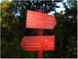 22
22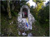 23
23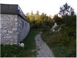 24
24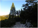 25
25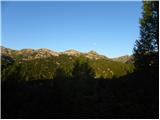 26
26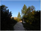 27
27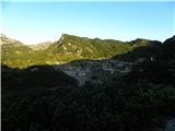 28
28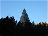 29
29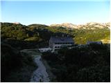 30
30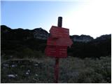 31
31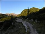 32
32 33
33 34
34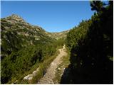 35
35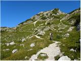 36
36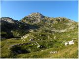 37
37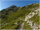 38
38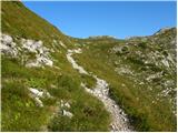 39
39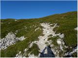 40
40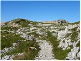 41
41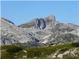 42
42 43
43 44
44 45
45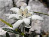 46
46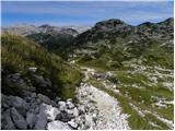 47
47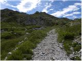 48
48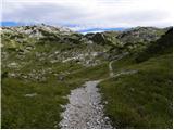 49
49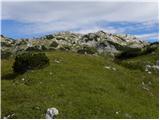 50
50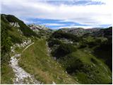 51
51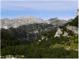 52
52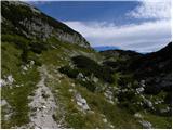 53
53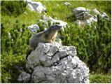 54
54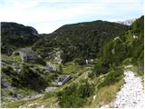 55
55 56
56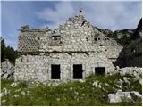 57
57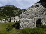 58
58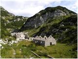 59
59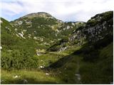 60
60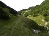 61
61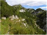 62
62 63
63 64
64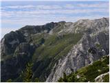 65
65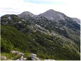 66
66 67
67 68
68 69
69 70
70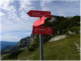 71
71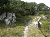 72
72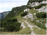 73
73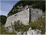 74
74 75
75 76
76 77
77 78
78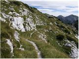 79
79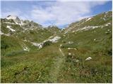 80
80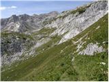 81
81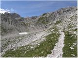 82
82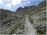 83
83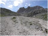 84
84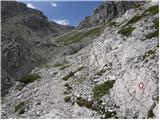 85
85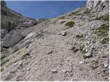 86
86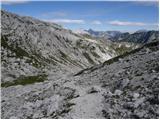 87
87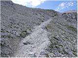 88
88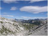 89
89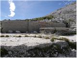 90
90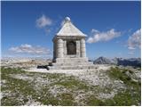 91
91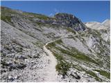 92
92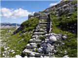 93
93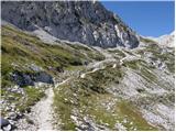 94
94 95
95 96
96 97
97 98
98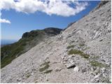 99
99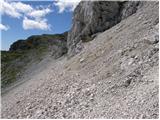 100
100 101
101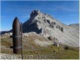 102
102 103
103 104
104 105
105 106
106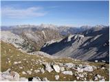 107
107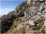 108
108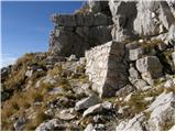 109
109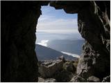 110
110 111
111 112
112 113
113 114
114 115
115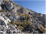 116
116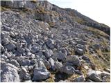 117
117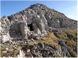 118
118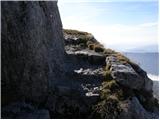 119
119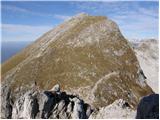 120
120 121
121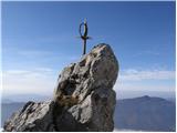 122
122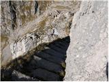 123
123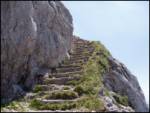 124
124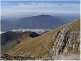 125
125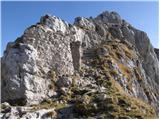 126
126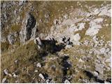 127
127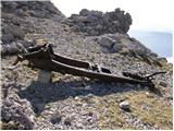 128
128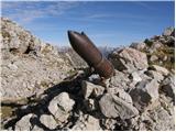 129
129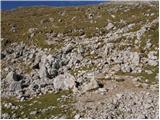 130
130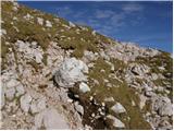 131
131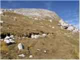 132
132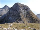 133
133 134
134 135
135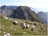 136
136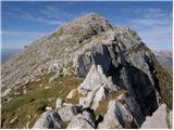 137
137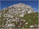 138
138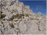 139
139 140
140
Discussion about the trip Koča pri Savici - Krn (via Prehodci)
|
| potočan8. 08. 2012 |
Last week I did this tour. Complete fantasy.
|
|
|
|
| mukl30. 08. 2014 |
With my friend Mirko, we did this route in both directions on 28th and 29th August, having already climbed from Koča pri Savici to Dom na Komni on the evening of 27th and stayed there overnight. The last part of the way to Komna caught us in a heavy downpour and soaked us to the skin. That evening we were the only guests at Dom na Komni. The friendly caretaker gave us a nice, clean room, and overall, Dom na Komni is like a real hotel in terms of comfort and food. Let me praise the staff at Dom na Komni for their friendliness and hospitality. The next morning, due to still bad weather, we slept a bit longer and set off towards Krn after it had completely poured around 8 o'clock. The path first led us along a walking trail past Planina na Kraju where Koča pod Bogatinom stands, then towards Bogatinsko sedlo where there was such fog that even birds were walking, and it was blowing like hell. In good weather, beautiful views of the Krn mountain range open from this saddle, and down there in the distance, you can even see a bit of Krnsko jezero. Dressed in windbreakers and with hats on our heads, we continued to the junction where we turned towards Prehodci and soon reached the valley (behind Lepoče) where there are still well-preserved supply barracks of the Soča front, even though 100 years have passed since World War I this year. After a relatively undemanding path surrounded by a lot of scree, a view opens to Krn and the well-visible path ahead of us, so we decided on a snack to strengthen ourselves before the ascent to Peske. The sandwich and the "late" canned drink were exceptional! The path through Peske dragged on, but we were lucky and encountered a chamois family that let us get very close, which is not usual for chamois unlike ibex. After the rocky path through scree, we headed to Prag and from there towards Batognica, from which we descended via a steep and not very pleasant path due to scree, over steep steps, to Krnska škrbina and past countless sheep immediately tackled the last part of the ascent to Krn, which we reached, slightly out of breath, in a good half hour. We were extremely lucky that the clouds cleared just then, so we enjoyed wonderful views in all directions for at least a few minutes. After the obligatory photos, we descended to Gomiščkovo zavetišče and refreshed ourselves a bit there. It's a pity that fogs kept rolling from the Tolmin side, obscuring breathtaking views of the Soča valley; at times you could even see to the sea, to Italian Grado. We continued the path towards Koča pri Krnskem jezeru, where after a long descent we arrived in the late afternoon and caught some rays that pleasantly caressed us while we "indulged" in pleasantly chilled from the bottle—I won't waste words on what luxury that is compared to the canned one. Here we then encountered a small problem that caused quite some inconvenience to many, namely, there is no GSM signal here, OK, don't scold me, not that I wanted to chat or surf the net, but it's nice to let your family know, who also expect that you've safely arrived somewhere and everything is OK with you, so all the blame to those who don't provide a repeater or whatever is the reason there's no signal there. By the way, on the advice of one of the hosts, I even went towards Lepena, where there should be signal by the cable car (good 20 min walk from the hut), but there wasn't any there either. We stayed overnight in a fairly tidy room, just lots of trash and dirt for export. We got up early in the morning, put on our backpacks, and headed back towards Komna. It was a beautiful and completely clear morning, so at Bogatinsko sedlo we decided to detour to nearby Mahavšček and we didn't regret it—such views practically all around our homeland and again you could see to the sea, and in between we encountered whole meadows of edelweiss. When we descended from Mahavšček, we cut straight towards Komna, but stopped midway at Koča pod Bogatinom and spent almost the entire Saturday afternoon there in the company of two pleasant female hikers. At Komna we ate beans with sausage and descended to Koča pri Savici, thus "nailing" the sausage. We spent two unforgettable days. I warmly recommend the mentioned route.
|
|
|
|
| 3glaw30. 08. 2014 |
read the description above - the barracks behind Lepoče were built after 1930, so they have nothing to do with supplying the Soča front...
otherwise thanks for your impressions from the route 
|
|
|
|
| mukl31. 08. 2014 |
Viš, a person learns all their life
|
|
|
|
| Enka26. 07. 2016 |
I'm considering this path, but since I have issues on narrow exposed (unprotected) sections of the path, especially if they are also scree-covered, I'm worried about the descent from Batognica to Krnska škrbina. That's why I'm interested in the Northern path mentioned in the path description that bypasses the summit of Batognica?
|
|
|
|
| Matej_K.26. 07. 2016 |
The section of the path that worries you is now very well secured, so no worries about that. The described path is very nice indeed, but I advise against it in mid-summer. There's practically no shade from Komna onwards. The altitude and terrain configuration also don't provide any refreshing breeze. I wouldn't tackle it before October myself. Regards
|
|
|
|
| Enka27. 07. 2016 |
Matej K., thanks for both pieces of information, the first one made me happy, the second a bit less, but of course useful . .
|
|
|
|
| keti127. 07. 2016 |
The Northern path that bypasses the summit of Batognica is completely easy and runs practically flat. The heat up there is also quite comparable to other areas. If you don't go in extreme heat and take enough water, it's totally fine. Regards
|
|
|
|
| Joco7928. 07. 2016 |
Hello! I'm interested in how demanding the path from Batognica via stairs to Krnska škrbina is. Where can the biggest problems arise?
|
|
|
|
| garmont28. 07. 2016 |
The steps are carved into the rock and are therefore somewhat exposed on one side. Otherwise, the path is wide and does not cause major problems.
|
|
|
|
| Joco7928. 07. 2016 |
Thanks for the information garmont.
|
|
|
|
| Enka28. 07. 2016 |
As far as I understood Mateja K., this part of the path is now also secured.
|
|
|
|
| keti128. 07. 2016 |
This descent was also secured before. When I was last there about 9 years ago, it was sufficiently secured. Maybe the protections have now been renewed. Regards
|
|
|
|
| SuzanaM28. 07. 2016 |
On hot days it's better to do the path in the opposite direction, so from Krn down there's only one ascent to Bogatinsko sedlo. I have walked the path in this direction (Krn-Savica) in extreme heat several times and with plenty of water (and a hat, sunglasses and high protection factor) you can survive. The ascent would be hellish and I advise against it. Especially the slope under the monument under Peski can be completely scorched.
The steps from Batognica are wide enough for a safe step. Sometimes the crossing under Vrh nad Peski is more difficult (depending on how trodden the scree is).
Otherwise, the path is very nice, a real hiking path where the brain can be off most of the time. For fans of endless mule tracks and remains from the 1st World War and after. For those who want to the top right away, it can drag on and on.
impressions from the path:
http://www.hribi.net/trenutnerazmere.asp?slo=1&gorovjeid=1&id=1031
http://www.hribi.net/trenutnerazmere.asp?slo=1&gorovjeid=1&id=666&stran=39
|
|
|
|
| Matej_K.28. 07. 2016 |
Both on the steps and on a couple of other nearby sections, steel cables are installed, so this path is now not problematic at all. From what I saw, I would say they installed this ironwork this month, before that I don't remember any cable there.
Given the popularity and high visitation of these areas, a bit more protection won't hurt, but otherwise we can walk those few steps without problems even without it. Sometimes a picture causes unnecessary worries... 
|
|
|
|
| Enka28. 07. 2016 |
Matej, of course, pictures are deceptive, sometimes things look worse on them, other times easier than in reality. That's why I wanted to equip myself with plan B (Northern trail).
SuzanaM, thanks for the links, I knew you wrote quite a bit about this trail, now I don't have to search.
Anyway, the plan is to start early in the morning from Koča pod Bogatinom in about a month when it might still be hot, and do the trail in both directions in one day. In the worst heat, according to this plan, we'd cool our feet in Krnsko jezero.
|
|
|
|
| SuzanaM29. 07. 2016 |
in the direction Krn-Savica there is another ascent - up stairs to Batognica, the ascent to Bogatinsko sedlo starts already at the barracks in the valley behind Lepoča.
The trail via Batognica is really nice and shouldn't be skipped. The cables are obviously a newer addition. They certainly come in handy if the path is slippery or icy.
The trail from Dom na Komni or Koča pod Bogatinom to Bogatinsko sedlo is warmed by the sun from sunrise and can be very hot already in the morning. Perhaps extend the first day to Krnsko jezero and overnight there. That way the second day will be easier too. The trail is quite long for one day (especially if you go to Krnsko jezero too).
|
|
|
|
| B231. 07. 2016 |
@keti1. Yes, this descent was secured 90 years ago, plus another 10 when the Italians fixed it after capturing Krn and Batognica. The cables were newly installed on 12.07.2016. I think the path was rightfully secured despite the concrete and even carved steps, because it can be deadly dangerous when slippery, wet, or icy. I would rather not give unnecessary comments, but thank the path markers for their voluntary and hard work that benefits everyone...
|
|
|
|
| Jigga16. 01. 2018 |
Does anyone have experience with this tour in winter time. We have it planned with friends within two weeks. How dangerous is it? We'll have all the gear of course, ice axe, crampons. How about the markers, since they are mostly under snow now. Can you still see where to go?
|
|
|
|
| UB7716. 01. 2018 |
 If you know the path without snow... If you know the path without snow...
|
|
|
|
| ljubitelj gora16. 01. 2018 |
Better not Jigga, I recommend from pl. Kuhinje.
|
|
|
|
| m965š17. 01. 2018 |
Jigga, I join the opinion of "mountain lover" there are several places where there is avalanche danger. Especially the path section in the avalanche chute above Vrh nad Peski seems unreliable to me, (a gallery was built there in the First World War for two reasons) also Batognca won't be very pleasant in the part where it descends to Škrbina. Better cautiously from planina Kuhinja, it will be just as enjoyable, good luck to all together.
|
|
|
|
| m965š17. 01. 2018 |
Jigga, I join the opinion of "mountain lover" there are several places where there is avalanche danger. Especially the path section in the avalanche chute below Vrh nad Peski seems unreliable to me, (a gallery was built there in the First World War for two reasons) also Batognca won't be very pleasant in the part where it descends to Škrbina. Better cautiously from planina Kuhinja, it will be just as enjoyable, good luck to all together.
P.S.
Superficial review, some corrections.
|
|
|
|
| darinka417. 01. 2018 |
What could be seen from the top of Krn on Friday, when the weather was clear, there is still a huge amount of snow behind. From Batognica, an avalanche has already come down with a lot of snow towards planina Kuhinja. When I was descending, I went through that avalanche there. How it will be further will be seen as we go?
|
|
|
|
| ribicm6. 09. 2018 |
Hello, I'm a big mountain lover but I have a great fear of heights. I'm interested in what the path is like to bypass Batognica on the north side. It has already been written that the path is flat and undemanding but I'm interested if there are precipices.
Thanks and best regards.
|
|
|
|
| bbugari17. 09. 2018 |
If height is a problem, it's best from Praga to turn north on the unmarked mule track towards Krnsko jezero. When you reach the marked path - left towards Krnska škrbina.
|
|
|
|
| _sandra_7. 09. 2018 |
@ribicm: there is no precipice on the S side, the path is actually almost flat and you arrive directly at Krnska škrbina. You can go past Krnsko jezero, but you lose quite some altitude in that case. Both paths are described on hribi.net and decide for yourself, or you can do a circular path. Regards
|
|
|
|
| A-Zaslap7. 09. 2018 |
Regarding the views into the depths, the northern side of Batognica is no more forgiving than the southern. The path itself is indeed beautiful, but the slope below the trail is quite steep in places. Much better to turn towards the lake at the saddle below Vrh nad Peski, then join the path back to Krnsko škrbina. A good kilometre of extra path and unnecessary descent and ascent, but you're always safe on solid ground.
|
|
|
|
| ribicm7. 09. 2018 |
Thank you very much for the answers. Regards.
|
|
|
To post a comment you must log in:
If you do not yet have a username, you must first
register.