Koča pri Savici - Krn (via Krnsko jezero)
Starting point: Koča pri Savici (653 m)
| Latitude/Longitude: | 46,2896°N 13,8022°E |
| |
Route name: via Krnsko jezero
Walking time: 7 h 50 min
Difficulty: easy marked way
Elevation gain: 1591 m
Elevation difference along the route: 2050 m
Map: TNP 1:50.000
Recommended equipment (summer):
Recommended equipment (winter): ice axe, crampons
Views: 65.456
 | 2 people like this post |
Access to starting point:
From the Ljubljana - Jesenice highway, take the Lesce exit and follow the road towards Bled and further towards Bohinjska Bistrica. Continue driving towards Lake Bohinj (Ribčev Laz), where you reach an intersection and continue straight along the left (southern) side of the lake in the direction of Ukanc and Savica waterfall. Then follow this increasingly narrow road to the large parking lot at Savica Hut. The parking lot is chargeable.
Route description:
From the parking lot, head onto the wide footpath in the direction of Savica Waterfall and Dom na Komni (right path over Komarča). After a short gentle ascent, the path leads to a marked junction, where the tourist path to Savica Waterfall branches off to the right, but we continue slightly left or straight on the wide footpath in the direction of Komna. The path continues to ascend briefly along the Savica, then leads to the first of the marked 48 switchbacks. After an hour and a half of moderate ascent through the forest, the path leads to the aforementioned 48th switchback, from which a beautiful view of Lake Bohinj opens up. Here the path turns slightly right and enters the valley called Pekel, where it ascends gently for some time, then turns right and ascends somewhat steeper again. After just a few dozen steps, the path turns left again and continues ascending parallel to the valley. The gentle to moderately steep path gradually transitions into a sparser forest, from which we soon see Dom na Komni. The path leads past a small interesting cave, higher up it leads to a junction, where the path to Black Lake branches off to the right, but we continue left and proceed further on the wide path. This is followed by some transverse ascent, at the natural abyss which is fenced for safety, the path turns right, then ascends to the next junction, where the path from Black Lake joins us.
Just a little further, the path splits again, and we choose the left path in the direction of Dom na Komni, or we can also take the slightly shorter path that continues straight and bypasses Dom na Komni (right Koča pri Triglavskih jezerih).
This is followed by an ascent past the hut Pri Hubertu and in a few minutes we reach Dom na Komni.
From Dom na Komni, go past a small chapel and follow the signs for Koča pod Bogatinom (left Vogel, Tolminski Kuk and Planina Govnjač), but we soon merge with the previously mentioned slightly shorter path.
Continue slightly left in the direction of Koča pod Bogatinom and along the wide and quite scenic path quickly reach Planina na Kraju, where past the pyramid (ossuary at Koča pod Bogatinom - mountain memorial monument) we reach Koča pod Bogatinom, located in the middle of the pasture.
Bypass the hut on the right side and quickly reach a marked junction, where the path over Lepa Komna branches off to the right, leading further to Lanževica or Oslova škrbina, but we continue straight, further on the wider gentle path in the direction of Bogatin Saddle. In the western part of Planina na Kraju, another path branches off to the left towards Planina Govnjač, but we continue for a few minutes in a light ascent along the southern side of Kozlov rob. The path ahead flattens completely for some time and transitions to the edge of Gracija valley, where we begin transverse ascending, first on the slopes of Srednji vrh, later on the slopes of the pre-peak Vrh nad Gracijo. Further on, the path becomes somewhat steeper and, with beautiful views, leads to a place where it splits.
We can continue further on the mule track, which makes a longer switchback, or on the slightly shorter steep path that ascends directly to Bogatin Saddle, where both paths merge.
From the junction at Bogatin Saddle, from where a beautiful view of Krn and the surrounding mountains opens, head straight downward in the direction of Lepena, Prehodci, Krn, Krn Lake and Dom pri Krnskih jezerih (left Mahavšček and Bogatin, right Lanževica) on the path that gradually begins to descend.
The path ahead leads along an old military mule track, which a few minutes lower leads to slopes overgrown with dwarf pines, a bit lower the path flattens.
Continue past some old structures that are part of the former Rapallo border.
Here, in a kind of small valley, a passage opens or an old trail leads to Velika Montura, but we continue on the marked path, which descends barely noticeably to the central part of the Za Lepočami valley, where some old Italian buildings stand, still quite well preserved.
Here, another marked path to Krn via Prehodci and Batognica branches off to the left, but we continue further west on the path that leads through the valley south of Velika Montura, and when we reach the small valley under Mala Montura, another path branches off to the left towards Prehodci or the Tolminka source.
The path ahead descends transitionally through the small valley overgrown with dwarf pines and sparse larches, when the small valley widens, the path to Mali Šmohor branches off to the left.
This is followed by a few minutes of easy walking and we reach the southern edge of Planina Duplje, where we keep to the left directions or signs for Krn Lake and Krn (right alpine farm on Planina Duplje, Dom pri Krnskih jezerih and Lepena).
Further on, we ascend somewhat to the saddle between Mali Šmohor on the left and Glava on the right.
From here, only a short descent to Krn Lake follows, from which a beautiful view of Krn opens.
The marked path, which continues higher into the Krn area, bypasses Krn Lake on the left, southern side, where we initially walk on the screes of Mali Šmohor. When we leave the lake shore, we initially continue easily on partially overgrown gravel flats, then the path turns slightly left and ascends steeper for a short time on a steeper slope. At the top of the steep part, the path that crosses the scree transversely joins from the left, but it is mostly abandoned due to the danger of falling stones, then the slope flattens, the path turns slightly right and leads us over torrent deposits of stones and sand to the grassy Planina na Polju, where we notice a hunting lodge on the right side.
On the pasture, an unmarked path branches off to the right towards Čez Potoče saddle, but with wonderful views of the surrounding mountains, we follow the marked path towards Krn. The path quickly transitions from the pasture into a small valley at the foot of Vrh nad Peski, along which we begin ascending. We continue past the branch to the spring, which dries up in dry days, the path higher becomes increasingly stony and in the Pri kolu area it flattens transitionally and leads to an unmarked junction, from where we continue on the right marked path leading to Krn Notch (straight a well-trodden but unmarked path to Prag or Batognica Saddle).
The path ahead begins to ascend steeper and in the part where the path turns left, the path to Krnčica branches off to the right. Further on, the path gradually transitions to steeper slopes, over which we ascend transversely to the left or all the way to Krn Notch (this part of the path may still be under snow in early summer).
From the notch, continue right in the direction of Krn (sharp left Prag, left Batognica and straight Planina Kuhinja) on the path that begins ascending on the grassy slope of Mount Krn. The steep path flattens somewhat a few minutes higher and splits.
Continue on the right path leading to the summit of Krn (slightly left, the lower path leads to Gomiščkovo zavetišče na Krnu) and gradually transitions to the ridge. Then follow this increasingly scenic path all the way to the summit of Krn, from which the view opens in all directions.
From the summit, you can continue to the shelter a few minutes away and from there back to Krn Notch.
Starting point - branch to Black Lake 2:15, branch to Black Lake - Memorial plaque to Matej Koblar 0:10, Memorial plaque to Matej Koblar - Dom na Komni 0:05, Dom na Komni - Koča pod Bogatinom 0:15, Koča pod Bogatinom - Bogatin Saddle 1:15, Bogatin Saddle - branch for Velika Montura 0:20, branch for Velika Montura - Za Lepočami 0:15, Za Lepočami - branch for Prehodci 0:20, branch for Prehodci - branch for Mali Šmohor 0:10, branch for Mali Šmohor - Planina Duplje 0:05, Planina Duplje - Krn Lake 0:10, Krn Lake - Planina na Polju 0:30, Planina na Polju - Pri kolu 0:50, Pri kolu - Krn Notch 0:40, Krn Notch - Krn 0:30.

Along the route: Jama ob poti na Komno (1303m), Odcep k Črnemu jezeru (1411m), Brezno pod lovsko kočo na Komni (1430m), Spominska plošča Mateju Koblarju (1481m), Pri Hubertu (1492m),
Dom na Komni (1520m), Piramida (1520m),
Koča pod Bogatinom (1513m), Bogatinsko sedlo (1803m), Odcep za Veliko Monturo (1712m), Za Lepočami (1617m), Doliči (1472m), Pod Šmohorjem (1420m), Planina Duplje (1371m), Preval pri Krnskem jezeru (1401m),
Lake Krnsko jezero (1391m),
Planina na Polju (1530m), Pri kolu (1842m), Gašperca (1903m), Odcep za Krnčico (2001m), Krnska škrbina (2058m), Razpotje nad Krnsko škrbino (2123m)
Photos:
 1
1 2
2 3
3 4
4 5
5 6
6 7
7 8
8 9
9 10
10 11
11 12
12 13
13 14
14 15
15 16
16 17
17 18
18 19
19 20
20 21
21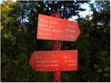 22
22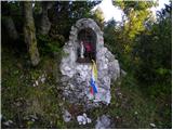 23
23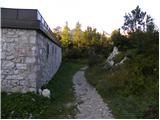 24
24 25
25 26
26 27
27 28
28 29
29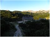 30
30 31
31 32
32 33
33 34
34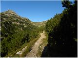 35
35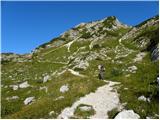 36
36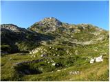 37
37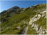 38
38 39
39 40
40 41
41 42
42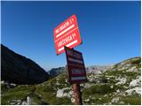 43
43 44
44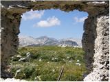 45
45 46
46 47
47 48
48 49
49 50
50 51
51 52
52 53
53 54
54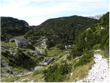 55
55 56
56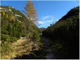 57
57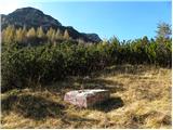 58
58 59
59 60
60 61
61 62
62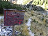 63
63 64
64 65
65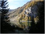 66
66 67
67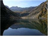 68
68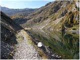 69
69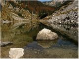 70
70 71
71 72
72 73
73 74
74 75
75 76
76 77
77 78
78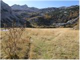 79
79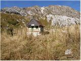 80
80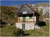 81
81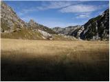 82
82 83
83 84
84 85
85 86
86 87
87 88
88 89
89 90
90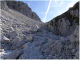 91
91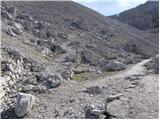 92
92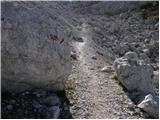 93
93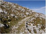 94
94 95
95 96
96 97
97 98
98 99
99 100
100 101
101 102
102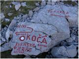 103
103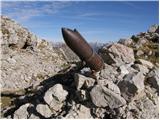 104
104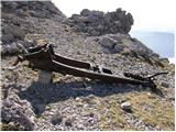 105
105 106
106 107
107 108
108 109
109 110
110 111
111 112
112 113
113 114
114 115
115 116
116
Discussion about the trip Koča pri Savici - Krn (via Krnsko jezero)
|
| Enka27. 06. 2011 |
Does anyone know how long it takes to hike this path to Krnsko jezero?
|
|
|
|
| Janez Seliškar27. 06. 2011 |
For average hiker from Ukanc to Krn summit up to 7 hours walking.
|
|
|
|
| scorpio27. 06. 2011 |
And worth via Peske if nice weather... Full of remnants of brutal war and other attractions. Otherwise valley past lakes. Loop also good idea:P
|
|
|
|
| Enka27. 06. 2011 |
How demanding is this path over the scree? And how long to walk from Krn to Savica afterwards?
|
|
|
|
| scorpio28. 06. 2011 |
No major difficult sections, just pay attention on exposed parts (around batognica), because the mule track goes along the edge and can be a bit uncomfortable in wind (I had fog . Otherwise from Krn to Savica via lakes about 6 hours? From Komna it's a bit faster downhill . Otherwise from Krn to Savica via lakes about 6 hours? From Komna it's a bit faster downhill
|
|
|
|
| Enka28. 06. 2011 |
Thanks everyone, maybe I'll muster up the courage  . .
|
|
|
|
| Žiga Šubic28. 06. 2011 |
Wow, really only about 4 hours to Krn Lake? This pleasantly surprised me, tomorrow afternoon I'll head up from Savica, thanks for the info
|
|
|
|
| Žiga Šubic1. 07. 2011 |
Well, I was at Krnsko jezero in 8 hours and back to Savica, but I ran about a third of the path. In between I rested about half an hour  In my opinion it's about 5 hours of walking, better count a bit more than less In my opinion it's about 5 hours of walking, better count a bit more than less
|
|
|
|
| Enka1. 07. 2011 |
Žiga, thanks! With kids we'll definitely need 5 hours, yes.
|
|
|
|
| JusAvgustin1. 07. 2011 |
I was there in three hours and back... :)
|
|
|
|
| Gayo8. 01. 2012 |
How passable or accessible is this trail in winter time? Especially from Komna onwards.
Thanks.
|
|
|
|
| potočan24. 07. 2012 |
I plan to ascend Krn from Savica via Komna, and I'm wondering if there is any other path besides this one via Krnsko jezero. Descent planned to village Krn, wondering if there is any public transport to the valley, to Kobarid or Most na Soči. Please, experts, reply.
|
|
|
|
| B224. 07. 2012 |
From Savica to Komna and past the hut under Bogatin, then further over Bogatinsko sedlo to konte Za Lepoča (distinct valley with remains of barracks). Here is a junction. Straight and down to Krnsko jezero, left past the ruins of barracks a marked path leads towards Planina Razor. After a couple hundred meters we encounter another (marked) junction. Here the paths split: straight to Planina Razor, right and down to the source of Tolminka, and right and slightly up towards Krn. The path is extremely scenic and panoramic. It leads us over grassy plateaus and later through scree and past the monument from World War I at Peski. Further over the scree of Peski and to the saddle between Peski and Batognica. Here we can decide - either over Batognica or along the lower (north) path under Batognica to Krnska škrbina, and to the top of Krn. Walking is certainly an hour and a half less than via Krnsko jezero. From village Krn, however, one has to walk to the main road Bovec - Nova Gorica. Bus connections are also rarer... I recommend the hiking map Julijske Alpe western part 1:50 000 or Krnsko pogorje 1:25 000 (both PZS publishing house). And lots of enjoyment on the way...
|
|
|
|
| potočan24. 07. 2012 |
Hey, thanks for the detailed description, but on the way back it doesn't show anything else than via the lake and home to Lepena and to the main road, then bus over Vršič.
|
|
|
|
| B225. 07. 2012 |
Definitely the better variant is descent past the lake to Lepena. There you might get a ride to the main road, from there bus - either towards Bovec or towards Kranjska Gora... Nice day!
|
|
|
|
| Pohodnica567. 08. 2012 |
Since my hiking partner and I next week, of course with promising weather forecast, have reserved stay in Koča pod Bogatinom hut for a couple days, we would like to side trip to Krn one day. Interested in approximate hiking time: Koča pod Bogatinom - Krn and back. Partner is a bit slower, and I'm not very fast so any reply welcome.
Safe steps to everyone in the mountains.
|
|
|
|
| sasy019126. 07. 2016 |
Hiked it this weekend. Great weather, beautiful views and friendly people. I recommend doing this as a multi-day trip, stop at a hut along the way and enjoy! It's great. For the descent I chose the planina pri kuhinji and as a reward goulash and sour milk...
|
|
|
|
| Hribolazec815. 08. 2022 12:52:38 |
Does anyone know the times for an average hiker:
Koča pri Savici - Koča pod Bogatinom
Koča pod Bogatinom - Krn
Krn - Batognica
Batognica - Koča pri Krnskih jezerih (For descent)
|
|
|
|
| mornar5. 08. 2022 13:34:14 |
I went on this path but didn't go over Batognica but the lower one and over Peske. For the path in both directions needed 13 hours with stops.
|
|
|
|
| Hribolazec816. 08. 2022 17:55:08 |
Thanks for the help, but what about parking at the parking lot near Koča pri Savici for several days?
I know parking is 10€ per day, but how do you pay for multiple days?
|
|
|
|
| _sandra_28. 06. 2023 06:56:12 |
On Saturday, a beautiful day for hiking to Krn from Koča pri Savici. At 6:00 the parking lot was almost empty, and there was no parking attendant either
|
|
|
To post a comment you must log in:
If you do not yet have a username, you must first
register.