Koča pri Savici - Črno jezero (via Komna)
Starting point: Koča pri Savici (653 m)
| Latitude/Longitude: | 46,2896°N 13,8022°E |
| |
Route name: via Komna
Walking time: 3 h 30 min
Difficulty: easy marked way
Elevation gain: 641 m
Elevation difference along the route: 850 m
Map: Triglav 1:25.000
Recommended equipment (summer):
Recommended equipment (winter): ice axe, crampons
Views: 33.520
 | 4 people like this post |
Access to starting point:
From the Ljubljana - Jesenice motorway, take the Lesce exit and follow the road towards Bled and onwards to Bohinjska Bistrica. Continue driving towards Lake Bohinj (Ribčev Laz), where you reach a junction and continue straight along the left (southern) side of the lake in the direction of Ukanc and the Savica waterfall. Follow this increasingly narrow road to the large parking lot at the Koča pri Savici. The parking lot is paid.
Route description:
From the parking lot, head onto the wide footpath in the direction of Slap Savica and Dom na Komni (right path over Komarča). After a short gentle ascent, the path soon reaches a marked junction where the tourist path to Slap Savica branches off to the right, while we continue slightly left or straight on the wide footpath towards Komna. The path then ascends for a short time along the Savica before reaching the first of the marked 48 switchbacks. After one and a half hours of moderate ascent through the forest, the path reaches the aforementioned 48th switchback, from which a beautiful view opens onto Lake Bohinj. Here the path turns slightly right and enters the valley called Pekel, where it ascends gently for a while, then turns right and ascends somewhat steeper again. After just a few dozen steps, the path turns left again and continues ascending parallel to the valley. The gentle to moderately steep path ahead gradually transitions into sparser forest, from which we soon see Dom na Komni. The path continues past a small interesting cave, and higher up reaches a junction where the path to Črno jezero branches off to the right.
Continue towards Črno jezero (the wider path to the left leads to Dom na Komni) and quickly reach the next junction, where we turn right again towards Črno jezero (left Komna and Koča pri Triglavskih jezerih).
The path continues through the forest; later a beautiful view opens onto the chain of the Bohinjsko-Tolminski mountains and Bohinj. For a while the path leads over partly grassy slopes, then returns to the forest and runs along the edge of the plateau above the Komarča wall. As we approach the summit of Orlič (1457 m), the path turns left and then descends steeply in a few switchbacks to Črno jezero.
Descent can be via the same path or a technically demanding route where a helmet is also recommended.
Starting point – junction to Črno jezero 2:15, junction to Črno jezero – Črno jezero 1:15.

Along the route: Jama ob poti na Komno (1303m), Odcep k Črnemu jezeru (1411m)
Photos:
 1
1 2
2 3
3 4
4 5
5 6
6 7
7 8
8 9
9 10
10 11
11 12
12 13
13 14
14 15
15 16
16 17
17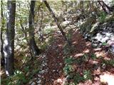 18
18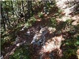 19
19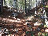 20
20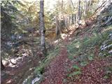 21
21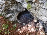 22
22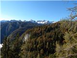 23
23 24
24 25
25 26
26 27
27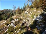 28
28 29
29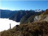 30
30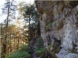 31
31 32
32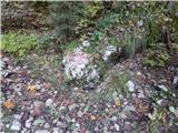 33
33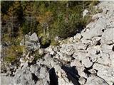 34
34 35
35 36
36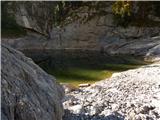 37
37
Discussion about the trip Koča pri Savici - Črno jezero (via Komna)
|
| Kokta27. 09. 2011 |
Well, it's quite long to the lake....phenomenal view along the way to Lake Bohinj.
|
|
|
|
| otiv28. 09. 2011 |
It's not really that long an ascent, you just need to have the stamina 
|
|
|
|
| slavkoo10. 09. 2016 |
I'm interested in how long it is from Dom na Komni to Črno jezero?
|
|
|
To post a comment you must log in:
If you do not yet have a username, you must first
register.