Koča pod slapom Rinka - Mrzla gora
Starting point: Koča pod slapom Rinka (1024 m)
| Latitude/Longitude: | 46,3696°N 14,5986°E |
| |
Walking time: 4 h 30 min
Difficulty: very difficult marked way
Elevation gain: 1179 m
Elevation difference along the route: 1200 m
Map: Kamniške in Savinjske Alpe 1:50.000
Recommended equipment (summer): helmet
Recommended equipment (winter): helmet, ice axe, crampons
Views: 114.317
 | 6 people like this post |
Access to starting point:
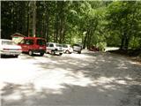
We drive to Luče (from Mozirje to here or via Kranjski rak) and continue towards Logarska dolina. Soon after the village of Solčava we come to a junction, where the road to Logarska dolina branches off to the left. We turn left towards Logarska dolina (toll payment) and drive along the road to the parking lot at Koča pod slapom Rinka, where we park.
Route description:
From the parking lot, we head onto a wide tourist path that starts gently ascending. After a good ten minutes of walking, we come out of the forest, where we reach a junction. We go left (right Orlovo gnezdo 3 minutes) in the direction of Dom na Okrešlju. The path ahead crosses a small bridge and on the other side starts to ascend more steeply. After a short ascent, the path brings us below the walls, from where a crossing to the top of the waterfall follows. This part is exposed to falling rocks. The path then crosses Savinja again and ascends further along the river with the aid of steps. Next, we ascend on the right side (left bank) of Savinja. Soon we come to the source of Savinja, where we cross the water again. On the other side, the path enters dense forest and after a short ascent brings us to the winter shelter on Okrešlju. We continue left and in a few steps reach Dom na Okrešlju.
At the hut, we head onto the path in the direction of Kamniško sedlo and Savinjsko sedlo. Soon we reach the edge of a panoramic meadow, where there is a junction. We continue straight across the meadow in the direction of Češka koča and Kranjska koča (left Kamniško sedlo). The path ahead crosses a torrent and then ascends beside scree slightly upwards. Soon we reach the next junction, where the path to Turški žleb and to the memorial branches off to the left, which is only a few dozen steps away. We continue straight through the increasingly narrow valley. The path starts to ascend more steeply and brings us below the walls of Mrzla gora. The path continues on the left side of the torrent, on a moderately steep grassy slope that is partly overgrown with dwarf pines. The path then passes to the left side below the screes of Štajerska Rinka. In a traversing ascent, the path brings us below the walls, where there is danger of falling rocks. A short steep step follows, then the path heads slightly right onto grassy slopes, where we reach a junction. We continue right in the direction of Mrzla gora (straight Savinjsko sedlo) along a path that first ascends through sparse dwarf pines and then brings us to a traverse across a rocky slab. Here we put on helmets, as the path ahead is very crumbly and exposed to falling rocks. From the traverse, the path brings us into a gully that we only cross. Now we enter the climbing section of the path. The path is well protected at the start, but the fixed protections soon run out. An unprotected ascent follows on a slope shaped like a pyramid. Since this part of the path is very steep, watch out for falling rocks. Before stepping onto the top of the pyramid, we have the feeling that this is the summit. But when we step onto the "summit," we see that it is not. A highly exposed crossing of a narrow ledge without protections follows. At the end of this ledge, the path turns left up a moderately steep wall straight upwards (without protections). Then we walk along the ridge, which is quite exposed in places. The path then turns slightly right and brings us to the summit in 30 minutes over fairly steep terrain.
The path is very demanding and poorly protected. Helmet is mandatory.
Koča pod slapom Rinka - Dom na Okrešlju 1:15, Dom na Okrešlju - Mrzla gora 3:15.

Photos:
 1
1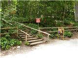 2
2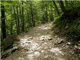 3
3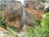 4
4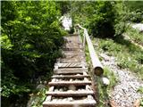 5
5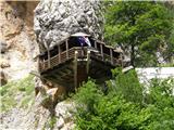 6
6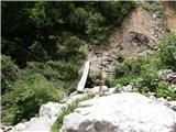 7
7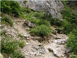 8
8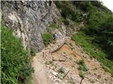 9
9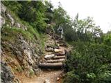 10
10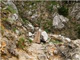 11
11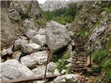 12
12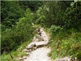 13
13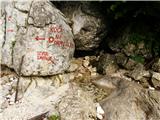 14
14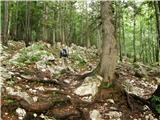 15
15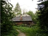 16
16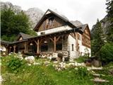 17
17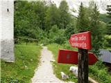 18
18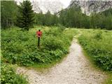 19
19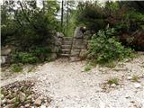 20
20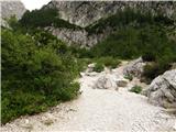 21
21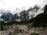 22
22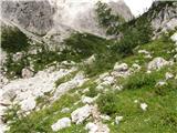 23
23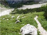 24
24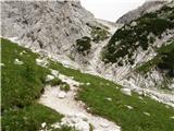 25
25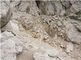 26
26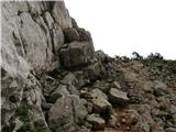 27
27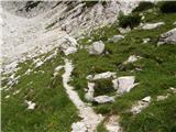 28
28 29
29 30
30 31
31 32
32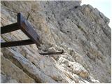 33
33 34
34 35
35 36
36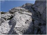 37
37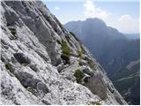 38
38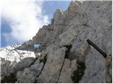 39
39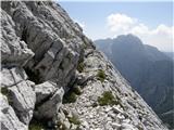 40
40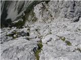 41
41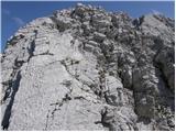 42
42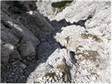 43
43 44
44 45
45
Discussion about the trip Koča pod slapom Rinka - Mrzla gora
Show older messages
|
| Gost28. 08. 2007 |
CRAZY
|
|
|
|
| Gost29. 08. 2007 |
Good description, very nice photos - I think you managed to evoke even greater exposure and difficulty in individual sections than in reality. The path is indeed less secured than we are used to on our secured paths, but the holds are mostly good. It might be worth mentioning that you have to return the same way if you are tied to transport in Logarska dolina, and that especially on descent it is sometimes quite hard to follow the already very faded markings. Markacisti PD Celje, where are you??? The path is indeed less secured than we are used to on our secured paths, but the holds are mostly good. It might be worth mentioning that you have to return the same way if you are tied to transport in Logarska dolina, and that especially on descent it is sometimes quite hard to follow the already very faded markings. Markacisti PD Celje, where are you???
|
|
|
|
| Gost21. 09. 2007 |
Markacisti PD Celje, where are you???
I completely agree, where are you?
|
|
|
|
| Gost21. 09. 2007 |
They probably got lost because the path was poorly marked.
|
|
|
|
| Gost16. 10. 2007 |
Well, it's not that badly marked after all.
It's a bit less secured, but the difficulty doesn't exceed poor II. at individual spots.
It is true that it's not suitable for an inexperienced mountaineer without an experienced guide.
I walked this path years ago and it was one of the first ascents to the high mountains at all and I admit it was a hellish experience (heat and exposure of this mountain).
Nice Hibovski greeting!
|
|
|
|
| Gost16. 10. 2007 |
Oh, I forgot to mention that the description and pictures are very nice!!
|
|
|
|
| Gost21. 10. 2007 |
I continued the path with a descent into Matkov kot. The descent was a real disaster in the upper part (crumbly) everything was sprinkled with scree (after the storm 18.9.07 - floods). The path from the cirque through the scree field to the forest was also terrible. Markings are poorly visible and great caution is needed so as not to stray. I was with my son and we both had a lot of trouble finding the right path. The pictures are very nice.
Best regards Zlatko
|
|
|
|
| zlatorog8. 06. 2008 |
The hike to MG is one of the better ones, not too long approach, not overly secured so you climb a bit and without too much crowd.
We had nice weather, so it was great!
|
|
|
|
| fpetel129. 08. 2009 |
Can we compare this path with some path to Jalovec? (via Jalovška škrbina, Kotovo sedlo), or perhaps Rinke from Mrzli dol (the last one in my opinion very well protected) Maybe comparison with the path via Plemenice?
|
|
|
|
| nisa28. 09. 2009 |
Question! Which path to MG is easier. The one from Okrešelj, or the one from Matkov kot. We're planning for Saturday. Please advise, because I have a lot of respect for Mrzla gora, not to say fear.
Thank you and best regards.
|
|
|
|
| nisa28. 09. 2009 |
Question! Which path to MG is easier. The one from Okrešelj, or the one from Matkov kot. We're planning for Saturday. Please advise, because I have a lot of respect for Mrzla gora, not to say fear.
Thank you and best regards.
|
|
|
|
| ben28. 09. 2009 |
Personally, I think the one from Matkov kot is easier, but it's certainly more crumbly than the one from Okrešelj. I myself went up from Matkov gor and down to Okrešelj and it seems to me that the rock at Okrešelj is less crumbly. But this is of course my opinion and not a statement. Anyway, good luck.
lp B
|
|
|
|
| grahelj7. 06. 2010 |
Is there still any snow on this path? Is the path safe for skiing?
|
|
|
|
| grahelj9. 06. 2010 |
Are there snowfields on the path?
|
|
|
|
| MBrando10. 06. 2010 |
Oh yeah... the first gully up to the ascent into Mrzla is still under snow. Be careful and sensible!
|
|
|
|
| grahelj10. 06. 2010 |
Thanks. And how is the rest of the trail?
|
|
|
|
| stuchlyan26. 06. 2010 |
Yesterday the snow was no problem anymore. Whatever is snowy (especially in Matkov kot) can be safely crossed even just with poles due to the smaller slope.
|
|
|
|
| brish11. 07. 2010 |
We were on Mrzla gora yesterday from Okrešelj and I think that the ascent to it, in terms of difficulty, is among the top, not only in the Kamnik-Savinja Alps, but in all Slovenian mountains. Definitely, it's a mountain that we write with a CAPITAL letter because of its beauty and demands.
Safe steps, lots of beautiful views and best regards!
|
|
|
|
| mvuk26. 07. 2010 |
Today Mrzla Gora really surprised me.
Beautiful mountain and beautiful ridge, but the path from Okrešelj is not a path by Slovenian standards!!
As a mountaineer I can say that most unmarked paths and climbing routes of II degree are easier and just as well marked. The fixed protections do not reduce the difficulty of the path and for a really safe ascent a rope is recommended.
That there is no sign at the start of the path "CLOSED, abandoned path, movable protections, climbing I-II degree, friable" is extremely irresponsible!
Perhaps it would be worth arranging a proper hiking approach to this prominent mountain?
|
|
|
|
| Joc26. 07. 2010 |
I too tried to conquer Mrzla gora, but turned back below the summit. I feared the possibility of thunderstorms forecasted for the afternoon.
Otherwise the path is really not secured and you have to climb quite seriously.
Personally I think it would be better for the path to remain as it is, so we have the option of choice. I would categorize it as "extremely demanding path".
|
|
|
|
| zabica17. 08. 2010 |
Yesterday we went up from Okrešelj, past (or rather under) Savinjsko sedlo. Weather conditions changed every five minutes, wind, dew, clouds, sun, the whole repertoire 
This is definitely a mountain for connoisseurs, with climbing experience, without vertigo and fear of heights.
On exposed sections there are enough fixed protections, where there aren't you can grab the rocks, which are quite sharp though.
Definitely a nice tour that leaves impressions and memories that will last a long time.
|
|
|
|
| micamaca17. 08. 2010 |
I was up there last Thursday. Oh, how I'll go again!!! Delicious to lick your fingers
|
|
|
|
| micamaca17. 08. 2010 |
Oh yeah, little frog, the rocks are really a bit sharp, my boyfriend scraped his palms a bit, so some half-gloves or something similar would come in handy 
|
|
|
|
| šerpa13. 09. 2010 |
I was yesterday on Mrzla gora from Okrešelj. What "mvuk" said holds true especially regarding safety when ascending. But I must praise the markers, as the path is completely newly marked, and as for the safety gear, all of them (there are) are in impeccable condition. Perhaps an additional warning sign at the entrance to the wall regarding difficulty, exposure and required equipment would not be superfluous. I noticed that quite a few carefree people are climbing up.
Otherwise, my opinion is that the path should remain as it is - that gives it charm and beauty.
Enjoyable, easy climbing for people with some knowledge and experience, for those for whom "real alpinism" is too much, but who still like to climb a bit. Too much iron would take away that charm. Regards
|
|
|
|
| Paintball9. 02. 2011 |
I fully agree with everything said by the predecessors. I also have an interesting experience with Mrzla Gora. Before that I had hiked all the difficult paths in KS Alps and thought nothing could surprise me anymore. So I took my girlfriend to MG, who wasn't a very experienced hiker, so I had a climbing harness and rope for self-belaying in my backpack for her. Everything fine except there were no fixed protections and nowhere to clip in. So I served as protection myself and when we struggled to the top with real effort she said she wouldn't go back down that path alive. And we decided to descend to Matkov kot I think I don't need to describe the descent in detail Personally, I think the path is really excellent!
|
|
|
|
| miksmajster28. 06. 2011 |
what's the snow situation like?
|
|
|
|
| gasperv19. 08. 2011 |
Hiked the path today. Early start was a good decision due to the heat.
Alone at the top, but on descent met quite a few people with the same goal.
I've had Mrzla gora planned for quite a while and tackled the tour with great caution.
By no means an easy goal. But nothing special if you have a steady step and some mileage from harder tours.
Definitely repeat from another starting point.
Best, G
|
|
|
|
| tomo_kugy23. 08. 2011 |
For my second ascent to Mrzla gora I decided very spontaneously, on Saturday evening, so I didn't even manage to call any mountain friend. At 4:45 I was already standing equipped and ready for the ascent at the parking lot in Logarska dolina. The first part of the trail to Okrešelj I shared with two insomniacs from Ljubljana (hope they successfully climbed Rinka), who kindly illuminated the path with headlamps for me, because I was too confident in the illuminating power of the moon and left my headlamp at home in the drawer. It took us 45 minutes to Okrešelj. There I took a little breath and started observing the dawn over Krofička and Ojstrica. After 10 minutes I continued alone towards Savinjsko sedlo. Behind me a beautiful day was dawning, the walls of Turska gora, Rink, Skuta were turning golden yellow, while I had already turned towards Mrzla gora. I climbed the wall in the shade, so it was all the nicer because the heat wasn't too bad yet at least then. Regarding protection, this is definitely one of the least protected mountains in our country that have marked trails leading to them. Definitely not for those with fear of heights!!! But the rock is sharp and provides good grip, so you have a feeling of secure steps. At 8:05 I was at the summit, alone with myself and the magnificent nature. The neighboring mountains were bathing in the morning sun, but on the top there was peace, peace, peace... Sadly, there is neither a logbook nor a stamp in the "collection box". But no matter, I know I was up there. After about 45 minutes of peaceful enjoyment I decided to descend, which is of course more demanding than the ascent itself, so time-wise not much shorter. During the descent I met about 12 other hikers who were a bit envious that I had already been up, because the sun was already mercilessly baking their heads. The descent to the valley was like waiting for a free path in alternating one-way traffic. But it was worth enduring that crowd a bit and at 12:00 I was back at the parking lot and a little after 1 p.m. already home. Super, super, super - for all who love adrenaline, are not bothered by vertigo, trust the rock and their equipment and skills, and have already walked many other protected trails. Definitely not for beginners or families. Best mountaineering greetings.
|
|
|
|
| urbancek23. 08. 2011 |
The stamp is on that curved "pole", at least until recently it was like that..
Nice tour, cool... Lp!
|
|
|
|
| tomo_kugy23. 08. 2011 |
@urbancek
I didn't even think to look at that pole
Anyway, I didn't go up there for the stamp, I already have that one from before
|
|
|
|
| prider27. 08. 2011 |
The stamp is on the curved pole, the logbook is from 25.8.2011 onwards at Mrzla gora. Verified!
|
|
|
|
| ljubitelj gora4. 09. 2011 |
I did this route to Mrzla gora today, it's true as you wrote, the path is absolutely less secured than others. That's why you need to hold on to the rocks more, the day was clear.
|
|
|
|
| janate15. 11. 2011 |
With my partner we decided to visit Mrzla gora on Sunday 13.11.2011. We were a bit worried about the weather, or conditions in the wall, but during the ascent it turned out conditions are good. Only individual exposed sections are secured, but that's no issue, as the wall is varied, not too crumbly and sharp, providing good grip for hands and shoes. At our pace we took under 4 hours to the top, just enough for descent. We really don't regret deciding to visit this goal, we'll surely return. Just wondering if anyone knows another way back towards the waterfall (descent via "Hudi prask")?
|
|
|
|
| matjazt29. 07. 2012 |
Visited the mountain with my wife on 14.07.2012. The path is well marked, offers exactly what the predecessors wrote. Unique, adrenaline tour! I recommend gloves and of course caution.
|
|
|
|
| Janiel742. 08. 2012 |
Success! The mountain requires full concentration at the top in the climbing section. Pure adrenaline
|
|
|
|
| soncyka14. 08. 2012 |
Excellent mountain, I was on it on 12.8., clear weather, although it started closing later. View magnificent. I recommend to all who have a bit more experience in mountains, as compared to others it's much less protected, but that's why it gave me even greater pleasure. Helmet is recommended, as others can quickly trigger rocks (e.g. at the top someone triggered rocks to the other side - I think the one coming from Matkov kot). I myself from Okrešelj to the top took 3 hours, the way back is not much shorter, as descent is perhaps even more demanding, so count on that too.
|
|
|
|
| soncyka14. 08. 2012 |
I mean pardon, I wrote a bit wrong - from Koča pod slapom Rinka to Mrzla gora I needed 3h 10min, so it might be useful to someone. But these times differ from person to person anyway. Good luck!
|
|
|
|
| krivec9. 09. 2012 |
I find this path very nice and interesting. On 8.9.2012 I needed 40 min to Okrešelj then 2.5h to the summit of Mrzla gora. It's marked, you need to pay attention and be careful not to stray from the path. On a few sections there are pegs and cables, mostly the path is unprotected. But good grip and if you're not afraid of heights, Mrzla gora is really great. Oh, back to Okrešelj I needed 1h 50 min.
|
|
|
|
| katja8722. 07. 2013 |
On Saturday, 20.7.2013, we took this path to the summit. It was a nice and sunny day, so we had beautiful views as well.
We did the route: Parking lot - Okrešelj - Mrzla gora - Savinjsko sedlo - Ledinski vrh - Okrešelj - parking lot.
The whole tour took us 9 hours.
Mrzla gora is truly worthy of respect and is only for experienced hikers. There is quite a lot of independent climbing without protections and it is mostly exposed. However, the rock itself offers excellent holds, which makes it somewhat easier
Helmet is mandatory, self-belay kit is useful only in the first half of the climbing. We had it with us, but in the second half it was just in the way.
When we came down from Mrzla gora, we had enough time to climb to Ledinski vrh as well No more snow on both paths
You can see pictures from the tour on the website of Planinsko društvo Matica Murska Sobota: http://www.mojalbum.com/pdmaticams/20130720-mrzla-gora-in-ledinski-vrh/slap-rinka/20942894
|
|
|
|
| ms_primoz25. 07. 2013 |
You don't need a climbing kit, because anyway there's nowhere to clip in
you just need a clear head and cautious steps. That's all you need for this worthy mountain.
|
|
|
|
| namor212. 08. 2013 |
On Saturday 3.8 I went to Mrzla gora from Logarska. I had a bit of fear due to supposedly poor securing and friability. Soon I realized that everything is a bit exaggerated. The aids are where needed. The rock is sufficiently structured and there are enough holds everywhere. I didn't notice any exposed ledge anywhere. The mountain is beautiful with wonderful views, so I recommend the ascent to everyone who has some experience. Lp
|
|
|
|
| jvali30. 08. 2013 |
Wow, namor2, this comment, from my experience with this mountain, I really needed it for the ascent to it. I've already postponed the trip up twice, precisely because of all the scary statements. This gave me will and energy and courage. It really holds true that you have to experience the mountain yourself. Safe steps to all. Val.
|
|
|
|
| wanyola7. 09. 2013 |
On 5.9.2013 we climbed Mrzla gora. I wrote climbed because you actually have to climb. Protections only at the start, later just some pitons. Without experience I do not recommend ascent at all, as descent is demanding too, very crumbly, if wet unimaginable...At certain spots you really ponder how to go on, very exposed. We were with experienced alpinist. On top pride that I managed, but cheered only after descent. Wonderful pristine mountain requires courage and respect.
|
|
|
|
| _sandra_8. 09. 2013 |
I was on Mrzla gora yesterday, protections really relatively few, need to watch where you step and what you hold, my opinion mountain not so crumbly as most describe..at certain parts exposed and fear of heights here definitely out..beautiful mountain worth visit, agree not for beginners..good luck
|
|
|
|
| B.Smart19. 09. 2013 |
Hello.
Has anyone been to the summit this week after the snowfall? I'm wondering if the snow has persisted. I'd like to go up on Sunday, but I'm a bit concerned about the conditions, as I don't want to walk on any exposed section with snow underfoot.
|
|
|
|
| zvone123. 09. 2013 |
B.Smart, have you been to Mrzla gora? Is there any snow? Thanks for the reply.
|
|
|
|
| dprapr23. 09. 2013 |
There is no snow on any path to Mrzla gora!
|
|
|
|
| zvone123. 09. 2013 |
Thanks for the information. Unfortunately, I'd have to go alone tomorrow, so I'll choose something easier. 
|
|
|
|
| zvone123. 09. 2013 |
Is anyone going on a tour tomorrow and could take someone along?
I'm a bit without an idea where to go. But I'd like to make use of the day.
|
|
|
|
| esque26. 09. 2013 |
I was at MG on Tuesday. There was no snow at all. I went from Okrešelj. Weather phenomenal, no clouds. The path is really brilliantly routed. The lower part is well protected, especially where there is scree. The higher you go, the fewer protections there are, in the last part there are none anyway, but the holds are good and it's really a pleasure to free climb in good rock. But one must be confident in one's psycho-physical abilities, as some sections are quite exposed and problems could likely arise otherwise. With me was a friend, for whom this was her second high mountain tour. Before that she had only been to Storžič through the gully. I really have to congratulate her that she succeeded and reached the top and back without major problems, she even descended faster and more confidently than me
|
|
|
|
| B.Smart26. 09. 2013 |
I was up there on Sunday and we had wonderful weather. First we planned a circular tour from Matkov kot and from the top to Okrešelj, but it didn't work out with the cars. Weather was wonderful on the Savinja side, on the other side of Kamniško sedlo clouds were swirling. Snow on the path was just a sample, enough to grab, but the path completely dry. Apparently those coming from Koroška Rinka down via ferrata had a bit more trouble. I really recommend the path, but I warn that some climbing experience is needed, as the mountain requires full concentration and no mistakes in certain places, especially on the descent. The views from the top are wonderful and reward all the effort
|
|
|
|
| Ninđa27. 09. 2013 |
Is anyone going up tomorrow?
LP
|
|
|
|
| vetrc27. 09. 2013 |
Come on! Is anyone up for Mrzla gora tomorrow? Regards
|
|
|
|
| dprapr6. 08. 2014 |
Mrzla gora is "Martuljek" of KSA!
|
|
|
|
| panda21. 08. 2014 |
No wonder it doesn't say on the rock: MrZLA gora (ZLA capitalized). I always go up with awe.
|
|
|
|
| oven2. 07. 2015 |
Is there still any snow on this trail?
lp
|
|
|
|
| xyzxyz19. 08. 2015 |
Is there any access to this mountain suitable for ordinary hikers at all? Which paths are comparable to those leading to it? Thanks
|
|
|
|
| Keko20. 08. 2015 |
The path is suitable for an experienced hiker for whom easy scrambling up to grade II is no problem and who is not afraid of heights. The rock is at least from the Okrešelj direction quite good and offers unique enjoyment in easy climbing. Shorter and slightly easier similar sections can be found on the path through Plemenice, on Škrlatica and elsewhere. If the hiker has the qualities I mentioned at the beginning, this path will not pose special difficulties but great pleasure.
|
|
|
|
| zipo20. 08. 2015 |
Grade II, like sections on e.g. Vernar? Can someone confirm this? To me it didn't seem quite that hard. But it's definitely the hardest path I've hiked. With the right amount of caution, it's certainly accessible even for us ordinary hikers - no overhangs as far as I remember. Ropes or pegs, which there are few of, are where needed. Where you free climb, the rock is quite crumbly or was 4 years ago, so check every hold well. But the path is beautiful, like few in KSA.
|
|
|
|
| dprapr20. 08. 2015 |
There is no grade II on this path. Grade II is on the pathless approaches to Mrzla gora.
Keko only mentioned that the path is suitable for those for whom grade II is not a problem.
|
|
|
|
| panda20. 08. 2015 |
Tough scramble on grade II sections, otherwise mostly grade I.
|
|
|
|
| Domch20. 08. 2015 |
Is the path from Okrešelj to MG comparable to Montaž and the Sunigar-Findenegg glacierette section? Which is more demanding?
|
|
|
|
| dprapr20. 08. 2015 |
As far as I remember the "path" from Montaž, there is more scree and less "trodden" than on Mrzla gora. There the "path" goes constantly upwards, on Mrzla gora both paths are more varied and nicer, especially the ridge one from Mrzli dol. In spring, however, via Škaf is the best choice.
What is more demanding? For someone not used to scree and rubble, definitely the Findenegg glacierette.
|
|
|
|
| panda20. 08. 2015 |
Domch: go up.....and try. If you can't make it, you can always turn back.
|
|
|
|
| xyzxyz20. 08. 2015 |
Thanks Keko.
Which path to Škrlatica did you mean? I have summited Škrlatica, but I don't know if there are more paths to it.
|
|
|
|
| Keko20. 08. 2015 |
There is only one hiking path to Škrlatica, you probably went along that one.
|
|
|
|
| Keko20. 08. 2015 |
I mean of course the last, more demanding part of the path.
|
|
|
|
| Keko20. 08. 2015 |
The Findenegg glacierette also seems harder to me, as it requires more concentration due to the scree.
|
|
|
|
| xyzxyz20. 08. 2015 |
I didn't find anything special on Škrlatica. Thanks
|
|
|
|
| xyzxyz20. 08. 2015 |
What about that exposed ledge!!!!
I'm also considering the ascent via Peter Skalar's path to Krn. Which of these two is easier.
|
|
|
|
| mirank20. 08. 2015 |
Well, we'll find out something new anyway
|
|
|
|
| xyzxyz20. 08. 2015 |
well there is a mistake in the name, it's Sivla Korena.... But now could you give some rating.
|
|
|
|
| zipo20. 08. 2015 |
You have more information than enough, we can't give more. We can only compare paths endlessly and hope your indecision passes. We can't decide for you. Go try, if it doesn't go, you'll turn back.
|
|
|
|
| Domch21. 08. 2015 |
Findenegg's glacierette has gotten quite a few votes, which encourages me even more. Only from Mrzla gora you have to go down the same way, from Montaža nicely via Pippan's ladder down. Based on that, MG is probably still a bigger bite.
|
|
|
|
| Keko21. 08. 2015 |
It's true that from Mrzla gora you have to go back the same way, but the descent didn't seem to me significantly harder than the descent via Pippan's ladder from Montaža. The rocks are not yet so polished as on Montaža. For those not unfamiliar with scrambling, Mrzla gora won't pose problems, even downhill.
|
|
|
|
| Pankrt21. 08. 2015 |
Yeah, how are you comparing... Mrzla Gora with Pipanova lojtra... rocks:iron....
|
|
|
|
| Keko21. 08. 2015 |
I didn't mean the ladder itself specifically, but rather the rest of the path. The ladder as a ladder is the least problematic. I feel that all who haven't been up to Mrzla gora yet have exaggerated fear before it. I too ventured onto it fearfully and then realized it was completely unnecessary. Nowhere is it particularly precipitous, no sharp ridges. It offers constant, moderate difficulty, without any special key or critical spot. You just climb and enjoy.
|
|
|
|
| panda23. 08. 2015 |
Keko: you're probably joking a bit. There are quite a few serious sections without iron in real precipitous steepness.
|
|
|
|
| Ceri28. 08. 2015 |
I've been dreaming about this Mrzla gora for the last three years. From the comments I thought it would really be a proper climbing adventure. I went up last week with great apprehension, but no need. The climbing parts are just under an hour below the summit and for an experienced hiker it's real pleasure and nothing to be scared of. Definitely fewer protections than we're used to in Slovenian mountains, but that's what makes it the real deal! Shame that this pleasure lasts only one hour. 
|
|
|
|
| Domch6. 11. 2015 |
I too had been dreaming of this peak for three years, diligently hiking and increasing the difficulty of secured mountain paths, and on Wednesday I did this ascent in beautiful late autumn weather. The path lives up to its reputation as one of the hardest here. Protection is surprisingly plentiful in the lower part, the second part is climbing. Plenty of holds and mostly not crumbly. Descent mostly backwards and sideways, in the upper part really great caution needed as rocks loosen. Helmet mandatory. I liked the path a lot, will repeat it, all who hesitate just go for it, not that bad, but requires caution and cool head.
|
|
|
|
| mukica6. 11. 2015 |
Nice mountain worth revisiting
All who have visited it know that real caution is needed, especially at the start of the season when scree isn't cleared yet and more people inadvertently dislodge...
|
|
|
|
| pohodnik3825. 06. 2016 |
On Wednesday 22.6. the trail was hiked, requiring a clear head and careful steps. True, I've been up there many times before but would go again
VIDEO Full trail shown 22.6.2016
Best regards! Tone
|
|
|
|
| Nastasja4. 06. 2017 |
Today I was on Mrzla gora, starting point Koča pod slapom Rinka. The path is almost entirely dry, one small patch is SE of Turski žleb, but it can be safely crossed without crampons. You can leave the via ferrata set at home; for those few belays, it's not worth carrying. Better to use hands. This is a great path for everyone who enjoys climbing as well as hiking. Someone used to hiking and climbing can do it in four hours (ascent and descent). And the markings are new in some places, so it's impossible to miss the path.
|
|
|
|
| Marx20. 09. 2018 |
This path to Mrzla gora is also psychologically demanding and really not for those afraid of heights (I am vertiginous...)... What you need to know but isn't in the description is that along the path you have to descend a few meters four or five times at the notches... for me personally, this almost psychologically and morally broke me to the point of quitting... At the exposed ledges, the rule is simple - don't look down...
Helmet mandatory, self-belay kit you can't attach anywhere because there are only four cables...
But Mrzla gora is an exceptional thing and I can hardly wait to go there again!
|
|
|
|
| MPS30. 09. 2018 |
For those who might find it helpful for a better idea of the path, I'm attaching a short video from the ascent on 20.9.2018.
Mrzla gora, 20.9.2018
|
|
|
|
| kolenc199622. 10. 2018 |
The path to the mountain itself is not so demanding as the descent. But of course it must be taken with all respect
|
|
|
|
| ločanka26. 10. 2019 |
Yesterday for the first time on Mrzla gora. Only one spot seemed a bit risky to cross, otherwise pure enjoyment on the entire path, of course with sufficient caution. There's also not much scree at this time.
We left the poles before entering the climbing section, you don't need them later. Pleasant scrambling, hands are practically constantly in use. The exposed sections aren't particularly problematic either, and I was surprised that the descent wasn't the harder part of the path. Quite the opposite for me, at least I wasn't out of breath.
But Mrzla gora doesn't have mass visits. Yesterday we saw a total of 6 hikers who were already descending during our ascent. All were smiling and in good spirits, as after all it's a mountain worthy of all respect, and when you're at its summit, you can feel it like a great celebration.
At least that's how it seemed to me!
|
|
|
|
| bo_zl9. 09. 2020 |
Today I climbed to Mrzla gora from Okrešelj. Few visitors, I think only 8 hikers total. The path isn't that bad as it seems. It deserves some respect but not exaggeration. Really seriously exposed is only the ledge before the last steep part before the summit. I managed it easily backwards. On descent it makes no problems. But it's true that the mountain is quite crumbly, there's still a lot of loose stones and scree so 100% focus is needed, especially on descent, so we don't slip or dislodge stones. Personally, the descent was harder for me than the ascent due to concentration. Surely it will come up again sometime.
|
|
|
|
| LISAC5. 08. 2021 12:28:19 |
Hi. Does anyone have any info on the condition of the path to Mrzla gora from Slap Rinka or from Matkov kot? Thanks
|
|
|
|
| garmont5. 08. 2021 16:28:39 |
I was up there last month from Okrešelj.
The path is without any special features… everything OK.
|
|
|
|
| smatjaz5. 08. 2021 16:40:17 |
I was there 14 days ago from Okrešelj, the only snow patch that needs to be crossed is at the end of Mrzli dol before the ascent to the saddle before the junction to Mrzla gora, which is quite hard in the morning and caution is needed but it's doable, in the afternoon it's so sun-exposed and there are already steps on it. Further on everything is bare rock, just scree, so helmet mandatory and watch if anyone is above you.
|
|
|
|
| LISAC5. 08. 2021 19:36:11 |
Thanks to both for the info
|
|
|
|
| Smilodon21. 07. 2022 08:40:21 |
Hello, I was on Mrzla gora on 20.7.2022.
The trail is demanding, so I suggest to those who haven't been there yet to leave it for the end. So, go to Mrzla gora after you've already conquered the other mountains starting from Logarska dolina (Ojstrica (via Kopinškova), Planjava, Brana, Turska gora (through the gully), Rinka (from the north) and Skuta.)
Perhaps a comment on time, the published 4:30 is too much. The sign at Koča pod slapom Rinka says 3:30, which is much more realistic.
Regarding safety gear: Right at the entrance there are some short cables, then just occasional pitons here and there. To me, it didn't seem that additional protection was needed, as most of the trail isn't so steep that you'd plummet into the valley if you slip.
Except right below the summit there's a 2m step where 3m cables would come in handy. There the step is precipitous on both sides.
Happy trails!
|
|
|
|
| panda21. 07. 2022 13:25:14 |
@smilodon: regarding the safety gear you're probably joking.
|
|
|
|
| dprapr21. 07. 2022 13:34:58 |
Probably joking when suggesting additional belay below the summit.
Leave at least Mrzla gora as it is. It is sufficiently secured for those who have some mileage behind them. There are plenty of other mountains around before that.
|
|
|
|
| dvojnit1. 08. 2022 21:08:22 |
Just back from Mrzla gora. Given all I've heard about it, I'll try to summarize some thoughts holistically to help those who want to go there for the first time. Those who have been there have already formed their own opinion anyway.
For starters, I've done most of R/SPP behind me. Based on that, I can say that this is definitely not one of the hardest marked paths in our mountains, as some think. Comments like mrZLA gora are paranoid. Certainly, our hardest mountains are much more equipped, where SVK saves you. Mrzla gora is special and probably difficult for many precisely because the final part practically has no pegs and you can't do without easy climbing. But still - this is not an alpinistic ascent. My colleague who went along rated the climbing difficulty in the most demanding sections at 2. I myself have no climbing experience from dedicated crags, so I don't know about that. But, in many places in the high mountains, you have to climb a bit even without the help of pegs and cables, so someone with appropriate mileage can tackle it without excessive fear. You have to climb a lot, but there is nowhere vertically sheer without protection; yes, it's steep, but looking down never made me dizzy. Where it's really precipitous (more at the beginning of the climbing part), there are cables or pegs. Actually, at the beginning of the climbing part there are quite a few cables (new, fresh - sincere thanks to those who installed them!), later almost none anymore. There you are on your own, with your knowledge and experience.
You have to approach every mountain with respect and well prepared. Of exceptional importance here are good boots with excellent soles that grip the wall and don't slip. Without proper footwear, it's life-threatening! There is often loose scree on the paths, so you have to step carefully. You have to check holds in the rock to make sure they are not loose. In principle, there are enough of them and you don't have to stretch excessively. For the first ascent, go with a similarly experienced friend (not necessarily someone who has been there before; both of us were first-timers), because more eyes see more and you can suggest better routes to each other. Definitely go in dry weather.
One more thing. Which path is easier. Personally, I don't know, because I only went this one. But two guys from Matkov kot came towards us and both confirmed that the path from Matka is harder than this one from Logarska dolina.
I hope I've helped someone who is properly prepared and experienced to dispel unjustified fear, but all those who haven't been to Jezerska kočna and Rinka yet really have no business here.
And the timetable: on the hiking part we had a pretty good pace: 35 min from the parking lot to Okrešelj and 45 min from Okrešelj to the junction for Mrzla gora in Mrzli dol. We did the climbing part appropriately calmly and carefully: 1:00 from Mrzli dol to the summit. Pure walking at a good pace is therefore 2:20. With some breaks and photo-taking or slower pace, 3:30 is a realistic timetable.
|
|
|
|
| zokipoki1. 08. 2022 21:42:56 |
Whatever it turns out like, I'll write it.
Given that you wrote there's nowhere precipitous, I'd say you weren't on Mrzla gora or you never looked left and right once!
|
|
|
|
| redbull2. 08. 2022 03:59:05 |
I agree with Zoki, but I'm of the opinion, or rather I'd put it at the top, if not the very top of the hardest marked paths in KSA!
|
|
|
|
| dprapr2. 08. 2022 06:13:21 |
But there's still no 2 anywhere.
|
|
|
|
| zokipoki2. 08. 2022 08:09:37 |
Yes, there's really no 2 Drago, and if I think about it Dejan, it really is the hardest marked summit in KSA.
My opinion about this mountain is that nowadays it's a bit underestimated, which is not good. Relatively easily accessible summit if you're at least a bit athletic and not afraid of heights, but still, don't take the ascent lightly, as a slip can cost you your life! It's beautiful and different for everyone. When I went up for the first time, there were three of us, all first-timers. Two with some high-mountain experience, the third with none, but tough and used to moving in steep terrain, with a forester's stride. Once I took a colleague who wanted to and had already stood on some very demanding summits, but we turned back at the notch, she didn't want to continue. It's all relative! As is the time! Moderate walking and slow climbing for a good 3h, as written above. I've done it in 2:20 before, but I was really pushing and breathing like an elephant! Different for everyone, but with a lot of caution towards the terrain!
|
|
|
|
| jax2. 08. 2022 08:25:19 |
In my opinion, some spots definitely deserve a 2. Technically, it's no easier than, for example, normal approaches to summits in the western Julians, like Divja koza, Krniška špica or Visoka polica. And there nobody claims that the key spots don't deserve a 2.
|
|
|
|
| dprapr2. 08. 2022 09:18:09 |
All three mentioned ZJ summits have harder spots.
|
|
|
|
| dvojnit4. 08. 2022 15:29:55 |
Thanks for the comments. Some terms are perceived differently by everyone (e.g. exposure). I have corrected and supplemented the comment.
A fresh comparison. Yesterday I was at Jalovec from Špič. Unintentionally, the comparison with Mrzla gora came to mind the whole way. No trail is fully comparable to another, but based on my experience so far, the trail to Jalovec from Špič seems most comparable to Mrzla gora from Okrešelj. And regarding Jalovec from Špič, I haven't seen any major hysteria about difficulty. So everything is relative. My message is that an experienced hiker has no reason to panic about Mrzla gora from Okrešelj (can't comment on from Matk). But I'll repeat for all those whose main desire might be fancy Instagram photos - if you haven't been to Jalovec, Jezerski kočni and Rinkah yet, this mountain is not for you.
|
|
|
|
| Hribovc9117. 10. 2022 08:47:19 |
Yesterday I hiked/climbed this path. The climbing section requires 100% concentration and experience throughout. The climbing is not overly demanding but can be quite mentally taxing for some due to constant exposure. For hikers with sufficient experience, it's otherwise a really nice experience. I suggest visiting the other KSA peaks via climbing paths before Mrzla gora.
|
|
|
|
| Tomaž0024. 06. 2023 21:16:08 |
I'm wondering if there's still any snow on this trail or if it's normally passable, thanks for the kind replies
|
|
|
|
| bongo25. 06. 2023 08:31:25 |
The approach isn't described, but I think it's still okay
čebejla
24. 06. 2023 22:04:46
Today 24.6. visited Mrzla gora. Trail almost entirely snow-free, crosses one short snow patch about 2m where you need to be a bit careful. Rest without issues.
|
|
|
|
| mirank25. 06. 2023 13:58:07 |
I notice increasing lack of overview in this forum. Quite a few of you don't bother to look back two pages or at least two lines in the right section, which is Current Conditions. Moreover, there are some guys who can't help but post the same trip with the same description under conditions and commented trips and elsewhere Let the moderator correct me if I'm wrong, but I think this section is meant for comments on the description and difficulty as stated by the author of this approach.
|
|
|
|
| dprapr25. 06. 2023 14:50:04 |
Not only that. I have the feeling that some go on trips just to get as many posts as possible. And even here, as you notice, one trip description is split over two days interval and description under four pages (current conditions, commented trips, animals, flowers). As if they couldn't cover all that in the description under current conditions.
Other pages in my opinion are more for comments, regardless of a specific trip.
I'm also thinking how to divide mushroom picking, when there's only one topic.
|
|
|
|
| turbo25. 06. 2023 16:36:58 |
Drago, simple. One section for boletus, second for chanterelles, third for other edible mushrooms and fourth for inedible. Here you write, and for current conditions add some photo. After every mushroom picking you'll write that it's a joy
|
|
|
|
| ločanka27. 06. 2023 07:36:39 |
Drago, I agree with some of what you say, but not with some. This section should really be only for commenting on trip descriptions or changes that happen over time.
Flowers and animals (birds) are their own separate topic and I often look there precisely for identification of names, where they belong. I won't look for names of flowers and birds under current conditions, that would take too long.
|
|
|
|
| Chasethesun7. 07. 2024 20:15:08 |
Hi, a question from my side
Mrzla gora compared to Jalovec via Kotovo sedlo?
|
|
|
|
| garmont7. 07. 2024 20:22:58 |
I think it will be quite similar…
|
|
|
|
| DVas8. 07. 2024 07:34:32 |
Mrzla was more annoying for me.
|
|
|
|
| CarpeDiem24723. 08. 2024 12:51:10 |
According to many, the most demanding (marked) mountain in KSA. Mrzla gora is a WILD mountain, not for everyone by any means, many complain it has too few safety features and their legs were shaking, especially on descent. Only for experienced hikers with lots of mountain mileage.
|
|
|
|
| Tbs21. 09. 2025 19:07:35 |
Hi How are you? Is anyone going to Mrzla gora? 😃 Please help me understand. It says the tour is 4:30. How much of that would you say is the climbing part? We're preparing for Mrzla gora, Skrlatica done, Jalovec via Kotovo too, and Mrzla will soon be next Thanks
|
|
|
|
| garmont21. 09. 2025 19:46:01 |
Realistically, the walking time is about at least an hour shorter. The climbing part is about an hour, which passes quickly because the path is very varied. SVK has no place here, as the safety gear is sparingly provided.
|
|
|
|
| Tbs21. 09. 2025 20:43:09 |
Thanks, garmont. I know about the safety gear, I didn't ask anything about that. There's no place to use it on Kotovo either...
|
|
|
|
| lepmackon117. 10. 2025 19:19:41 |
It's true that snow has already fallen this year.. But for next year I'm interested if this path is harder than the one from Matkov kot. Is it comparable to Bambergova, which seemed ridiculously easy to me and for which users of this forum scared me for nothing...?
|
|
|
|
| garmont7. 10. 2025 19:57:35 |
If the path through Plemenice was ridiculously easy for you, then you'll take a stroll to Mrzla gora. From both sides…
|
|
|
|
| DVas8. 10. 2025 07:56:28 |
I think that of the marked paths to Mrzla gora, the most annoying one is precisely from Matkov kot. I wouldn't go that side again.
|
|
|
|
| dprapr8. 10. 2025 13:18:17 |
This trail from Matkov kot is the most beautiful early in spring, when there are still many snow patches. Excellent uphill, even better downhill.
|
|
|
|
| DVas8. 10. 2025 15:22:39 |
I'd say yes. In summer it's just a divine mess.
|
|
|
To post a comment you must log in:
If you do not yet have a username, you must first
register.