Koča pod slapom Rinka - Planjava
Starting point: Koča pod slapom Rinka (1024 m)
| Latitude/Longitude: | 46,3696°N 14,5986°E |
| |
Walking time: 4 h 45 min
Difficulty: difficult marked way
Elevation gain: 1368 m
Elevation difference along the route: 1362 m
Map: Kamniške in Savinjske Alpe 1:50.000
Recommended equipment (summer): helmet
Recommended equipment (winter): helmet, ice axe, crampons
Views: 46.667
 | 3 people like this post |
Access to starting point:
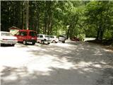
We drive to Luče (to here from Mozirje or over Kranjski rak) and onwards towards Logarska dolina. Soon after the village of Solčava we come to a crossroads, where the road to Logarska dolina branches off to the left. We turn left towards Logarska dolina (toll payment) and drive along the road to the parking lot at Koča pod slapom Rinka, where we park.
Route description:
From the parking lot, we head onto a wide tourist path that starts gently ascending. After a good ten minutes of walking, we come out of the forest, where we reach a junction. We go left (right Orlovo gnezdo 3 minutes) in the direction of Dom na Okrešlju. The path ahead crosses a small bridge and on the other side starts ascending more steeply. After a short ascent, the path brings us below the walls, from where a crossing to the top of the waterfall follows. This part is exposed to falling rocks. The path then crosses Savinja again and further ascends along the river upwards with the help of steps. Next we ascend on the right side (left bank) of Savinja. Soon we come to the source of Savinja, where we cross the water again. On the other side, the path goes into dense forest and after a short ascent brings us to the winter shelter on Okrešlju. We continue left and in a few steps we come to Dom na Okrešlju.
At the hut we head onto the path in the direction of Kamniško sedlo and Savinjsko sedlo. Soon we come to the edge of a panoramic meadow, where there is a junction. We continue left in the direction of Kamniško sedlo on the path that first moderately ascends through the forest and then across a belt of bushes. The path then levels out completely and in a short crossing brings us to the scree, on which via a well-made path we ascend to the entry into a less demanding wall. Further with the help of numerous fixed protections we ascend one level higher, where the steepness eases somewhat, but the path is still quite steep and exposed to falling rocks. Higher the path brings us to a steep and in snow slippery-dangerous scree, which we merely cross. A short ascent follows on a wide and somewhat exposed ledge, after which the path brings us to the extensive grassy slopes of Kamniško sedlo. Just a few steps further we come to a junction, where we continue left (right Turska gora and Brana) and on a gentle path surrounded by meadows in a few minutes descend to Kamniška koča.
At the hut we head east in the direction of Planjava, to which we still have two hours of walking. The path ahead first in the upper part crosses scree and then becomes technically demanding. The path then ascends a wide ledge and brings us into the wall of Planjava. Fixed protections assist us through ledges and gullies in which there is still snow in early summer, bringing us to the summit less steep slopes of Planjava. The path ahead runs through high-alpine grasses and brings us to a junction, where we head left (right Korošica). We follow the path, which in places becomes quite steep, towards the summit of Planjava. Just a few minutes below the summit, the path from Logarska dolina and Korošica joins us from the right. The path, which from here is no longer demanding, quickly brings us to the panoramic summit.
Koča pod slapom Rinka - Dom na Okrešlju 1:15, Dom na Okrešlju - Kamniško sedlo 1:30, Kamniško sedlo - Planjava 2:00.

Photos:
 1
1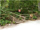 2
2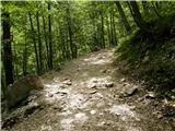 3
3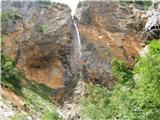 4
4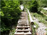 5
5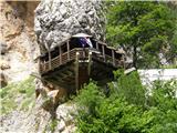 6
6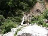 7
7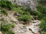 8
8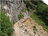 9
9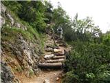 10
10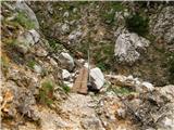 11
11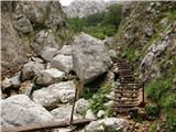 12
12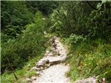 13
13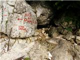 14
14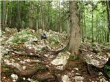 15
15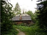 16
16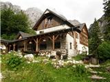 17
17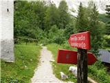 18
18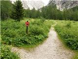 19
19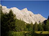 20
20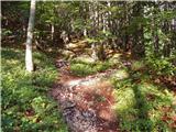 21
21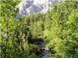 22
22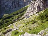 23
23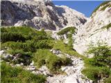 24
24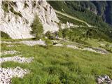 25
25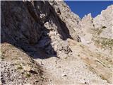 26
26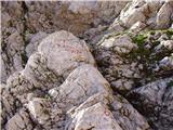 27
27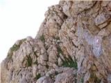 28
28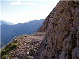 29
29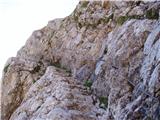 30
30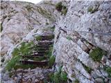 31
31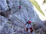 32
32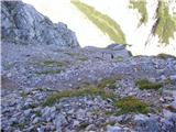 33
33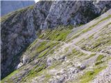 34
34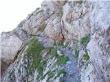 35
35 36
36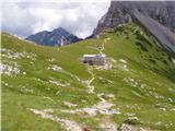 37
37 38
38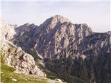 39
39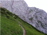 40
40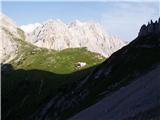 41
41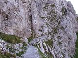 42
42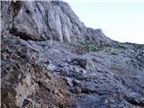 43
43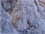 44
44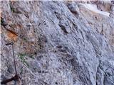 45
45 46
46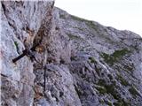 47
47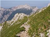 48
48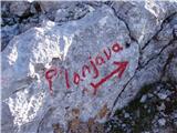 49
49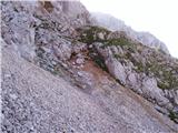 50
50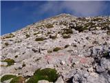 51
51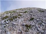 52
52 53
53
Discussion about the trip Koča pod slapom Rinka - Planjava
|
| Domch2. 08. 2012 |
Nice hike with not too many demanding climbing sections. I descended via Bab and Škarij to Klemenčeva jama and back to Logarska dolina. Between Planjava and Škarje, the markers are poorly visible and I strayed off path several times. The same applies to the descent from Škarij towards Klemenčeva jama. Markers need to be renewed and some more added - PD Celje matica, take action.
|
|
|
|
| jprim2. 08. 2012 |
Yes, markers... but the path is well-trodden, a bit higher or lower, I mean the path from Škarij onwards.
|
|
|
|
| franjo663. 09. 2014 |
What are the conditions like towards Planjava!
|
|
|
|
| SunBurned3. 09. 2014 |
On Sunday everything was fine.
Now it's probably a bit white.
|
|
|
|
| redbull3. 09. 2014 |
by the weekend everything will be dry
|
|
|
|
| katja8723. 10. 2014 |
How interesting that just a few days ago we enjoyed the sunshine for more than an hour on the top of Planjava, and now everything is already white 
More photos and tour description are published on the website of Planinsko društvo Matica Murska Sobota: http://www.pdmaticams-drustvo.si/
|
|
|
|
| M4A3G2. 07. 2016 |
Is there still any snow on this path to Planjava?
|
|
|
|
| franjo6625. 05. 2017 |
What kind of fresh information?
|
|
|
|
| franjo6625. 05. 2017 |
What kind of fresh information?
|
|
|
|
| volinjak31. 07. 2017 |
Yesterday during the ascent to the summit around eleven o'clock, three irresponsible people were descending the gully before the fixed cable and endangering hikers by dislodging very large stones onto the normal route.
For example; the stones were larger than a protective helmet. If any of the descent participants
reads this, they should think about what could happen if such a rock hits a hiker. I'm only sorry that I didn't wait for them and report them to the police. From the logbook, I saw who it might have been and I will check it too.
|
|
|
|
| Zzzmaaja16. 10. 2017 |
Has any mountaineer recently done this tour and can provide up-to-date info on the trail condition? Snow?
|
|
|
|
| MajaDenis8. 06. 2018 |
This weekend I plan to go this way... any fresh info?
|
|
|
To post a comment you must log in:
If you do not yet have a username, you must first
register.