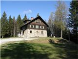
Koča na Šumiku - Koča na Klopnem vrhu
Starting point: Koča na Šumiku (1100 m)
| Latitude/Longitude: | 46,449°N 15,4196°E |
| |
Walking time: 1 h 45 min
Difficulty: easy marked way
Elevation gain: 160 m
Elevation difference along the route: 235 m
Map: Pohorje 1:50.000
Recommended equipment (summer):
Recommended equipment (winter):
Views: 10.590
 | 1 person like this post |
Access to starting point:
A) From the highway Ljubljana - Maribor, we take the exit Slovenske Konjice, and then we follow the road to the mentioned settlement. In Slovenske Konjice, we turn right towards Oplotnica, to which a few kilometers of winding road separate us. In Oplotnica, where we join the road from Slovenska Bistrica, we continue left in the direction of Osankarica. Further on, for some time we ascend along the Oplotnica stream, and then we arrive at a crossroad where the road splits into two parts. Here we can continue left in the direction of Osankarica, or right in the direction of the village Kebelj. If we continue on the left road, which soon turns into macadam and higher up brings us to a somewhat larger crossroad, there we continue right in the direction of Osankarica (left Rogla). From the crossroad, a few hairpin turns follow and the macadam road brings us to the parking lot below the Dom na Osankarici mountain hut, where there is a crossroad. We continue slightly left on the road, which initially continues towards the north. Further on, the road gradually starts to descend, and we, at the crossroad after a few kilometers, continue left. Further on, we drive past the starting point of the path to the Šumik waterfall, where the road turns quite to the right. At the crossroad after the mentioned turn, we continue left, and then only a little further we park in an appropriate place near the Koča na Šumiku mountain hut.
B) From the highway Maribor - Ljubljana, we take the exit Slovenska Bistrica - Jug, and then we continue driving towards Oplotnica. In Oplotnica, where we notice signs for Osankarica, we continue straight, then for some time we ascend along the Oplotnica stream, and after a shorter ascent we arrive at the place where the road splits into two parts. Here we can continue left in the direction of Osankarica, or right in the direction of the village Kebelj. If we continue on the left road, which soon turns into macadam and higher up brings us to a somewhat larger crossroad, there we continue right in the direction of Osankarica (left Rogla). From the crossroad, a few hairpin turns follow and the macadam road brings us to the parking lot below the Dom na Osankarici mountain hut, where there is a crossroad. We continue slightly left on the road, which initially continues towards the north. Further on, the road gradually starts to descend, and we, at the crossroad after a few kilometers, continue left. Further on, we drive past the starting point of the path to the Šumik waterfall, where the road turns quite to the right. At the crossroad after the mentioned turn, we continue left, and then only a little further we park in an appropriate place near the Koča na Šumiku mountain hut.
C) We drive to Ruše (to here from Maribor or Selnica ob Dravi), and then we continue driving towards Smolnik and higher to Šumik. At the crossroad, where the road to Koča na Šumiku branches off to the right, we continue right, and then after some 10 meters of further driving, we park in an appropriate place near the Koča na Šumiku mountain hut.
Route description:
From the starting point, we head onto the footpath in the direction of Osankarica and Koča na Klopnem vrhu. Already after a few steps of ascent, we reach the macadam road, which we follow to the left, but we walk along it only to the nearby crossroad, where we turn onto the upper right road (straight on the lower road Osankarica). We walk on the mentioned road for a short time, then the mountaineering signs direct us left onto a marked footpath, which continues somewhat to the left of the road. Higher up, we temporarily return to the road, then leave it again for a short time. When we next return to the road, we follow it to its end.
From the end of the road, we continue right following the signs for Klopni vrh, and continue along the cart track, which gradually begins to descend moderately. When the path levels out, a marked path from the Dom na Osankarici mountain hut also joins us from the left.
We continue the path for some time on and alongside the cart track, then we arrive at the NOB monument, behind which we soon step onto a wider macadam road.
When we step onto the road, we continue straight, then at the nearby crossroad along the lower right road. From the crossroad, only a few minutes of easy walking follow and the path brings us to the Koča na Klopnem vrhu mountain hut.

The trip can be extended to the following destinations: Klopni vrh
Photos:
 1
1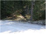 2
2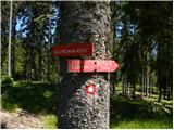 3
3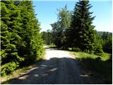 4
4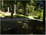 5
5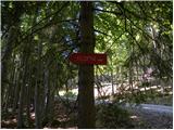 6
6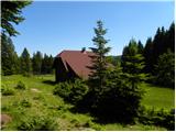 7
7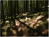 8
8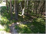 9
9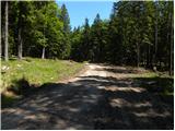 10
10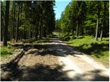 11
11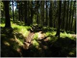 12
12 13
13 14
14 15
15 16
16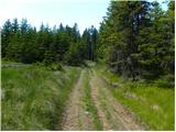 17
17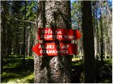 18
18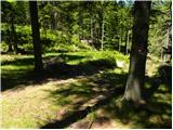 19
19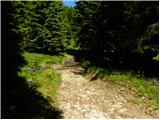 20
20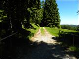 21
21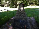 22
22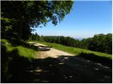 23
23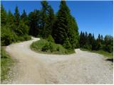 24
24 25
25 26
26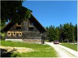 27
27
Discussion about the trip Koča na Šumiku - Koča na Klopnem vrhu
|
| balon19. 08. 2013 |
Is it possible to drive by car to picture 10 and how much walking is it to the hut from there?
|
|
|
|
| artur19. 08. 2013 |
If you don't mind your car, you can drive up to picture 15. From there it's about half an hour to the Koča na Klopnem vrhu.
|
|
|
|
| balon19. 09. 2013 |
thanks for the answer
|
|
|
|
| balon17. 03. 2014 |
We decided to go from start to finish on foot. When we return I'll post pictures.
Balončki
|
|
|
|
| smatjaz18. 03. 2014 |
It seems to me there's still too much snow up there for car access. 14 days ago from Osankarice to Koča na Šumniku on the road at least half a meter of snow ???
|
|
|
|
| balon4. 05. 2015 |
How is the trail to the summit today?
|
|
|
|
| Ajda_Zitnik2. 02. 2020 |
I walked the path yesterday, 1.2.2020.
Both huts are currently closed. For Koča na Šumniku it's supposed to be over winter, for Koča na Klopnem vrhu I haven't heard when it will reopen.
The path is fairly well marked, except in the last section where the markers disappear.
Currently parts along the road are partially icy and dangerous for slipping.
The rest is fine.
|
|
|
|
| karibu2. 02. 2020 |
Koča na Klopnem vrhu is closed indefinitely (dispute with PZS).
But it has happened to me that in very bad weather they let me stay under the roof
Best regards and happy trails!
|
|
|
|
| Enka2. 02. 2020 |
We called the Koča pod Klopnim vrhom, where they assured us that we could warm up and eat something there today. And it was so. Exceptionally nicely arranged hut, where they kindly served us coffee, drinks and bean stew and treated us to a whole plate of fried voles! Really, all praise and thanks! But it's now a private hut. Path easy, OK marked, on the road sometimes black ice, here and there snow on the path too. The SPP stamp is now - as I understand - the Klopni vrh stamp (which is at the top in the box).
|
|
|
|
| bbugari12. 02. 2020 |
Enka, everything checks out. The hut is unofficial and open, also for emergency overnight stay. And all praise to the caretakers!
|
|
|
To post a comment you must log in:
If you do not yet have a username, you must first
register.