Koča na Pesku - Rogla (footpath)
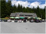
Starting point: Koča na Pesku (1386 m)
| Latitude/Longitude: | 46,467°N 15,3441°E |
| |
Route name: footpath
Walking time: 30 min
Difficulty: easy marked way
Elevation gain: 131 m
Elevation difference along the route: 131 m
Map: Pohorje 1:50.000
Recommended equipment (summer):
Recommended equipment (winter):
Views: 29.841
 | 3 people like this post |
Access to starting point:
A) From the highway Ljubljana - Maribor, we take the exit Slovenske Konjice and continue driving towards the mentioned settlement. From Slovenske Konjice, we continue towards Zreče, and further we follow the road in the direction of Rogla. When we arrive at Rogla, we continue on the main road, which for some time continues without major changes in altitude, then turns to the left and gradually starts to descend. We follow the mentioned road to the mountain hut Koča na Pesku, where we park on the parking lot near the mountain hut.
B) First, we drive to Lovrenc na Pohorju (to here from the road Maribor - Dravograd), then we continue driving towards Rogla and Koča na Pesku. Continuing, the macadam road first brings us to Mašinžaga and then to the mountain hut Koča na Pesku. We park on the parking lot at the mountain hut Koča na Pesku.
Route description:
From the mountain hut Koča na Pesku, some 10 meters further we continue on the asphalt road towards Rogla, then we continue right onto a cart track in the direction of Rogla. We continue the path for some time on a gentle cart track, then immediately after crossing a smaller stream we continue left onto a somewhat steeper footpath, which then ascends through the forest. Higher, the footpath gradually flattens and brings us into a gradually thinner forest. From the spot where the forest thins out, only a short walk separates us from the lookout tower on Rogla.
If there is no danger of storms, we can, on our own responsibility, also climb the mentioned tower, from which a nice view opens up over a larger part of Pohorje, and with good visibility also on the Karavanke, Kamnik Savinja Alps and Triglav.
The trip can be extended to the following destinations: Koča na Pesku
Photos:
 1
1 2
2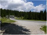 3
3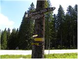 4
4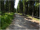 5
5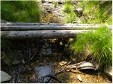 6
6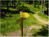 7
7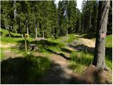 8
8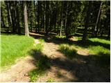 9
9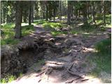 10
10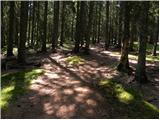 11
11 12
12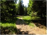 13
13 14
14 15
15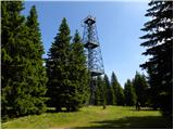 16
16 17
17 18
18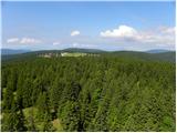 19
19 20
20
Discussion about the trip Koča na Pesku - Rogla (footpath)
|
| yesi@hootmail.com10. 04. 2008 |
I'm wondering why no one describes the path from Vitanje to Rogla, it's supposedly very beautiful and also easy
|
|
|
|
| Tadej10. 04. 2008 |
In Slovenia we have many mountains and even more hiking trails, which we happily walk and describe. When we have walked the mentioned trail, or if someone sends us a description, we will gladly publish it. LP
|
|
|
|
| hostar10. 04. 2008 |
At the end of last summer I spent time on Rogla. The path from Rogla to Koča na Pesku is quite short, so we extended it to Lovrenških jezer and back of course. If people realized how many beauties our Slovenia hides, they wouldn't go on vacation anywhere else.
|
|
|
|
| yesi@hootmail.com11. 04. 2008 |
I have also walked the path from Rogla to Lovrenških jezer and I quite agree with you.
|
|
|
|
| sova5517. 11. 2010 |
The marked path from Mislinja over Volovica to Rogla is also nice and easy. It's a shame that various motorcycles are destroying our Pohorje trails and making deep ruts, thus greatly hindering the path for hikers.
|
|
|
|
| kamelube30. 08. 2013 |
The 'circular' trail Rogla - Lovrenška jezera - Koča na Pesku - Rogla is very nice. The sweetest is when the blueberries are ripe.
|
|
|
|
| bruny30. 08. 2013 |
Very nice is also the circular trail Rogla - Lovrenška jezera - Ribniška koča - Kope - Koča na Pesniku - Koča na Pesku - and the mentioned description for  ,,dessert,, back to Rogla. Beautiful 45/50 kilometers, some elevation gain too and excellent view... I'd say into the western central Pohorje - possible. ,,dessert,, back to Rogla. Beautiful 45/50 kilometers, some elevation gain too and excellent view... I'd say into the western central Pohorje - possible.
|
|
|
To post a comment you must log in:
If you do not yet have a username, you must first
register.