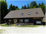
Koča na Klopnem vrhu - Tiho jezero (Falski ribnik)
Starting point: Koča na Klopnem vrhu (1260 m)
| Latitude/Longitude: | 46,5019°N 15,3991°E |
| |
Walking time: 40 min
Difficulty: easy marked way
Elevation gain: 6 m
Elevation difference along the route: 148 m
Map: Pohorje 1:50.000
Recommended equipment (summer):
Recommended equipment (winter):
Views: 10.370
 | 1 person like this post |
Access to starting point:
The road Maribor - Dravograd, in the settlement Vurmat over the bridge we cross the Drava river (signpost for Lovrenc na Pohorju), after a little less than 2 km we turn left and after 4 km on a good asphalt road we get to Činžata. In the center of the settlement, we turn right upwards, the asphalt soon ends and after 6 km of macadam, partly quite steep road we get to the Koča na Klopnem vrhu - altogether 12 km.
Route description:
From the mountain hut, we go past the information board on the road in the direction towards the south. At the first crossroad, we just continue straight, at the next crossing we turn right and we get to NOB monument (*10 min). We go straight through a clearing and left uphill through the forest, steepness quickly decreases and we come to a crossing, the left path leads to Šumik, and our path continues straight (*10 min). The path starts descending and there we get to a clearing, by the edge of which runs a forest road. The sign on a tree for Tiho jezero points us to the right on the road, after good 50 meters we go left into the forest and after a good minute we get to the embankment of the Tiho jezero (*20 min).
Photos:
 1
1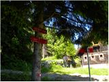 2
2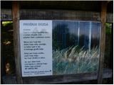 3
3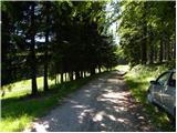 4
4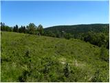 5
5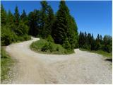 6
6 7
7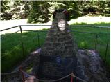 8
8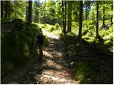 9
9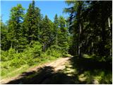 10
10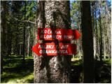 11
11 12
12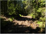 13
13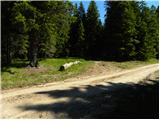 14
14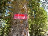 15
15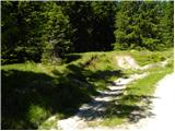 16
16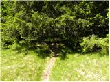 17
17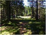 18
18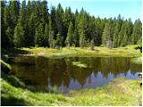 19
19
Discussion about the trip Koča na Klopnem vrhu - Tiho jezero (Falski ribnik)
|
| andr33j3. 05. 2009 |
If you plan to continue the path from the lake towards Treh Žebljev. YOU WILL NOT FIND ANY MARKINGS
|
|
|
|
| igor2233. 05. 2009 |
Not true.
Return to the forest road and the mountain path and you can continue to Treh Žebljev and to the hut on Osankarica.
This is also part of the Slovenian mountain traverse.
|
|
|
To post a comment you must log in:
If you do not yet have a username, you must first
register.