Koča na Gozdu - Kumlehova glava
Starting point: Koča na Gozdu (1226 m)
| Latitude/Longitude: | 46,4399°N 13,7624°E |
| |
Walking time: 2 h
Difficulty: difficult unmarked way
Elevation gain: 562 m
Elevation difference along the route: 575 m
Map: Kranjska Gora 1:30.000
Recommended equipment (summer):
Recommended equipment (winter): ice axe, crampons
Views: 24.603
 | 1 person like this post |
Access to starting point:
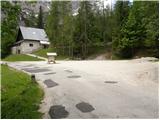
From Kranjska Gora, we drive towards the Vršič pass, but only to the Koča na Gozdu hut, near which we park on a large parking lot.
Route description:
From the Koča na Gozdu hut on the Vršič road we descend a few hundred meters to a marked junction, where we notice mountain signposts for the Erjavčeva koča na Vršiču hut. We head to the mentioned path, which we follow only a few dozen steps. After a few steps of ascent we come to an unmarked junction, where we continue right on an unmarked path, which first starts gently, then ascends steeper towards the north. Relatively easy-to-follow path, along which we notice some PP marks (Planica - Pokljuka path), brings us after approximately 1 hour of walking to a saddle between Kumlehova glava on the left and Visoki Mavrinc on the right.
We continue left (right Visoki Mavrinc 10 minutes) on the path which continues on the southeastern ridge of Kumlehova glava. The path, which ahead for some time still runs through the forest, soon withdraws from the ridge a little to the right, where it crosses a short and slightly exposed ledge. The path then returns to the ridge, where it starts ascending steeper and steeper on a more panoramic slope.
Higher the ridge narrows and the path brings us to an exposed passage, where we cross the upper part of a precipitous gully (in wet great risk of slipping). After the gully the path steeply ascends a slope which is overgrown with dwarf pines. After approximately 15 minutes of steep ascent through dwarf pines, the path brings us to the main ridge, where it turns to the right. Only a few dozen steps of ascent follow on the panoramic and partly precipitous ridge of Kumlehova glava.

Photos:
 1
1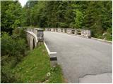 2
2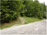 3
3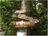 4
4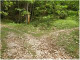 5
5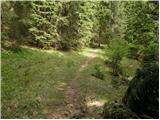 6
6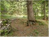 7
7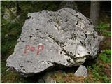 8
8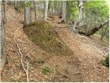 9
9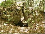 10
10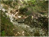 11
11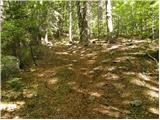 12
12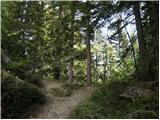 13
13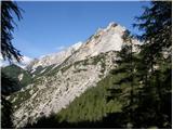 14
14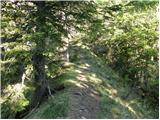 15
15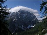 16
16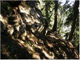 17
17 18
18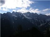 19
19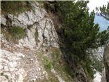 20
20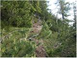 21
21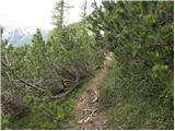 22
22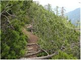 23
23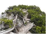 24
24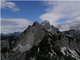 25
25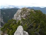 26
26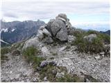 27
27
Discussion about the trip Koča na Gozdu - Kumlehova glava
|
| tango27. 10. 2019 |
Beautiful day, among the dwarf pines towards the summit it's quite hot already, even though it was only nine o'clock. Alone at the top and I could peacefully "drink in" the views in all directions. On the way back also visited Visoki Mavrinc, which was quite crowded. I admit, this was a nice conclusion to the hot autumn.
|
|
|
|
| strelec19548. 12. 2019 |
8 December to Mavrinc path is bare, further on snow starts soon and snow depth increases rapidly. Luckily the snow doesn't sink in so I can advance quickly towards the summit.
Nice sunny day with quite strong wind on top.
|
|
|
|
| J.P.26. 07. 2020 |
Very well-trodden path, easily followable. A must-stop point should also be V.Mavrinc. Both peaks have such beautiful views! Safe steps, lp
|
|
|
|
| ljubitelj gora2. 04. 2023 12:07:18 |
No need to park the car at the hut and walk back on the road, but park just above the last bend on the right, where there's also a marked larger parking lot. The path is not marked, go directly right into the forest, looks like a forest path. Immediately to the left appear some dots (straight path) on the trees, pass by the hunting hut and continue above to reach the unmarked path that goes to Mavrinc, Kumlehova glava.
|
|
|
|
| grega_p15. 11. 2024 19:47:40 |
This forest path that goes from the lower road bend, according to my experience today, soon disappears when it reaches a small stream/gully. But maybe I just missed it because of the leaves and undergrowth on the ground. In any case, pathless in the same direction further (left side of the gully) through the forest and some bushes you reach the path to Kumlehova glava or V. Mavrinc after 15 min.
|
|
|
To post a comment you must log in:
If you do not yet have a username, you must first
register.