Kobilje - Voglerjeva koča
Starting point: Kobilje (185 m)
| Latitude/Longitude: | 46,6813°N 16,39034°E |
| |
Walking time: 1 h 10 min
Difficulty: easy marked way
Elevation gain: 72 m
Elevation difference along the route: 95 m
Map: Pomurje 1:40.000
Recommended equipment (summer):
Recommended equipment (winter):
Views: 102
 | 1 person like this post |
Access to starting point:
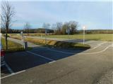
We leave the Pomurska motorway at the Gančani exit, then follow the signs for Renkovci and further to Dobrovnik. In Dobrovnik, when we reach the main road Murska Sobota - Lendava, we continue right, and from the nearby roundabout, we head in the direction of the signs for Kobilje. We then drive towards Hungary, later leaving the main road towards Hungary and continuing left towards Kobilje. Before the settlement of Kobilje, we arrive at the Kobilje cemetery, where we park; we can also park at some other parking lot in Kobilje.
Route description:
From the starting point, we continue along the cycling path towards Dobrovnik, but after a few minutes, we turn right, first carefully crossing the road to a side road, next to which there are signs for Voglerjeva koča (on some signs also written as Voglarjeva koča). We continue along the gravel road, which initially leads through extensive meadows, as indicated by the information boards along the path. Later, the path turns left and gradually enters the forest, where it begins to gently ascend, and we follow the yellow-white markers. Initially, the path leads along the Čibiš stream, which is interesting due to its meanders in the gentle section through the forest, and we also pass the Zgornje Kobilje Forest Reserve. The gravel road, which has a few smaller intersections, ascends moderately higher up, and we follow it to a ridge in the direction of Voglerjeva koča.
At the ridge, we reach a road intersection, and we continue right towards Voglerjeva koča (left Dobrovnik, straight down Bukovniško jezero) and proceed along the road through the forest. Later follows a short descent, and upon reaching the next marked intersection, we go left towards Voglerjeva koča (right Motvarjevci).
A few more minutes of easy walking through the forest follow, and we arrive at Voglerjeva koča, where there is a resting area under a shelter.
The description and photos refer to the condition in February 2026.

Along the route: Gozdni rezervat Zgornje Kobilje (210m)
Photos:
 1
1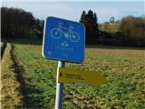 2
2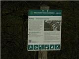 3
3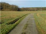 4
4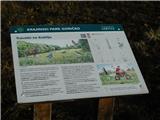 5
5 6
6 7
7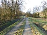 8
8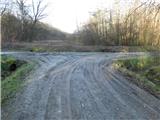 9
9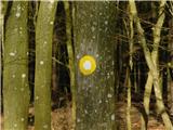 10
10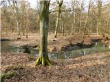 11
11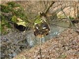 12
12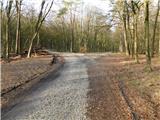 13
13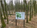 14
14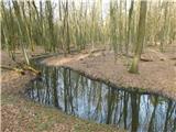 15
15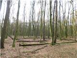 16
16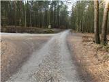 17
17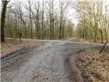 18
18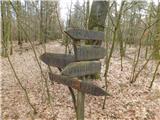 19
19 20
20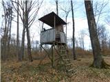 21
21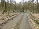 22
22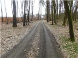 23
23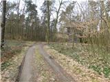 24
24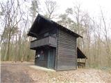 25
25
Discussion about the trip Kobilje - Voglerjeva koča
To post a comment you must log in:
If you do not yet have a username, you must first
register.