Starting point: Kobarid (234 m)
| Latitude/Longitude: | 46,2482°N 13,5774°E |
| |
Walking time: 2 h 15 min
Difficulty: easy marked way
Elevation gain: 991 m
Elevation difference along the route: 991 m
Map: Julijske Alpe - zahodni del 1:50.000
Recommended equipment (summer):
Recommended equipment (winter): ice axe, crampons
Views: 11.362
 | 3 people like this post |
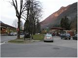
Access to starting point:
From Bovec or Tolmin we drive to Kobarid, where in the center we go towards the border crossing Robič. We follow this road only a few dozen meters to the parking lot, which we notice on the right side of the road at the spot where there used to be a gas station. During weekdays the parking lot is often occupied.
Route description:
From the parking lot, we go back (towards the east) to a crossroad in the center of Kobarid. At the crossroad, we go left and after a few meters we will notice on the left side the signpost »Stol 4h«. At the signpost, we continue right upward on a narrow road past houses. The road soon ends and we continue on a footpath into the forest. After a short ascent through the forest we come to a crossroad, where we go left towards Stol, and right leads the path towards Veliki Rob. Because the path runs through the forest there isn't much view, only occasionally we can see Kobarid and Krn through the branches. The path then leads us past some ruins to a crossroad where we join the cart track. We go left on the cart track, on which we ascend past some old houses. The cart track soon ends, and we continue on a footpath, which brings us to a crossroad. Left runs the path to the vantage point on Hom (1015m), which is a 5-minute walk.
We continue right on a marked path, which in approximately 10 minutes brings us to the ridge, where the steepness eases and a nice view also opens up on Kobarid and surrounding peaks. The path ahead runs along the ridge partly over grassy slopes, partly through sparse forest. We soon come to a crossroad, where from the left joins the path from Staro selo and from the right the path from Trnovo ob Soči.
We continue on grassy slopes past a shepherd hut and hunting cottage Starijski vrh. A little before the hunting cottage our path joins a narrow mountain road, which we follow to the nicely arranged bivouac Hlek.

Along the route: Lovska koča Starijski vrh (1215m)
Photos:
 1
1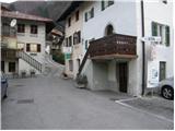 2
2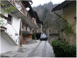 3
3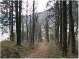 4
4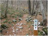 5
5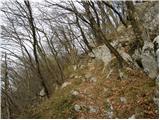 6
6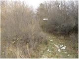 7
7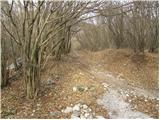 8
8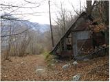 9
9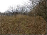 10
10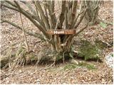 11
11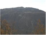 12
12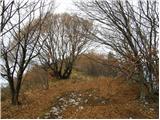 13
13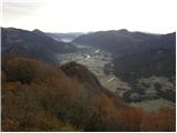 14
14 15
15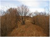 16
16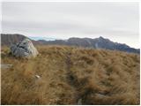 17
17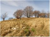 18
18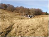 19
19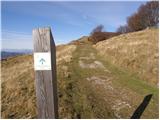 20
20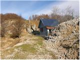 21
21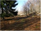 22
22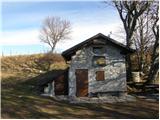 23
23
Discussion about the trip Kobarid - Bivak Hlek
|
| starakapa12. 12. 2007 |
Already in 2004 I was at Hlek and continued the path towards Stol and further to the Musci shelter. Whoever has the time should continue the path via Ribežnov and on to Musci, they won't regret it. When I was first at the bivouac it wasn't equipped like in 2005 and I carried armaflex and a sleeping bag with me. Now that's no longer necessary, as everything is in the bivouac including blankets. The path itself is strenuous especially in summer heat, so I recommend an early start. The sunrise was unforgettable.
|
|
|
|
| Okmodko28. 11. 2013 |
The hiking time is written incorrectly. It takes significantly longer. Please correct this.
Unless others can confirm that 2h 15min is correct, because we went during a heat wave and it really exhausted us.
|
|
|
|
| pohodnik0128. 11. 2013 |
A couple of years ago my wife and I visited this bivouac. It took us less than stated. The times and trail descriptions on this site are quite realistically written. Of course, it depends on the individual how much time they spend on a certain trail. And also, if you took longer, we hike for our own pleasure, nature, and experiences. Let time not be your master.
|
|
|
|
| Okmodko28. 11. 2013 |
Then the heavy backpacks and the heat were really to blame. Darkness was chasing us, we went to overnight in the bivouac. Darkness is the master if you're not at home in these areas
|
|
|
To post a comment you must log in:
If you do not yet have a username, you must first
register.