Kneške Ravne (Prošček) - Planina v Prodih
Starting point: Kneške Ravne (Prošček) (754 m)
| Latitude/Longitude: | 46,2197°N 13,8256°E |
| |
Walking time: 55 min
Difficulty: easy unmarked way
Elevation gain: 316 m
Elevation difference along the route: 316 m
Map: TNP 1:50.000
Recommended equipment (summer):
Recommended equipment (winter): ice axe, crampons
Views: 1.720
 | 2 people like this post |
Access to starting point:
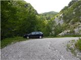
From the road Bača pri Modreju - Podbrdo, in the settlement Kneža we turn onto the road in the direction of Kneške Ravne. Continuing, we ascend along the road which continues through the valley of the stream Kneža. Initially a quite gentle and partly macadam road, higher it starts to ascend more steeply, on the steep part the road is mostly asphalt. Higher, the road splits, and we choose the slightly right road which leads towards the mountain pasture Planina v Prodih and becomes macadam (left Kneške Ravne). There follows another few 100 metres of ascent on the macadam road, and then we park at an appropriate place before the gate.
Route description:
From the starting point, we continue on the macadam road across which there is a gate, we follow it in a few hairpin turns and after approximately 35 minutes we arrive at the forestry cottage.
At the cottage, we leave the road and on the right side of the cottage we walk into the forest, where a nicely traceable and still unmarked footpath continues. There follows an ascent, mostly through the forest, occasionally some views also open up in the direction of the pre-Alpine hills. There follows the crossing of a torrent bed, and then we reach the marked Geological Trail.
We reach the marked trail on the edge of the mountain pasture Planina v Prodih, and we go right and walk to the nearby hunting cottage.
Description and pictures refer to the condition in 2018 (July).
Along the route: Gozdarska koča (937m)
Photos:
 1
1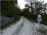 2
2 3
3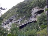 4
4 5
5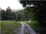 6
6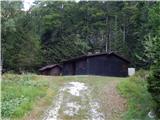 7
7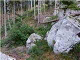 8
8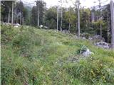 9
9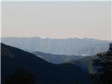 10
10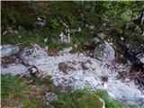 11
11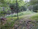 12
12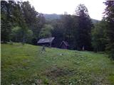 13
13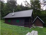 14
14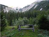 15
15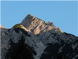 16
16
Discussion about the trip Kneške Ravne (Prošček) - Planina v Prodih
To post a comment you must log in:
If you do not yet have a username, you must first
register.