Klemenčevo - Kamniški vrh (on southwest slope)
Starting point: Klemenčevo (600 m)
| Latitude/Longitude: | 46,2739°N 14,5659°E |
| |
Route name: on southwest slope
Walking time: 1 h 45 min
Difficulty: easy unmarked way
Elevation gain: 659 m
Elevation difference along the route: 659 m
Map: Kamniško - Savinjske Alpe, 1 : 50.000, PZS
Recommended equipment (summer):
Recommended equipment (winter): ice axe, crampons
Views: 32.436
 | 3 people like this post |
Access to starting point:
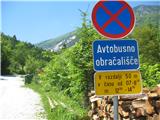
From Kamnik we drive towards Stahovica. Immediately after the village Godič we turn left onto the road in the direction of Županje njive, and at the next crossroad we turn left in the direction of Bistričica. We follow the road to the village Klemenčevo, we drive past the sign which marks the beginning of the settlement to the very settlement, past the bus turning point, and then we park on a smaller parking lot a few tens of meters ahead from the turning point, on the right edge of the road, just before the turn-off of the narrower path (cart track), which descends a little towards the riverbed of Bistričica (it is also possible to park a few tens of meters ahead by the road, if there isn't enough space lower down). The path towards the riverbed branches off to the right at the spot where the road on which we came ascends a little steeper and slightly turns to the left.
Route description:
From the parking lot we head onto the narrower path which branches off to the right downwards and quickly brings us to the shallow riverbed of Bistričica, which we cross twice (over stones, there is no bridge). The cart track then mostly ascends gently, for a short time also a little more steeply, beside the meadow and through thin forest. Soon we come to a path junction, sticking to the wider cart track to the right. A little after that we reach a grazing fence on the cart track, behind it the cart track path on which we are walking turns right. At the spot where the cart track turns right, another path also branches off upwards to the left, but it is worse and joins the path we are on higher up. Soon we come out of the forest and see a grazing fence on our right, while we ascend along a small path which takes us past it upwards. The path brings us to a panoramic slope where we encounter a bench; after a short ascent from the bench onwards we come again to a grazing fence which we cross. At this spot we arrive at the junction of the unmarked path we are on with the marked path which arrives from the hamlet Slevo on our right. We just cross this marked path and continue ascending in our previous direction (not continuing slightly left along the marked path), along a well-visible path (wide cart track) which then continuously ascends along the right edge of the pasture of the mountain pasture Ravne senožeti. When we pass a decaying wooden shack (on our left), the path ascends more steeply and soon brings us to a junction. To the left upwards leads a more demanding, very steep path which ascends along the edge of the gully named Slevška roža; we continue straight ahead along the path which quickly brings us to a somewhat awkward crossing of the scree which descends steeply downwards from that gully. This section is short, only about 30 m, but due to the slope of the scree a careful step is needed because of the risk of slipping. After that we come onto the extensive grassy southwest slope of Kamniški vrh, which we cross on a very narrow but well-trodden path in a very moderate ascent towards the south. The path brings us to a vantage point with a bench which is to the right of our path; the path here turns left and ascends somewhat more steeply, soon bringing us to a junction with direction signs. From the right the path from Stahovica and Županje njive joins here; the signpost to the left directs towards Kamniški vrh and mountain pasture Osredek. Straight upwards the direct path steeply ascends to Kamniški vrh, while we take the left path which then ascends relatively steeply to a saddle where we turn right onto the wide steep path to Kamniški vrh, which we reach in a further 10 minutes of walking when we arrive at the logbook box and stamp. A few minutes further along the path we come to a vantage point with a few benches and bivouac.

Photos:
 1
1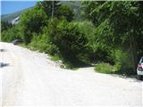 2
2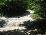 3
3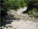 4
4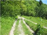 5
5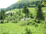 6
6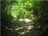 7
7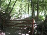 8
8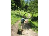 9
9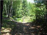 10
10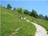 11
11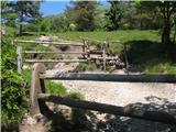 12
12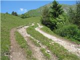 13
13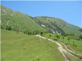 14
14 15
15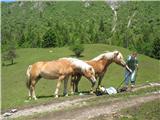 16
16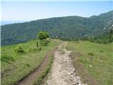 17
17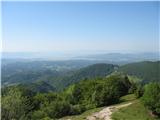 18
18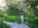 19
19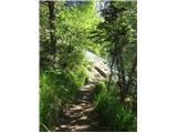 20
20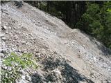 21
21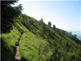 22
22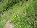 23
23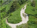 24
24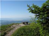 25
25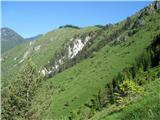 26
26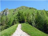 27
27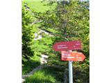 28
28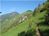 29
29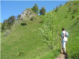 30
30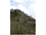 31
31 32
32
Discussion about the trip Klemenčevo - Kamniški vrh (on southwest slope)
|
| AnzeKozjek28. 05. 2013 |
Hi!
Can anyone tell me if from the ridge (Kamniški vrh, Kamniška Planjava and Planina osredek) there is a nice view of the Kamniške Alpe - the two-thousanders behind? Because the view is more or less only to the south, as the north is more overgrown with forests... 
|
|
|
|
| Rokovnjacica28. 05. 2013 |
As you already wrote yourself: "the view is more or less only to the south". On the two-thousanders in Kamniške Alpe there is none.
I recommend that you go to Kompotelo once, there you'll have the two-thousanders like on the palm of your hand...
|
|
|
|
| pikec128. 05. 2013 |
If you go to K.Planjava, on that small plateau, you can see from Brana to Velka, but no more
Regards
|
|
|
|
| bostjanp30. 05. 2013 |
@anze: you can combine a walk from Klemenčevo via Osredka to Kriška pl. below Krvavec, pl. Koren to Komptele or to the top of Korena and you'll have Kamniške right there. Back to pl. Koren and down the Korošica valley to the gondola.
|
|
|
|
| AnzeKozjek1. 06. 2013 |
I know about Kompotelo, I was already there at the top when I was still little legs but I don't remember much from then... I would repeat it soon, just let the snow melt a bit... I've been to Kamniški vrh quite a few times, but I've never climbed further to Planjava on Kamniški vrh yet.. thanks for the answers and tips!
|
|
|
|
| Hribolazec8110. 07. 2016 |
Today I did this path, it's very very beautiful, I returned via Planina Osredek where a gentle breeze was blowing just right to refresh and enjoy the views and natural beauties, the path down the valley is nice but caution needed when stepping over scree.
|
|
|
|
| črnozanohtam27. 03. 2021 |
Hello. Yesterday afternoon I left my poles, black diamond, yellow-gold, on the sand pile in the upper part of the parking lot. When I got home in the evening, I called the nearby farm and the kind lady went to check, but the poles were no longer there, but a couple who had just returned from the hike said they had still seen them in the sand when they started. If by chance someone took them home, I would ask if they are not life-essential, to call me at 031 467 296. Thank you.
|
|
|
To post a comment you must log in:
If you do not yet have a username, you must first
register.