Kandrše (Trata) - Sveti Mihael (Križate)
Starting point: Kandrše (Trata) (473 m)
| Latitude/Longitude: | 46,1331°N 14,8395°E |
| |
Walking time: 25 min
Difficulty: easy marked way
Elevation gain: 18 m
Elevation difference along the route: 60 m
Map:
Recommended equipment (summer):
Recommended equipment (winter):
Views: 328
 | 1 person like this post |
Access to starting point:
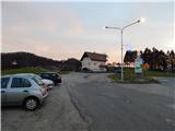
A) We leave the Štajerska motorway at exit Krtina, then we follow the signs for Moravče and Zagorje ob Savi. Just a little after the road sign which marks the beginning of the settlement Kandrše, we arrive at a pass by the hamlet Trata, where we turn left and park on the macadam parking lot opposite the company Strip's, elektrotehnika - elektronika, d.o.o.
B) We drive to Izlake (to here from Trojane or Zagorje ob Savi), then we continue driving in the direction of Moravče. In the settlement Kandrše, at the company Strip's, elektrotehnika - elektronika, d.o.o. we turn right and park on the macadam parking lot next to the hiking signposts.
Route description:
From the parking lot, we head to the road in the direction of Limbarska gora, Golčaj and Vrh pri Mlinšah. At first we walk on a gently sloping asphalt road which leads us across a meadow, at the hamlet of a few houses the markers direct us to the left side road, from it we go immediately once again left (straight marked path to Limbarska gora) and ascend to the nearby church of St. Lenart, from which a beautiful view opens up, reaching all the way to Zasavska Sveta gora.
From the church we quickly return to the marked path, then continue on the macadam road which ascends to the saddle between Jerščeva gorica (586 m) on the left and Kandrški grič on the right. At the saddle we leave the road leading to the nearby homestead and continue slightly right on the marked cart track which descends through the forest. The path soon levels out, then past a cross and an older chapel we arrive at an asphalt road, which we follow northwards. We quickly arrive at the hamlet of a few houses, where at the chapel we go left downhill to the nearby church, which we have already seen for a few minutes from our path. After a short descent we arrive at the church of St. Michael, which was renovated in 2015.
Trata - St. Lenart 0:08, St. Lenart - St. Michael 0:17.
Description and pictures refer to the condition in 2019 (December).

Along the route: Sveti Lenart (Kandrše) (508m)
Photos:
 1
1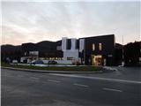 2
2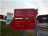 3
3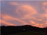 4
4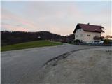 5
5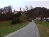 6
6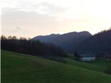 7
7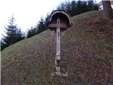 8
8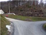 9
9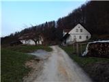 10
10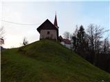 11
11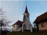 12
12 13
13 14
14 15
15 16
16 17
17 18
18 19
19 20
20 21
21
Discussion about the trip Kandrše (Trata) - Sveti Mihael (Križate)
To post a comment you must log in:
If you do not yet have a username, you must first
register.