Kamnik - Visoka špica (via Stari grad)
Starting point: Kamnik (375 m)
| Latitude/Longitude: | 46,2209°N 14,6124°E |
| |
Route name: via Stari grad
Walking time: 50 min
Difficulty: easy unmarked way
Elevation gain: 285 m
Elevation difference along the route: 285 m
Map:
Recommended equipment (summer):
Recommended equipment (winter): crampons
Views: 12.046
 | 2 people like this post |
Access to starting point:
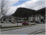
A) From Komenda, Trzin or Domžale we drive towards Kamnik, and then we continue driving on Kamnik bypass road towards Gornji Grad and Kamniška Bistrica. When we get to Kamnik, at the first traffic light crossroad we turn right in the direction of health center Kamnik near which we also park on a large organized parking lot.
B) From Gornji Grad over the Črnivec pass we drive to Kamnik, where we continue driving on Kamnik bypass road. At the last traffic light in Kamnik we turn left in the direction of health center Kamnik near which we also park on a large organized parking lot.
C) From highway Maribor - Ljubljana we go to the exit Vransko, and then we continue driving towards Tuhinj and Kamnik. When we get to Kamnik we need to pay attention, because at the last traffic light we turn left in the direction of health center Kamnik near which we also park on a large organized parking lot.
Route description:
From the starting point, we continue on Novi trg street, and we walk there in the direction towards the north. On the mentioned street in a few minutes we get to Kamnik bypass road, where we walk for a short time by the edge of the road, and then we already notice the first signs for Stari grad, which point us on a wide and nicely arranged natural learning trail. The path quite quickly starts relatively steeply ascending and passes into the forest, through which it is then for quite some time ascending. During the ascent, we notice several benches and boards of the learning path, and only a little above the area, where there is a larger number of small mills and learning boards we get to a junction, where we continue straight (sharply left - Stari grad) in the direction of the hunting path to Visoka špica. A little further, the path again splits into two parts, and we continue on the right path, which a little higher crosses the asphalt road Kamnik - Stari grad.
On the other side of the road, the path steeply ascends, and then we get to a junction, where we continue right. Follows a few minutes of moderate ascent and the path brings us to a viewpoint with numerous benches.
From the viewpoint, we continue slightly left and in a few steps we get also to the log box on Visoka špica.

Photos:
 1
1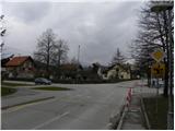 2
2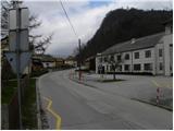 3
3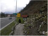 4
4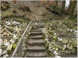 5
5 6
6 7
7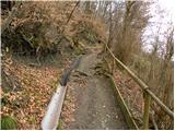 8
8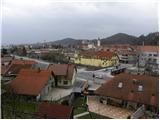 9
9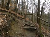 10
10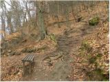 11
11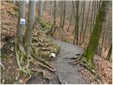 12
12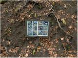 13
13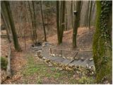 14
14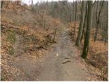 15
15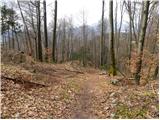 16
16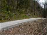 17
17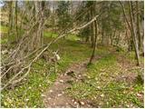 18
18 19
19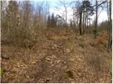 20
20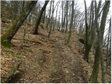 21
21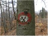 22
22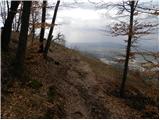 23
23 24
24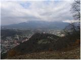 25
25 26
26
Discussion about the trip Kamnik - Visoka špica (via Stari grad)
To post a comment you must log in:
If you do not yet have a username, you must first
register.