Kamenščina - Velika Milanja
Starting point: Kamenščina (900 m)
| Latitude/Longitude: | 45,5912°N 14,2903°E |
| |
Walking time: 40 min
Difficulty: easy unmarked way
Elevation gain: 199 m
Elevation difference along the route: 199 m
Map: Snežnik 1:50.000
Recommended equipment (summer):
Recommended equipment (winter):
Views: 9.296
 | 1 person like this post |
Access to starting point:
From the Ljubljana - Koper highway, take the Postojna exit and follow the road ahead in the direction of Pivka, Reka and Ilirska Bistrica. In the settlement of Pivka, leave the main road which runs towards Ilirska Bistrica and continue driving towards the village of Knežak. Only a little after Knežak, we come to the village of Šembije, where we pay attention to the first turn-off to the left. So from the main road we turn sharply left and continue driving on a macadam road which at first ascends gently, then a little steeper over karst fields. The road then flattens and brings us into a smaller plateau-like world below Volovja reber. If we intend to do a circular tour on the ridge of Volovja reber, we can park already here; if not, we drive further on an occasionally somewhat worse macadam road, which higher brings us to a sharp left turn, in the middle of which a rougher road branches off to the right. We continue on the left "main" road, which higher brings us to the next crossroad, by which we park.
Route description:
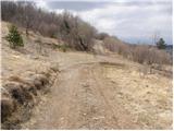
From the crossroad, we go sharply left onto a somewhat worse forest road which starts to ascend diagonally over more and more panoramic grassy slopes. The worsening road soon turns to the right and almost entirely flattens. A little further, we notice a worse cart track which branches off to the right from the road. We head onto the mentioned cart track, which is at first somewhat less visible. The mentioned cart track first barely ascends, followed by a short descent, and then starts to ascend diagonally towards the saddle between Velika Milanja on the left and Lunjevica on the right.
When we arrive at the mentioned saddle, we will at the same time step onto the junction of cart tracks.
We continue sharply left on the more distinct cart track which soon brings us to the spot where a path branches off to the right to some kind of forepeak of Velika Milanja, on which there is a natural window (to the window is only 3 minutes of walking), while we continue straight on the increasingly panoramic path, along which in a few minutes of further walking we ascend to the summit.

Photos:
 1
1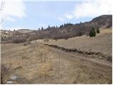 2
2 3
3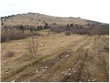 4
4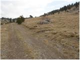 5
5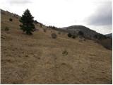 6
6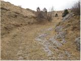 7
7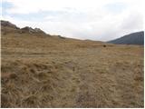 8
8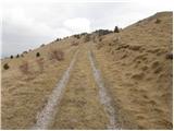 9
9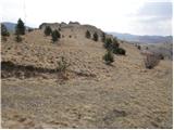 10
10 11
11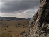 12
12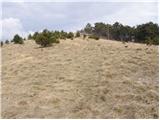 13
13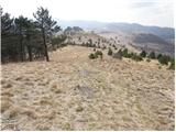 14
14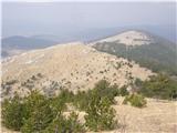 15
15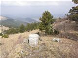 16
16
Discussion about the trip Kamenščina - Velika Milanja
|
| bizgo9327. 04. 2021 11:10:29 |
To the highest peak of Volovje rebri, besides the path from Kamenščina, which is interesting but quite short, there are three more paths.
One is even shorter and starts in Mrzli dol (the starting point is about a good km away from the 'cactus' by the road Il. Bistrica-Sviščaki, at the so-called Trnovska bajta). From there, you have less than a km walk on a gravel road, turn left towards the above-mentioned Milanski kamen (above in picture no. 11), from there you have only less than 15 minutes to the summit of Velika Milanja, which has a stamp box and also a slightly cracked stamp. On this path, you cover just over 100 m of elevation gain and in the worst case, you cover it in half an hour.
The second path is already more hiking-oriented. It starts in the village of Koritnice (630 m) on the northern forested side of Volovje rebri. Do not follow the markers, as they do not lead to Velika Milanja; instead, at the first intersection, head right, and when the path starts to ascend more steeply, go left towards V. Milanja (the right path would lead you to Milanka). You need to reach 100 m before the antenna from the forest, from there head along the path below the summit of Bela ovca and there find a goat path, which will then ascend very steeply for another 300 m to the summit of Velika Milanja. I did the path in a good rhythm in just over an hour, so I would say an hour and a half of normal walking from Koritnice to the summit.
The third path is the longest, most scenic, and to me personally the most interesting, as it runs along the entire ridge of Volovje rebri. It starts in the village of Šembije (592 m). Follow the gravel road that runs to the right of the drying Šembijsko jezero for about 3 kilometers, then at the first major intersection join the left track, follow it for less than a kilometer, and then turn right onto a goat trail that will take you to Milanka (948 m) - follow the blue dots and arrows that serve as markers. From Milanka, there is a short ascent along the trail to Mala Milanja (975 m), where there is also an improvised stamp box and stamp. From there, you will descend slightly to the antenna, where you will join the path I described above (starting from Koritnice). The path is about 8 km long and, with an intermediate ascent to Bele ovce (1029 m) and many stops for photos and views, took me just over 2 hours. Along the path, there are extremely beautiful views of Pivško podolje, surrounding hills with Snežnik, Učka, part of Kvarnerski zaliv, Brkine all the way to the Alps.
Truly beautiful excursions through the idyllic and fairly unspoiled Volovje rebri.
|
|
|
To post a comment you must log in:
If you do not yet have a username, you must first
register.