Starting point: Kal (817 m)
| Latitude/Longitude: | 46,2151°N 13,9402°E |
| |
Walking time: 2 h 30 min
Difficulty: easy marked way
Elevation gain: 1027 m
Elevation difference along the route: 1027 m
Map: Škofjeloško in Cerkljansko hribovje 1:50.000
Recommended equipment (summer):
Recommended equipment (winter): ice axe, crampons
Views: 112.150
 | 2 people like this post |
Access to starting point:
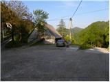
A) First, we drive to Škofja Loka, and then we continue driving towards Železniki, Podbrdo and Tolmin. A few kilometers after Podbrdo, we will get to a crossroad, where a narrower ascending road towards the villages Znojile, Stržišče and Kal branches off sharply to the right. We follow the relatively narrow road towards the village Kal, where we park on an appropriate place in the middle of the village.
B) From the road Idrija - Most na Soči, at the settlement Bača pri Modreju we turn right, or left, if we come from the direction of Posočje, and we continue driving towards Podbrdo. After the settlement Hudajužna, we get to a crossroad, where signs for the villages Znojile, Stržišče and Kal point us to the left onto a narrower ascending road. We then follow the relatively narrow road to the village Kal, where in the center of it we park on an appropriate place.
Route description:
At the starting point, we notice signs for Črna prst, which lead us past a trough with water and some houses to a cart track, which first ascends over a grassy slope, then passes into the forest, through which we then ascend for some time. Higher, we join a poorer forest road, which we follow to the right, walking along it to the marked junction at the saddle Sedlo.
From Sedlo, where the path from Podbrdo joins, we continue left and follow the cart track only for a short time, as the blazes then direct us left onto a footpath, which starts to ascend ever more steeply through the forest. Higher, the path temporarily flattens a little, then brings us to a viewpoint with a bench. A little after the bench, the path splits into two parts (the right path is better beaten), and after approximately 15 minutes they join again. Just a little above the junction of both paths, we arrive at the next bench, from which a beautiful view opens towards Kobla and the peaks above Soriška planina.
From the bench, we continue through the forest for a short time, then the path moves onto ever more panoramic grassy slopes. When we step out of the forest, the path slowly starts to turn a little to the right, then turns left and ascends across to the saddle Čez Suho, where the path from the Bohinj side joins.
Here we continue left, and with views of Baška grapa, Bohinj and the highest peaks of the Julian Alps, we ascend in a few minutes to the Dom na Črni prsti, which is located just a few meters below the summit.
We bypass the Dom Zorka Jelinčiča on the left side and over a short steep slope ascend to the panoramic summit in a few steps.

Along the route: Sedlo (985m), Čez Suho (1760m)
Photos:
 1
1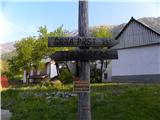 2
2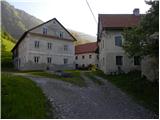 3
3 4
4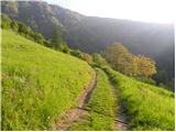 5
5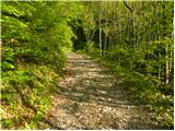 6
6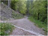 7
7 8
8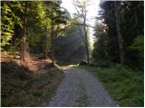 9
9 10
10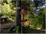 11
11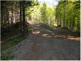 12
12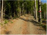 13
13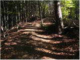 14
14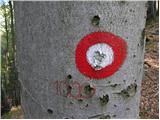 15
15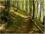 16
16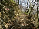 17
17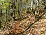 18
18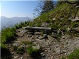 19
19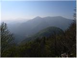 20
20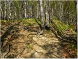 21
21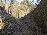 22
22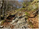 23
23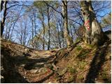 24
24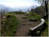 25
25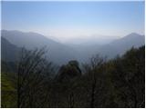 26
26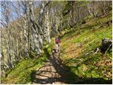 27
27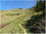 28
28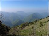 29
29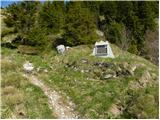 30
30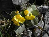 31
31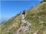 32
32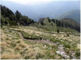 33
33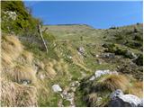 34
34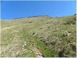 35
35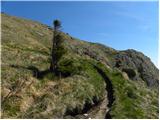 36
36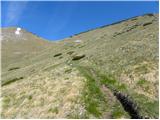 37
37 38
38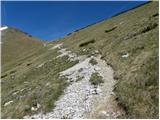 39
39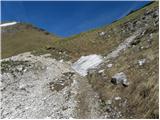 40
40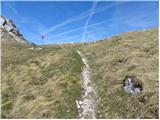 41
41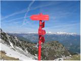 42
42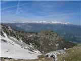 43
43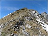 44
44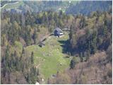 45
45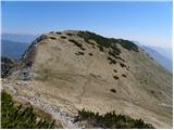 46
46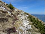 47
47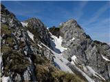 48
48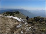 49
49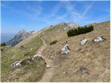 50
50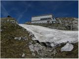 51
51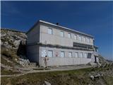 52
52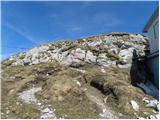 53
53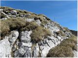 54
54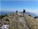 55
55 56
56
Discussion about the trip Kal - Črna prst
|
| Stolar19. 05. 2011 |
Beautiful mountain, nice view, only the hut with its appearance doesn't quite fit into these parts.
|
|
|
|
| miri19. 05. 2011 |
The hut was built in the early 1960s on a voluntary basis on the remains of an Italian guard post. To me it doesn't seem disturbing to the environment, since from Porezen for example it's hard to spot it.
|
|
|
|
| Janiel741. 07. 2011 |
Which path to Črna prst do you recommend? Which has the best views? Thanks
|
|
|
|
| funnyboy1. 07. 2011 |
The best views are on the path from Razor planina along the ridge. But this path is long. Otherwise the path from Bohinjska Bistrica is quite scenic, especially above Orožnova koča.
Or you can also go from Baška grapa, those paths are nice and at least somewhat scenic too.
|
|
|
|
| Alpski Slovenc13. 11. 2011 |
The small village of Kal welcomed us on Saturday in beautiful cool sunny weather. The top of Črna prst hid under a cap of fog, which the northeastern wind chased down the ridge. The wind accompanied us to the top, especially showing its power at the saddle. But despite the wind and cold, it enchanted us with a beautiful view of the surrounding peaks and the valley below.
|
|
|
|
| vesnapl14. 11. 2011 |
Is there any snow at the top?
|
|
|
|
| bostjan2928. 11. 2011 |
No snow, but yesterday there were beautiful views of the surrounding and distant mountains! The lowlands covered in fog... luckily with a little will we can avoid it :-).
|
|
|
|
| katty6. 01. 2013 |
Today up to the saddle no trace of any snow - only down on the forest road there's a bit of avalanche, further on there was always more... Of course it's quite crusty, it broke through several times even up to the knees. About the amount of course I'd rather not, since it's negligible. Despite everything there were quite a few of us up there, on the way back we, despite the fairly late hour, met another trio of hikers. The views outweigh all the effort... It was nice :-)
|
|
|
|
| lubadar6. 01. 2013 |
katty
where are the pictures and your nice detailed comment 
|
|
|
|
| katty6. 01. 2013 |
@lubadar, the comment is there, the pics will come ;-)
|
|
|
|
| lubadar6. 01. 2013 |
katty
I'm used to more extensive ones from you, and also reinforced with   so it's nicer to read so it's nicer to read
|
|
|
|
| katty6. 01. 2013 |
Haha, yeah I surprised even myself today when I wrote so little ....Hm, but one long chitchat doesn't really fit...so from now on I'll start with reducing comments and pics...so that the wolf is full and the goat whole ....Hm, but one long chitchat doesn't really fit...so from now on I'll start with reducing comments and pics...so that the wolf is full and the goat whole 
|
|
|
|
| lubadar7. 01. 2013 |
You just write it's quite ok . When did you start in the morning,that it was breaking through,for me on Rodica nothing,nothing sank,you could go wherever you wanted.I started at 7:20
|
|
|
|
| katty7. 01. 2013 |
Wow, you know quite well. Around 9:40. Haha, if I think about it, we walked up good 2.5h. The snow was already soft then, that it didn't hold the weight. But no panic, sorry for the boots, that I didn't have real winter ones.
|
|
|
|
| lubadar9. 01. 2013 |
The path was frozen in the morning, ideal walking without crampons to the top, no wind at the top, but for the descent the "chains" from Veriga were very useful.
|
|
|
|
| Jaka-Eva17. 03. 2013 |
How is the path (trodden)? Is the hut open? Has anyone been to Črna prst recently?
|
|
|
|
| igor3713. 04. 2013 |
I'm wondering if the path to Črna prst from the village Kal is passable.
Thanks for info
|
|
|
|
| BLhribi2. 05. 2014 |
Today my girlfriend and I were the only ones (at least according to the logbook entries) to visit the summit from the direction of Kal village. The weather spared us. The path is passable. Only in places are there fallen trees across the path, but they can be bypassed without major difficulties. The summit is still surrounded by a considerable mass of snow, which must be crossed in the last 5 minutes of walking if you want to reach the hut or summit.
|
|
|
|
| mornar5. 05. 2017 |
I'm curious about the condition of the path to Črna prst, and where the stamp is located.
|
|
|
|
| ana5. 05. 2017 |
The path from Kal is dry, I was on Rodica from Ruta on Sunday, that path is also dry.
|
|
|
|
| Slakuter2. 10. 2017 |
Hi,
yesterday (1.10. on the path Kal - Črna prst) I lost my car keys. Most likely somewhere on the last crossing under the saddle Čez Suho. If someone finds them by chance, please let me know.
040 four 5 three 0 nine 5
|
|
|
|
| Sa8a16. 04. 2018 |
Hi,
I'm interested in what the path is like if we start from Kal? Is the path already passable or is there still a lot of snow? Thanks for info
|
|
|
|
| miratan1. 04. 2019 |
Hello,
has anyone been to Črna prst these days? Are there still winter conditions?
|
|
|
|
| črow1. 04. 2019 |
Today I was on a nearby summit and the conditions are still not to be underestimated. Ice axe and crampons are mandatory too, if you plan to go up from Baška grapa. From the Bohinj side it's still proper winter. But it's true, the snow is melting quickly.
|
|
|
|
| mikkeni28. 01. 2022 19:36:00 |
What are the conditions like from Baška grapa? Is there still a huge amount of snow, or can one go without crampons or micro-crampons?
|
|
|
|
| ljubitelj gora29. 01. 2022 12:49:38 |
12-point crampons are mandatory as well as the ice axe.
|
|
|
|
| NEIC0084. 07. 2025 09:41:22 |
A few kilometers past Podbrdo, we'll reach an intersection where a narrower ascending road branches sharply right towards the villages Znojile, Stržišče and Kal.
Does anyone know if this road is even open?
|
|
|
|
| docepe24. 07. 2025 11:22:32 |
This is an asphalt road to these three villages. In Stržišče there is a nicely arranged parking lot. In the smaller village Kal, where the normal road ends, there is space for about three cars, just like the picture shows!
|
|
|
|
| Rožcagre6. 08. 2025 08:53:51 |
Yesterday I was at the summit via the described path. Especially in the lower part of the path there are several path variants, but everything is well marked. The path ascends steadily all the time, so with slightly poorer fitness I needed 3 hours for the ascent when the path emerges from the forest it ascends through beautiful meadows full of flowers. It was wonderful, but I observed them better on the way back
|
|
|
To post a comment you must log in:
If you do not yet have a username, you must first
register.